Topics > County Durham > Crook > Historic Buildings and Monuments in Crook Ward
Historic Buildings and Monuments in Crook Ward
Listed buildings and scheduled monuments in the non-parished area of Crook Ward, County Durham, from the National Heritage List for England[1]. Use the Search (below) if looking for a specific building / monument.
| Structure | List No. | Grade | Built~ | Note |
|---|---|---|---|---|
| Former Schools | 1228809 | II | 1877 | Helmington Row |
| Beechburn Grange | 1228804 | II | ||
| Cart Shed, Stables and Loft and Byre East of High Woodfield Farmhouse | 1279336 | II | ||
| Central Methodist Church | 1229012 | II* | 1868 | Crook. Now St Andrew's Church. |
| Church of Our Lady Immaculate and Saint Cuthbert | 1228976 | II | ||
| Fir Tree Grange | 1229281 | II | ||
| Fir Tree War Memorial Drinking Fountain | 1436984 | II | ||
| Gate Piers, Gates, Walls and Railings in Front of Former Schools | 1228948 | II | 1877 | Helmington Row |
| Helmington Row and Sunnybrow War Memorial | 1438090 | II | 1927 | Helmington Row |
| High Woodfield Farmhouse, East and West | 1228806 | II | ||
| Howden-le-Wear War Memorial | 1438107 | II | ||
| Low Woodifield Farmhouse | 1228807 | II | ||
| Outbuildings North of Fir Tree Grange | 1229020 | II | ||
| Outbuildings to North West of Beechburn Grange | 1228805 | II | ||
| Premises Occupied by JG Forster and Ye Olde Horse Shoe Inn | 1279274 | II | ||
| Presbytery Attached to Church of Our Lady Immaculate and Saint Cuthbert | 1229009 | II | ||
| War Memorial, Piers and Chain | 1229011 | II | 1919 | Crook |
Primary source: the National Heritage List for England - NHLE is the register of nationally protected historic buildings and sites in England, including listed buildings, scheduled monuments, protected wrecks, registered parks and gardens, and battlefields. The list is maintained by Historic England. Check NHLE for updates and new entries. Secondary sources: British Listed Buildings and Keys to the Past.
Co-Curate Page
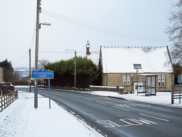
Former Board School, Helmington Row
- Overview Map Street View Located by the junction of the A690 and Holy Well Lane, in Helmington Row, is Helmington House - it is a former Board schools (Girls, Boys …

Co-Curate Page
Helmington Row and Sunnybrow War Memorial
- Helmington Row and Sunnybrow War Memorial is located by the junction of Holy Well Lane and the A690, in Helmington Row. The memorial was unveiled by Mr. N. Greener of …

Co-Curate Page
St Andrew's Church, Crook
- Overview Map Street View St Andrew's, Crook, Methodist / United Reformed Church is located on Dawson Street in Crook, County Durham. The Church was originally built as a Primitive Methodist …
Co-Curate Page
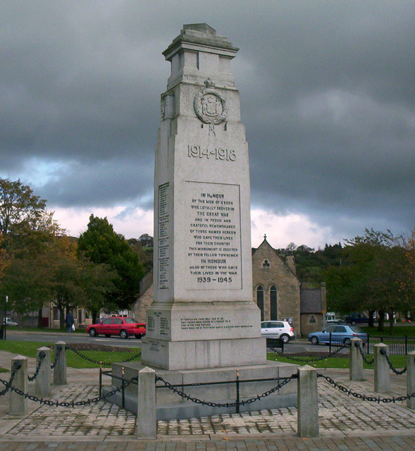
War Memorial, Crook
- Overview Map Street View The Cenotaph in Crook occupies a prominent position in the town, at the centre of an open garden area between Church Street and North Street. The …

Co-Curate Page
Former Board School, Helmington Row
- Overview Map Street View Located by the junction of the A690 and Holy Well Lane, in Helmington Row, is Helmington House - it is a former Board schools (Girls, Boys …
Co-Curate Page
Helmington Row and Sunnybrow War Memorial
- Helmington Row and Sunnybrow War Memorial is located by the junction of Holy Well Lane and the A690, in Helmington Row. The memorial was unveiled by Mr. N. Greener of …
Co-Curate Page
St Andrew's Church, Crook
- Overview Map Street View St Andrew's, Crook, Methodist / United Reformed Church is located on Dawson Street in Crook, County Durham. The Church was originally built as a Primitive Methodist …


