Topics > Northumberland > Civil Parishes in Northumberland > Allendale Civil Parish > Allendale Parish, 1848 > High West Allen
High West Allen
High West Allen was one of the eight "grieveships" (sub-divisions) of the ancient parish of Allendale in Northumberland. It covered a wide geographical area around the River West Allen, including Carrshield (the adjacent grieveship of Low West Allen included Ninebanks). Today, the area of the grieveship of High West Allen is part of West Allen Civil Parish, which was formed in 1897.
WEST ALLEN (HIGH) grieveship comprises the villages of Coalcleugh and Carr Shields, besides several hamlets. At Carr Shields there is a Chapel of Ease, under the Church at Ninebanks. It is a handsome stone edifice, erected in 1822, by Mrs Diana Beaumont and others, for the convenience of the mining population of the neighbourhood. There are also two Wesleyan Chapels in this grieveship, one at Limestone Brae, rebuilt in 1847, and the other near the village of Coalcleugh. W. B. Beaumont, Esq. has lately erected a school here.
Extract from: History, Topography, and Directory of Northumberland...Whellan, William, & Co, 1855. [full directory entry]
Whellan's 1855 directory of Northumberland includes the following farms and hamlets listed under High West Allen: Appletree Shield, Bateshields, Black Cleugh, Carrshields, Coalcleugh, Dell Hill, Dyke Nook, Farney Shields, Farney Side, Greenley Cleugh, Harsley, Harty Cleugh, Kiersley Well Row, Limestone Brae, Moap, Nether Harsley, Park House, Smallburns, Sparty Well, Taylor-burn, Whitelea Shields, and Wolfcleugh (not nessessarily an exhausive list!).
Co-Curate Page
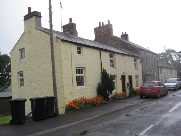
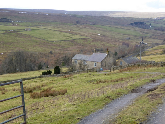
Carrshield
- Overview About Carrshield Map Street View Carrshield is a village situated by the River West Allen in Northumberland. It is part of West Allen Civil Parish. Carrshield is a village …
Co-Curate Page
Coalcleugh
- Overview Map Street View Coalcleugh is a distributed settlement in Northumberland, located near the county border with Cumbria, about 7 miles south of Allendale (town) and 5 miles east of …

Co-Curate Page
Limestone Brae, West Allen
- Overview Map Street View Limestone Brae is a hamlet situated by the River West Allen and located about 2 miles south of Ninebanks. There are a number of properties spread …

Co-Curate Page
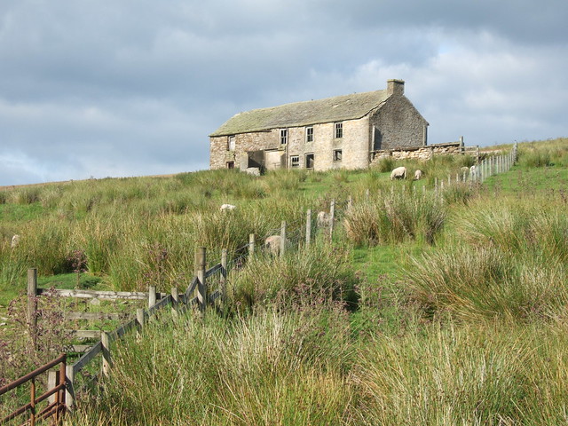
Appletree Shield (ruins)
- The castlesque ruins of the former Appletree Shield farm, by Wellhope Burn, are located about 2 miles south-west of Ninebanks in West Allen. Whellan's 1855 directory of Northumberland lists Appletree …

Co-Curate Page
Farney Shield, West Allen
- Overview Map Farney Shield is a farm in West Allen, Northumberland. Whellan's 1855 directory of Northumberland lists Farney Shield under the grievship of High West Allen, in the ancient parish …

Co-Curate Page
Farneyside, West Allen
- Overview Map Street View Farneyside (aka Farney Side) is a farm / hamlet situated by the River West Allen in Northumberland, about 1 mile south of Ninebanks. North of the …
Co-Curate Page
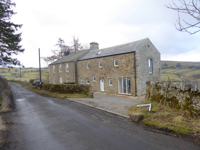
Bates Hill, West Allen
- Overview Map Street View Bates Hill is a former(?) farm by the River West Allen in Northumberland. The farmhouse was renovated (sold in 2015) and the adjacent Bates Hill Barn …
Co-Curate Page
Spartywell
- Overview Map Street View Spartywell (aka Sparty Well) is located just under a mile south of Ninebanks in Northumberland .A medieval settlement was documented at Spartywell, but there are no …

Co-Curate Page
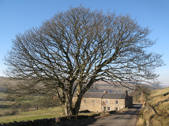
Wolfcleugh, West Allen
- Overview Map Street View Wolfcleugh (farm) and High Wolfcleugh are situated by the River West Allen, south of where the steep gorge of Wolf Cleugh (stream) joins the river. At …
Co-Curate Page
Turney Shield, West Allen
- Low Turney Shield and High Turney Shield are farms are located by the River West Allen, north of where Turney Cleugh joins the river. The farmhouse and outbuilding at Low …

Co-Curate Page
Carrshield
- Overview About Carrshield Map Street View Carrshield is a village situated by the River West Allen in Northumberland. It is part of West Allen Civil Parish. Carrshield is a village …
Co-Curate Page
Coalcleugh
- Overview Map Street View Coalcleugh is a distributed settlement in Northumberland, located near the county border with Cumbria, about 7 miles south of Allendale (town) and 5 miles east of …
Co-Curate Page
Limestone Brae, West Allen
- Overview Map Street View Limestone Brae is a hamlet situated by the River West Allen and located about 2 miles south of Ninebanks. There are a number of properties spread …
Co-Curate Page
Appletree Shield (ruins)
- The castlesque ruins of the former Appletree Shield farm, by Wellhope Burn, are located about 2 miles south-west of Ninebanks in West Allen. Whellan's 1855 directory of Northumberland lists Appletree …
Co-Curate Page
Farney Shield, West Allen
- Overview Map Farney Shield is a farm in West Allen, Northumberland. Whellan's 1855 directory of Northumberland lists Farney Shield under the grievship of High West Allen, in the ancient parish …
Co-Curate Page
Farneyside, West Allen
- Overview Map Street View Farneyside (aka Farney Side) is a farm / hamlet situated by the River West Allen in Northumberland, about 1 mile south of Ninebanks. North of the …
Co-Curate Page
Bates Hill, West Allen
- Overview Map Street View Bates Hill is a former(?) farm by the River West Allen in Northumberland. The farmhouse was renovated (sold in 2015) and the adjacent Bates Hill Barn …
Co-Curate Page
Spartywell
- Overview Map Street View Spartywell (aka Sparty Well) is located just under a mile south of Ninebanks in Northumberland .A medieval settlement was documented at Spartywell, but there are no …
Co-Curate Page
Wolfcleugh, West Allen
- Overview Map Street View Wolfcleugh (farm) and High Wolfcleugh are situated by the River West Allen, south of where the steep gorge of Wolf Cleugh (stream) joins the river. At …


