Topics > Newcastle City Centre > Streets > Hanover Street
Hanover Street
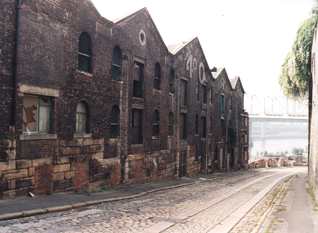
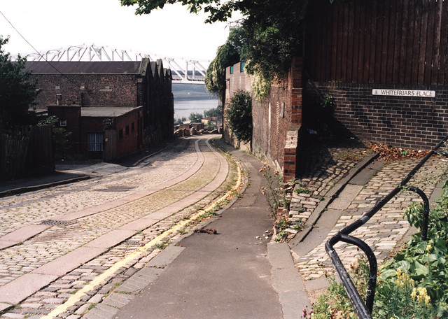
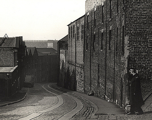
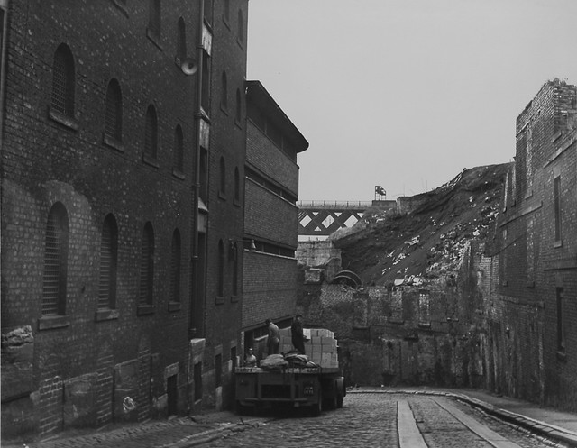
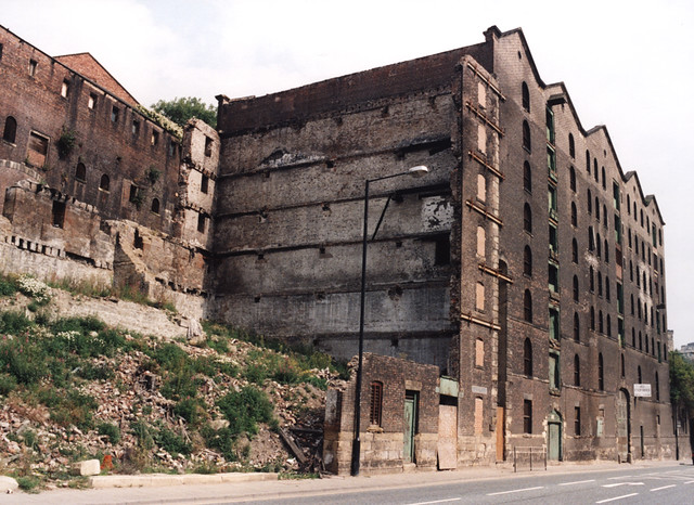
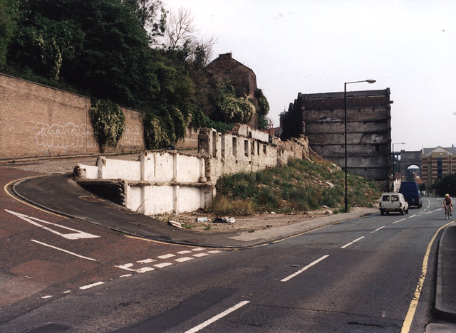
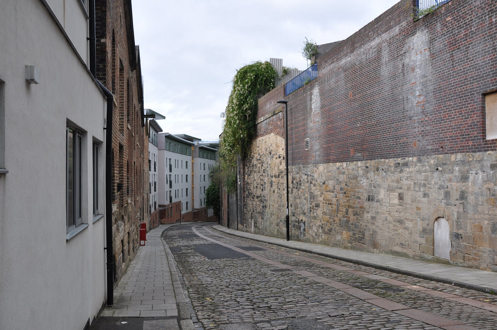
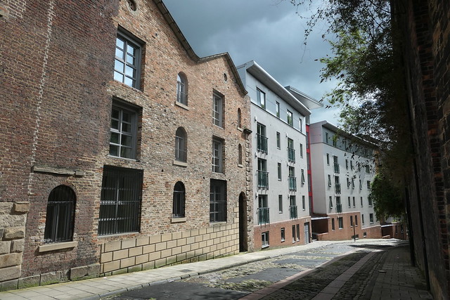
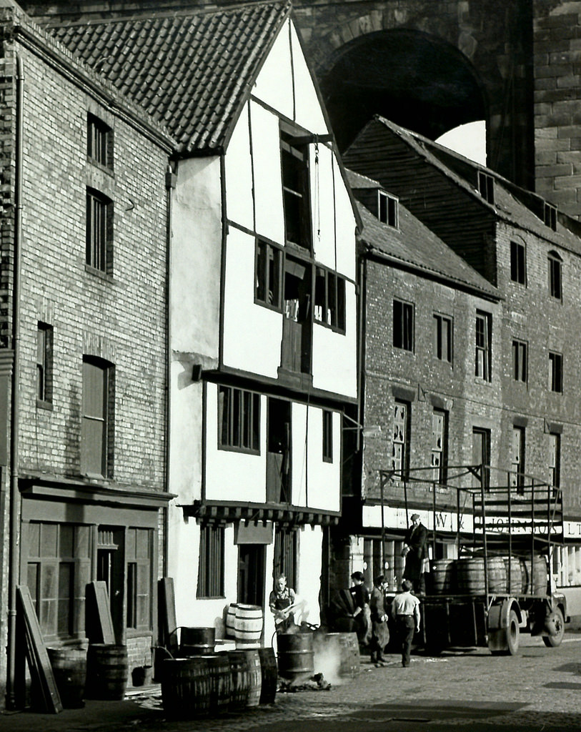
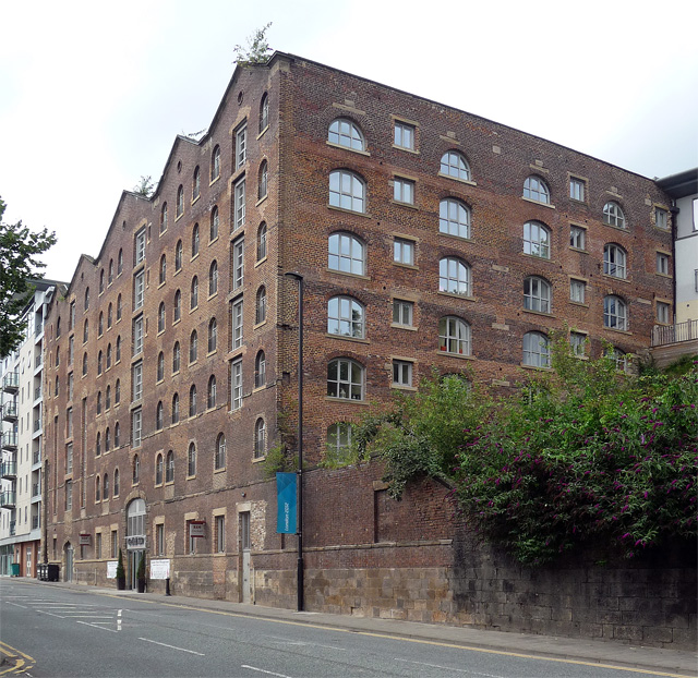
Hanover Street in Newcastle runs from Clavering Place in a roughly south-west direction down to Close. Hanover Street was laid out when massive bonded warehouses were built here for Amor Spoor from 1841-1844. The warehouses were numbered 10, 20, 30, 40, and 50 from the top to the bottom of the hill. Today, only warehouse 40 remains, after the buildngs became derelict and there were a series of fires. Notably, the street retains its original stone tramways - large granite baulks, laid into the cobbled surface. These were once common in cobbled streets or on steep hills, where the stone 'tramways' formed a smooth path for cart wheels.
from Newcastle libraries (flickr)
066298:Hanover Street Newcastle upon Tyne Malcolm Maybury 1998
Pinned by Simon Cotterill
from Newcastle libraries (flickr)
066297:Whitefriars Place/Hanover Street Newcastle upon Tyne Maybury Malcolm 1998
Pinned by Simon Cotterill
from Newcastle libraries (flickr)
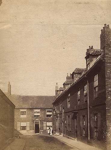
013819:Hanover Street Newcastle upon Tyne Unknown 1965
Pinned by Simon Cotterill
from Newcastle libraries (flickr)
043684:Hanover Street Newcastle upon Tyne City Engineers 1971
Pinned by Simon Cotterill

from Newcastle libraries (flickr)
053801:Hanover Street Newcastle upon Tyne City Engineers 1989
Pinned by Simon Cotterill
from Newcastle libraries (flickr)
Tor262, Hanover Street, Newcastle upon Tyne
Pinned by Simon Cotterill
from Newcastle libraries (flickr)
043336:Hanover Street Newcastle upon Tyne City Engineers 1971
Pinned by Simon Cotterill
from Newcastle libraries (flickr)
013962:Hanover Street Newcastle upon Tyne 1965
Pinned by Simon Cotterill
from Newcastle libraries (flickr)
066302:Hanover Street/the Close Newcastle upon Tyne Maybury Malcolm 1998
Pinned by Simon Cotterill
from Newcastle libraries (flickr)
066301:Hanover Street/Close the Newcastle upon Tyne Malcolm Maybury 1998
Pinned by Simon Cotterill
Co-Curate Page
Clavering Place
- Overview Map Street View Clavering Place is a street in Newcastle, which runs south from Westgate Road under a railway viaduct down to Tuthill Stairs, which lead down to the …
Co-Curate Page
Close
- Overview Map Street View Close is a street in the Quayside area of Newcastle upon Tyne. It runs south west from Sandhill to Forth Banks and Skinnerburn Road. Close was …

from https://www.twsitelines.info/…
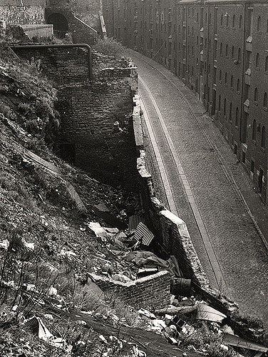
Tyne and Wear HER(4348): Newcastle, Hanover Street, Stone Tramways
- "Hanover Street retains its original stone tramways. These are large granite baulks, laid into the normal cobbled surface. They form a smooth path for cart wheels, whilst allowing a good …
Added by
Simon Cotterill
Co-Curate Page
Hanging Gardens, Close
- Overview Map Street View The Hanging Gardens (now closed to the public) are a landscaped area on the steeply sloping bank running from Hanover Street down to Close, in Newcastle. …

from https://www.geograph.org.uk/p…
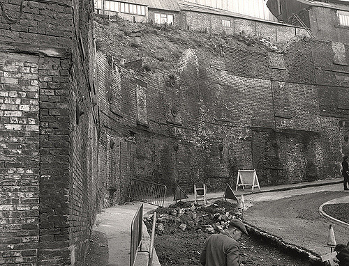
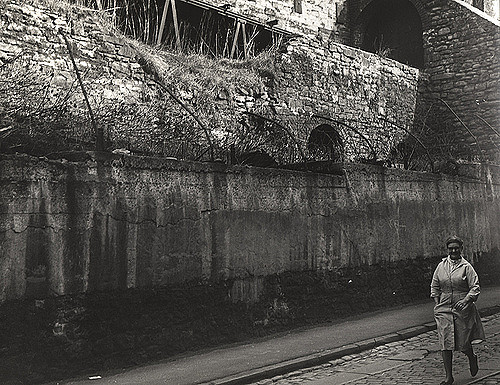
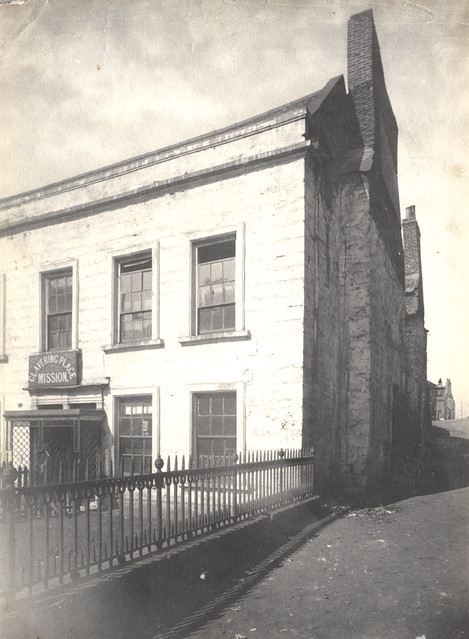
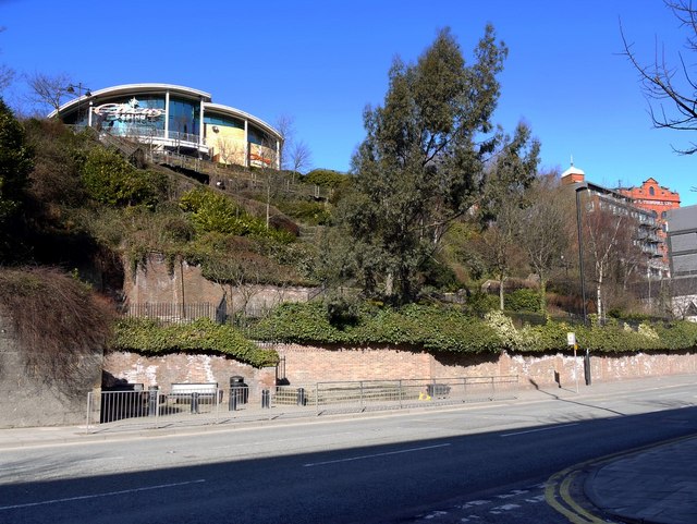
Fragment of the Newcastle Town Wall
- 14th century fragment of the Town Wall near Hanover Street. Photo by Oliver Dixon, 16 August, 2017 , Geograph, CC-BY-SA 2.0
Added by
Simon Cotterill
Co-Curate Page
Town Wall section near Hanover Street
- Scheduled Monument area - based on Historic England data (Open Government Licence). This Scheduled Monument is a section of the Town Wall which stretch between Hanover Street and the River …

from Newcastle libraries (flickr)
066298:Hanover Street Newcastle upon Tyne Malcolm Maybury 1998
Pinned by Simon Cotterill
from Newcastle libraries (flickr)
066297:Whitefriars Place/Hanover Street Newcastle upon Tyne Maybury Malcolm 1998
Pinned by Simon Cotterill
from Newcastle libraries (flickr)
013819:Hanover Street Newcastle upon Tyne Unknown 1965
Pinned by Simon Cotterill
from Newcastle libraries (flickr)
043684:Hanover Street Newcastle upon Tyne City Engineers 1971
Pinned by Simon Cotterill
from Newcastle libraries (flickr)
053801:Hanover Street Newcastle upon Tyne City Engineers 1989
Pinned by Simon Cotterill
from Newcastle libraries (flickr)
Tor262, Hanover Street, Newcastle upon Tyne
Pinned by Simon Cotterill
from Newcastle libraries (flickr)
043336:Hanover Street Newcastle upon Tyne City Engineers 1971
Pinned by Simon Cotterill
from Newcastle libraries (flickr)
013962:Hanover Street Newcastle upon Tyne 1965
Pinned by Simon Cotterill
from Newcastle libraries (flickr)
066302:Hanover Street/the Close Newcastle upon Tyne Maybury Malcolm 1998
Pinned by Simon Cotterill
from Newcastle libraries (flickr)
066301:Hanover Street/Close the Newcastle upon Tyne Malcolm Maybury 1998
Pinned by Simon Cotterill
Co-Curate Page
Clavering Place
- Overview Map Street View Clavering Place is a street in Newcastle, which runs south from Westgate Road under a railway viaduct down to Tuthill Stairs, which lead down to the …
Co-Curate Page
Close
- Overview Map Street View Close is a street in the Quayside area of Newcastle upon Tyne. It runs south west from Sandhill to Forth Banks and Skinnerburn Road. Close was …
from https://www.twsitelines.info/…
Tyne and Wear HER(4348): Newcastle, Hanover Street, Stone Tramways
- "Hanover Street retains its original stone tramways. These are large granite baulks, laid into the normal cobbled surface. They form a smooth path for cart wheels, whilst allowing a good …
Added by
Simon Cotterill
Co-Curate Page
Hanging Gardens, Close
- Overview Map Street View The Hanging Gardens (now closed to the public) are a landscaped area on the steeply sloping bank running from Hanover Street down to Close, in Newcastle. …
from https://www.geograph.org.uk/p…
Fragment of the Newcastle Town Wall
- 14th century fragment of the Town Wall near Hanover Street. Photo by Oliver Dixon, 16 August, 2017 , Geograph, CC-BY-SA 2.0
Added by
Simon Cotterill
")


