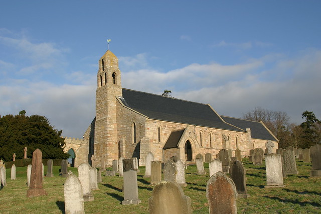
Topics > Northumberland > Ford > Ford Colliery
Ford Colliery
Scheduled Monument areas - based on Historic England data (Open Government Licence).
Ford Colliery was located by Ford Moss, to the east of the village of Ford, in Northumberland. It was worked for coal from at least mid-17th century. The site is a Scheduled Monument (legally protected)
Scheduled Monument (#1020746): Ford Colliery 920m north east of Blackcrag Wood
Click the headings below to expand (selected extracts from the Historic England scheduling)
The remains of coal workings at Ford Colliery are well-preserved and are important as a remarkably complete upland mining landscape of great complexity and chronological range. The colliery contains a range of mining features and forms which, as a group, are of major technological importance with evidence of both animal and steam powered shaft winding and pumping. The association of the colliery remains with the remains of workers housing provides additional interest.
The monument includes the above and below ground remains of Ford Colliery, situated on open moorland partly on and adjacent to Ford Moss. The colliery was worked continuously from at least the middle of the 17th century through to 1914. It exploited coal seams which are part of the Scremerston coal measures.
The visible remains are complex and represent many phases of mining stretching over nearly three centuries. The later phases of mining are well-preserved and visually dominant. They include a wide range of features such as engine houses, shafts, gin circles, leats, spoil tips, workers housing and ancillary structures.
Earlier mining remains survive in the areas unaffected by later mining and will also survive beneath the later remains. Underground remains dating from all periods are also believed to survive. A considerable amount of documentary evidence survives relating to the development and exploitation of the site. The earliest recorded mining activity dates to 1660, when the three sisters of Thomas Carr received shares of `collieries and coal mines within the manor of Ford'. The sisters were gradually bought out by Francis Blake, who became the sole owner of the site in 1673. These early workings on the site were by outcrop and bell-pit mining; a map of 1777 shows straight lines of closely spaced `old pits' that are thought to relate to this period of activity. Drainage was a constant problem at the colliery because the coal seams dipped eastward at a steep angle. The first attempt to work the colliery at depth, rather than by bell-pit and outcrop working, was begun in 1697 when a water level drift was constructed which appears to have been an attempt to lower the water table of the entire colliery. The drift was constructed of stone but was too narrow for haulage so new winding shafts were also sunk. Work on the water level drift continued intermittently for many years. Its maintenance, and that of subsequent drainage systems, was key to the colliery's development until steam pumps were introduced. Documentary evidence records the sinking of three new pits in the period 1709-1710, although it is clear that drainage remained a problem. The colliery was taken over by the Delaval family in 1718 who invested significantly in its development.
Although the colliery was tenanted for much of this period, there was usually a requirement to provide Ford Castle and its estate limekilns with coal. Much of the coal was sold locally but in 1756 it was also being shipped from Berwick to the copperas works at Hartley. Later in the 18th century there was also considerable demand from the Ford Estate for coal to supply the pantile shed, forge and nailers and the quarry. In 1744 it was noted that five pits were in action. In 1762-1763 there are descriptions of the sinking of new shafts and the repair and improvement of the drainage system. This included the provision of a windmill to draw water. In 1767-68 a new drainage system was installed to allow working below the water level; this included provision of an undergound water wheel to pump water from the lower levels. Accounts of the mid-18th century also refer to the building of miners housing, work on a school house and the building of two `cinder ovens' to supply coke to the iron forge. A plan of 1775 shows twelve pits in use and, despite continuing problems with drainage, accounts indicate that by the early 19th century the colliery was starting to be quite profitable.
In 1822 the site came into the ownership of the Waterfords. There was an expansion of the colliery in 1844 with the sinking of a new shaft, the `Engine Pit', thought to be the shaft now known as Moss Pit, at the northern edge of the site. In 1858 the colliery employed almost 100 men and supported a sizeable community; a lease of 1883 mentions mines, cottages, an engine house, blacksmiths shop, joiners shop and stables. Problems arose however with the opening of the Alnwick to Cornhill railway line in 1887, which permitted cheap coal to be brought in from South East Northumberland. By 1889 output had fallen substantially, with only 12 men employed. The colliery was acquired by the Joicey family in 1906 and continued to be worked until 1914.
The visible remains of the colliery are complex and dominated by the later phases of mining activity. A series of large pits run roughly in a north east to south west direction across the site and are thought to be 19th or early 20th century in date; all of these pits have been filled in but the fill has sunk, allowing the mouths of the pit shafts to be clearly seen. At the southern end of the site, to the east of Hill (or Hill End) Pit, are the remains of what is considered to be a beam pumping engine house; its boiler, constructed of curved red bricks on a square, dressed stone base, still survives to its full height. The pit for the boiler house survives to a depth of 2m, and the base of the winch lies nearby. The engine house chimney is a Listed Building Grade II.
Immediately to the east of the engine house lies a large heap of furnace waste standing up to 7m high. To the north east of the chimney are the remains of the largest pit on the site, known at various times as Temple Pit or Middle Pit. Adjacent to this pit are the remains of a steam powered winding engine, visible as the foundations of its boiler house, the stone remains of the engine bed and a square pit, believed to be the bob pit. At the north eastern edge of the colliery site is Moss Pit with the remains of two stone built engine houses, believed to be mid-19th century in date. These are roofless but stand almost to full height. The remains of miners housing survive in four discrete areas, all aligned roughly north east to south west along the main track which runs through the site. The most southerly group of houses, known as Blue Row, has foundations surviving up to 1m high. The other groups of housing survive as earth covered foundations between 0.2m and 1m high. Each of these areas of housing has a small area of enclosed land associated with it which would have provided gardens and allotments. The remains of stables and sheds have also been identified immediately to the north west of Temple Pit; these are constructed of dressed stone and survive up to 1.5m high.
The remains of earlier mining can be seen in the areas between the pits and miners housing on the east side of the track and also on the area of gently sloping hillside to the west of the track. These remains include traces of gin circles, a series of leats associated with colliery drainage, which survive up to 1.5m wide and 0.3m deep, and possible storage bins immediately to the west of the track. To both sides of the track are a series of smaller shafts, both round and square, some of which are stone-lined, often associated with small tips. Some of these represent air shafts whilst others are believed to be the remains of earlier workings. All fences and gates which cross the monument are excluded from the scheduling, although the ground beneath them is included.