Topics > Newcastle City Centre > Streets > Dog Bank
Dog Bank
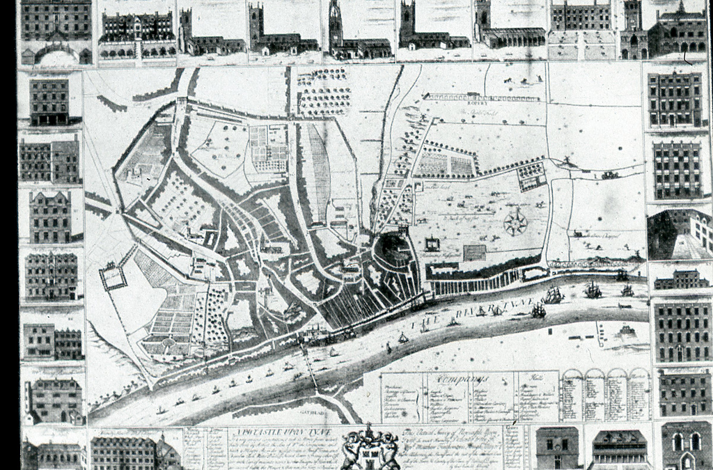
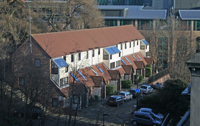
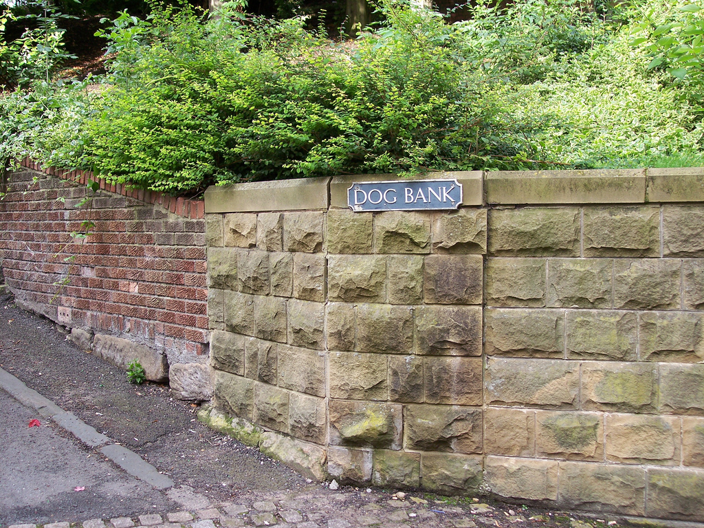
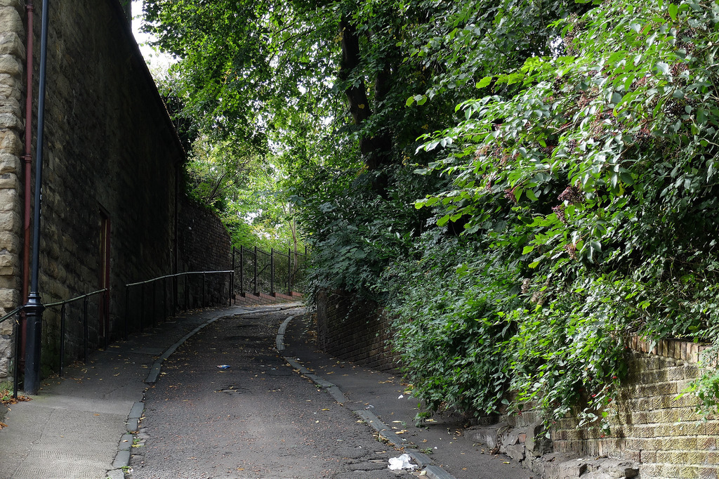
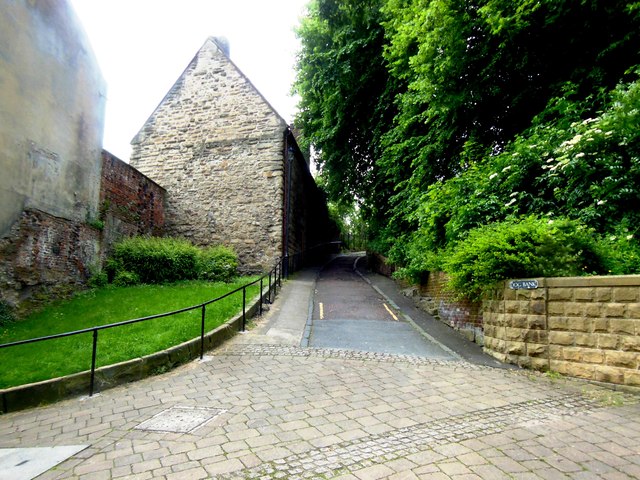
Dog Bank is a narrow street in Newcastle upon Tyne, which joins Akenside Hill and runs around the south edge of the churchyard of All Saints Church. It dates from medieval times, when it linked the three main routes through the town. "Anciently there was a sloped bank, about 10 yards broad, called the Dog Bank, close to the outside of the wall which led from Sandgate-gate down towards the river, by which horses were brought to their daily waterings, and through which passengers descended, and turned eastward along the shore." (Gray, 1649)
from Newcastle libraries (flickr)
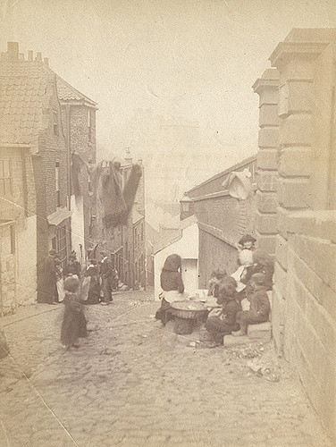
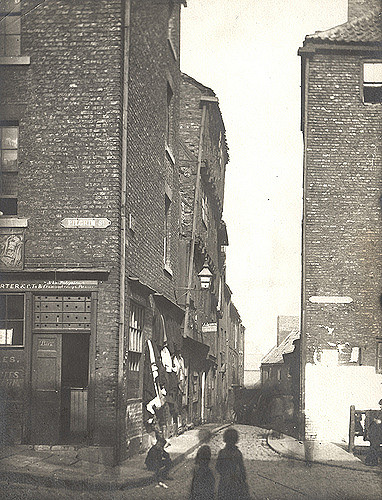
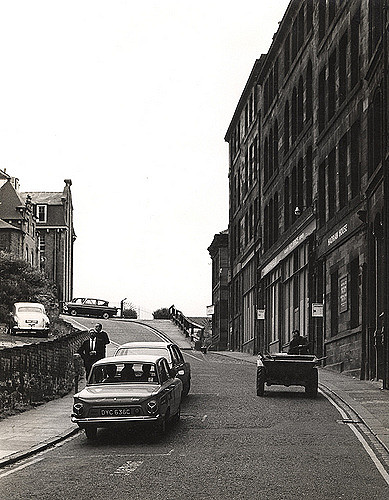
043976:Dog Bank Newcastle upon Tyne Unknown 1879-1880
Pinned by Simon Cotterill
from Newcastle libraries (flickr)
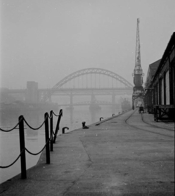
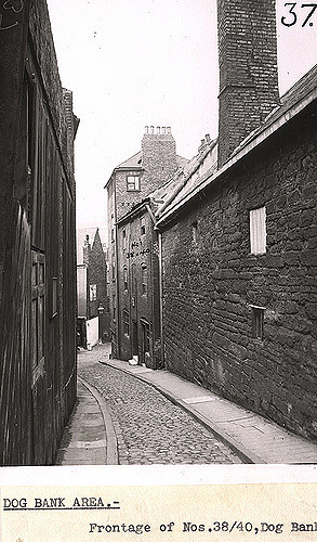
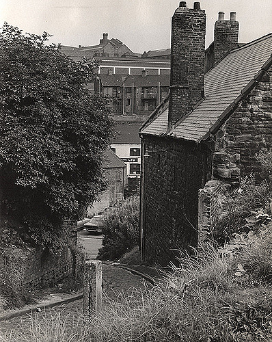
034848:Dog Bank Newcastle upon Tyne Dept of Environmental Health c.1935
Pinned by Simon Cotterill
from Newcastle libraries (flickr)
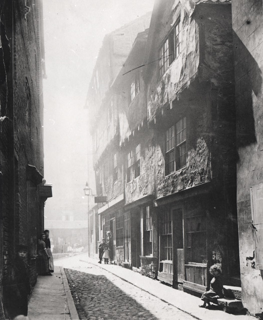
058016:Dog Bank Newcastle upon Tyne Unknown c.1890
Pinned by Simon Cotterill
from Newcastle libraries (flickr)
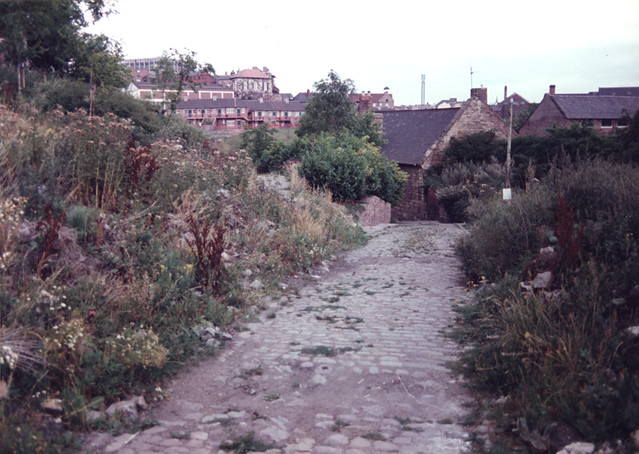
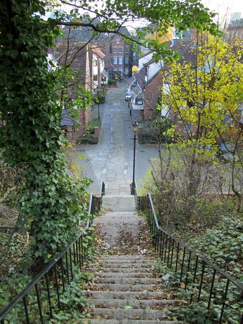
066080:Dog Bank Newcastle upon Tyne Unknown 1987
Pinned by Simon Cotterill
from Newcastle libraries (flickr)
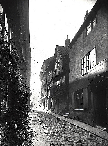
012188:Dog Bank Newcastle upon Tyne Unknown 1879-1880
Pinned by Simon Cotterill
from Newcastle libraries (flickr)
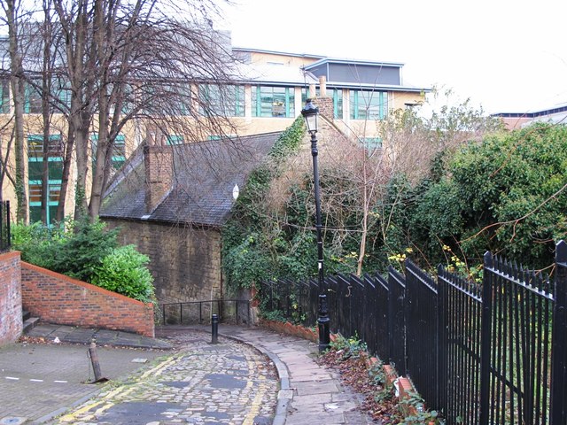
016086:Dog Bank Newcastle upon Tyne Signey J. 1967
Pinned by Simon Cotterill
Co-Curate Page
Broad Garth
- Broad Garth is a short narrow passage leading from the Quayside to Dog Bank.

from http://twsitelines.info/SMR/6…
Tyne and Wear HER(6565): Newcastle, Dog Bank
- "One of the minor medieval streets linking the three main routes through the town. Street around the south edge of All Saints churchyard...."
Added by
Simon Cotterill
Co-Curate Page
Akenside Hill
- Overview Map Street View Akenside Hill is a street in Newcastle, named after the poet Mark Akenside, who was born there in 1721. In the past the hill was known …
Co-Curate Page
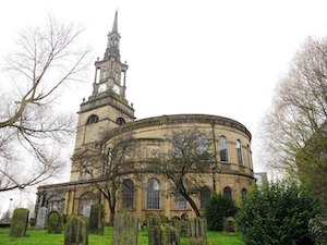
All Saints Church
- Overview About the Church Map Street View All Saints Church in Newcastle city centre was a parish church built 1786-1796 by David Stephenson, replacing an earlier medieval church. Its spire …
from Flickr (flickr)
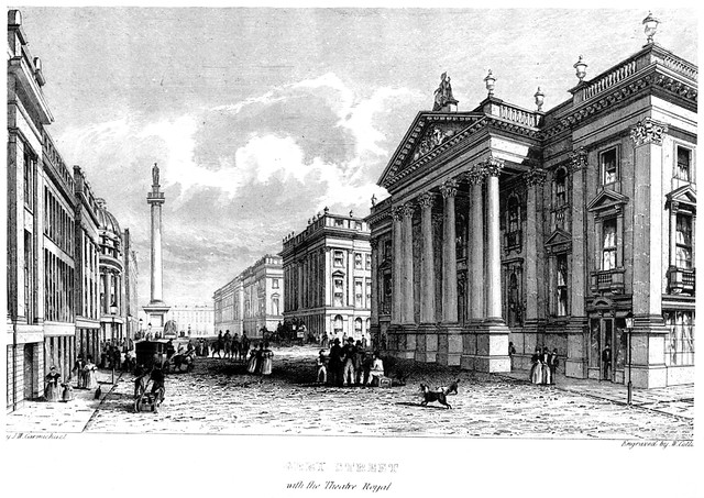
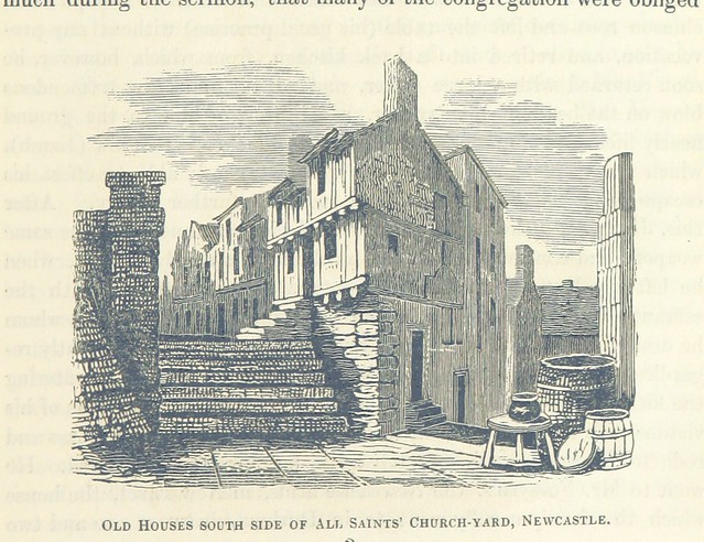
Image taken from page 415 of 'The Local Historian's Table Book of remarkable occurrences, historical facts, traditions, legendary and descriptive ballads, connected with the Counties of Newcastle-upon-Tyne, Northumberland, and Durham. Historical Division.
Pinned by Simon Cotterill

from Newcastle libraries (flickr)
043976:Dog Bank Newcastle upon Tyne Unknown 1879-1880
Pinned by Simon Cotterill
from Newcastle libraries (flickr)
034848:Dog Bank Newcastle upon Tyne Dept of Environmental Health c.1935
Pinned by Simon Cotterill
from Newcastle libraries (flickr)
058016:Dog Bank Newcastle upon Tyne Unknown c.1890
Pinned by Simon Cotterill
from Newcastle libraries (flickr)
066080:Dog Bank Newcastle upon Tyne Unknown 1987
Pinned by Simon Cotterill
from Newcastle libraries (flickr)
012188:Dog Bank Newcastle upon Tyne Unknown 1879-1880
Pinned by Simon Cotterill
from Newcastle libraries (flickr)
016086:Dog Bank Newcastle upon Tyne Signey J. 1967
Pinned by Simon Cotterill
Co-Curate Page
Broad Garth
- Broad Garth is a short narrow passage leading from the Quayside to Dog Bank.
from http://twsitelines.info/SMR/6…
Tyne and Wear HER(6565): Newcastle, Dog Bank
- "One of the minor medieval streets linking the three main routes through the town. Street around the south edge of All Saints churchyard...."
Added by
Simon Cotterill
Co-Curate Page
Akenside Hill
- Overview Map Street View Akenside Hill is a street in Newcastle, named after the poet Mark Akenside, who was born there in 1721. In the past the hill was known …
Co-Curate Page
All Saints Church
- Overview About the Church Map Street View All Saints Church in Newcastle city centre was a parish church built 1786-1796 by David Stephenson, replacing an earlier medieval church. Its spire …
from Flickr (flickr)
Image taken from page 415 of 'The Local Historian's Table Book of remarkable occurrences, historical facts, traditions, legendary and descriptive ballads, connected with the Counties of Newcastle-upon-Tyne, Northumberland, and Durham. Historical Division.
Pinned by Simon Cotterill