Topics > Cumbria > Brough Sowerby
Brough Sowerby
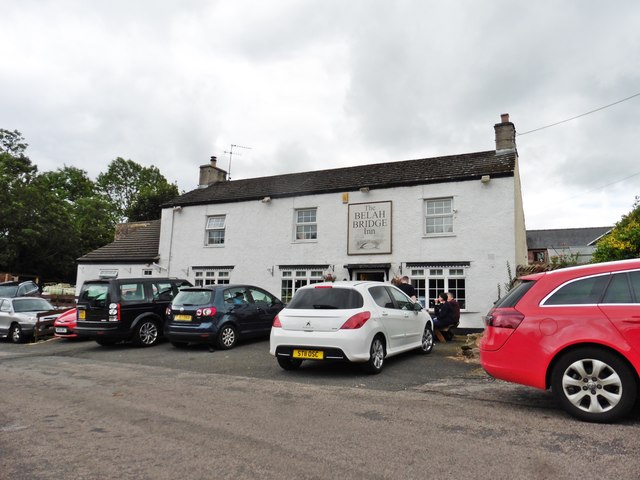
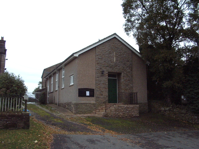
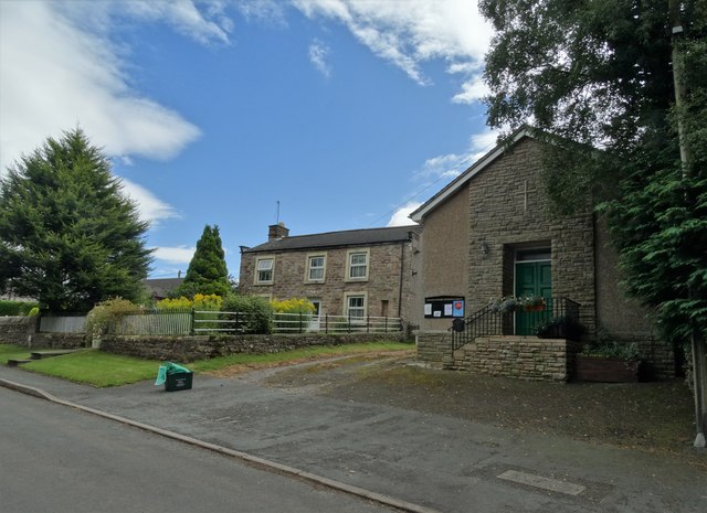
Brough Sowerby is a village in the Eden district of Cumbria, located about 1 mile south of Brough and 3 miles north-east of Kirkby Stephen. The village is located on the A685 road. To the west of the A686 is Westwood Farm and the Belah Bridge Inn public house and restaurant (established in the 1840’s and formerly called the Black Bull). Most of the residential housing, along with a Methodist church, are on a long road running east off the A685.
Extract from: A Topographical Dictionary of England comprising the several counties, cities, boroughs, corporate and market towns, parishes, and townships..... 7th Edition, by Samuel Lewis, London, 1848.
Brough Sowerby is a village and civil parish in the Eden district of Cumbria, England. It is located 22.3 miles south east of the town Penrith. According to the 2001 census it had a population of 127, increasing to 137 at the 2011 Census. The village is near the River Belah.
'A township in Brough parish, Westmoreland; 1½ mile S of Brough. Acres, 1,083. Real property with Kaber, £3,664. Pop., 140. Houses, 32.' There are quite a few Black Bull inns in the area surrounding Brough Sowerby, this comes from the old Scottish black cattle that were driven through Kirkby Stephen.
Meaning of the name Sowerby
The areas in Lancashire are recorded as "Sorbi" and "Sourebi" in the Domesday Book of 1086, and the ones in Yorkshire as "Sorebi", which is also in the Domesday Book of 1086. These places share the same meaning and derive from the same place, which is "the farm or village in marshy ground", from the Old Norse "saurr", mud, sour ground, with "byr", farm, settlement.
Population
in 1801 the population was at 139, rising to a peak of 180 in 1821. The population fluctuated between 155 and 128 throughout the rest of the 19th century and between 78 (in 1971) and 127 (in 2001) during the 20th century.
Industry and economic activity
In the earliest census of 1801 the population was clearly in the categories 'chiefly employed in agriculture', those 'chiefly employed in trade, manufacturers or handicraft', and others. A medieval corn mill, Joiners and wheelright, a clogger and a blacksmith were recorded in 1829. In the 21st century, the main occupations are farming, building and vegetable oil refining. Coaching inn, the Black Bull, was recorded in 1810; still there today in 2012.
There are surprisingly many businesses currently located in Brough sowerby for such a small village. Most notably the disposal of waste oil is a service which is provided in Brough Sowerby by Bay oils Ltd, who are a family run company who have been working within the oil industry for over 25 years.
Land ownership
It is part of theWestmorland/appleby barony. Brough Sowerby was held successively by the Vetriponts, the Cliffords, and the earls of Thanet. The Wharton family started to accumulate freehold in Sowerby in late Tudor times. In 1747, the Lowther estate bought these holdings from the trustees of the Duke of Wharton Mrs. Ewbanke, William Cleasby, of Kirkby Stephen; Christopher Bousfield, Thomas Davis, John Waistell, of Appleby, and several other small owners are the principal landowners.
Housing needs
In September 2009 the Cumbria Rural Housing Trust who are commissioned by the Eden District Council, conducted various Housing Needs Surveys across the parishes of the Upper Eden area with the purpose of identifying the need for affordable housing. The information received from the survey responses from the Brough Sowerby Parish show that 7.69% of the responses said that either the whole household or someone living within the household, wished to move within the parish in the next 5 years but the housing is not available.
Visit the page: Brough Sowerby for references and further details. You can contribute to this article on Wikipedia.

Co-Curate Page
Brough under Stainmoor Parish, 1848
- BROUGH, or BURG, under Stainmoor (St. Michael), a parish, in East ward and union, county of Westmorland; comprising the townships of Brough, Brough-Sowerby, and Hilbeck, and the chapelry of Stainmoor …


