Topics > Landmarks, Parks and Buildings > Boundary Stone
Boundary Stone
Boundary stones and boundary posts in Northern England. Old boundary stones can give a fascinating insight into the historical environment. Some mark existing boundaries, such as the large iconic stones at Carter Bar on the England-Scotland border. Others mark old boundaries, such as Three Shires Stone, marking the meeting of he historic counties of Lancashire, Westmorland and Cumberland, the boundaries of which have since changed. Other, often smaller boundary stones mark parish boundaries, erected at a time when the parish had greater political and social importance. The old boundary stones of Town Moor in Newcastle, give an example of marking boundaries following longstanding disagreements over ownership and access to land. Many of the photographs of boundary stones and boundary posts here were taken during surveys by the Milestone Society and shared on Geograph.co.uk. See also: Milestones
Co-Curate Page
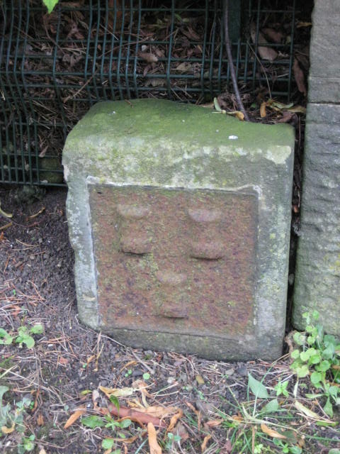
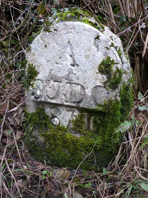
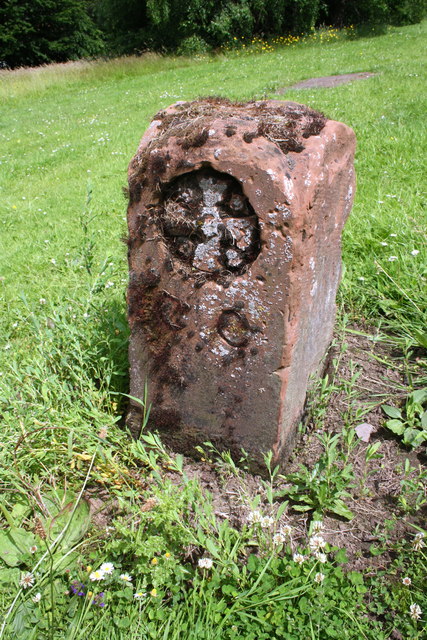
Town Moor Boundary Stone, Poneland Road, Fenham
- Overview Map Street View There is an old Town Moor Boundary Stone, next to the north gatepier of Millmount (house) on Poneland Road in Fenham, Newcastle - near Nun's Moor …

Co-Curate Page
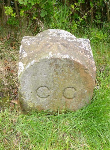
City boundary stone, Weavers Bank, Carlisle
- Overview Map This old city boundary stone is located by Weavers Bank in Bitts Park, Carlisle. It dates from the 1830s or 1840s and is inscribed on 2 faces "C.C." …

Co-Curate Page
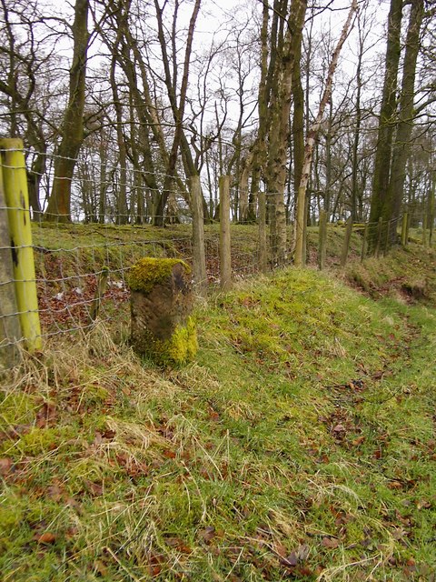
Boundary Post, B6385, by Main Line Industrial Estate
- Overview Map Street View There is an old stone boundary post, located a short distance north of the Main Line Industrial Estate. It is inscribed "M H", marking the boundary …
Co-Curate Page
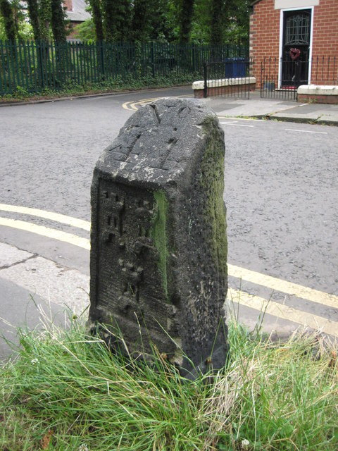
Town Moor boundary stone, Higbury, Jesmond
- Overview Map Street View This Town Moor boundary stone is located opposite No.73, Highbury in Jesmond, by the footpath to Jesmond Dene Road. The boundary stone dates from the 18th …
Co-Curate Page
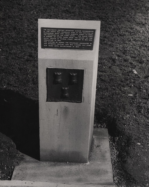
Town Moor Boundary Stone, Barras Bridge
- Overview Map Street View This old Town Moor Boundary Stone is located by the Civic Centre at Barras Bridge, Newcastle. The boundary marker was originally sited at the junction of …
Co-Curate Page
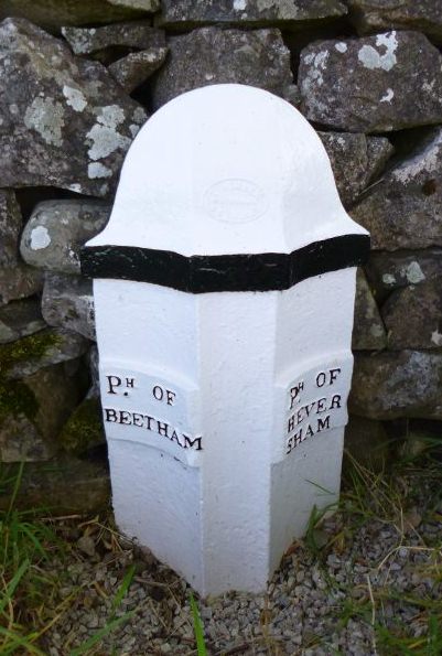
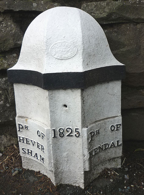
Old Parish Boundary Post, Ackenthwaite
- Overview Map Street View There is an old boundary post at the junction of the B6384 with Paradise Lane, between Ackenthwaite and Whasset. It marked the boundary between the parishes …
Co-Curate Page
Old Boundary Post, Barrows Green
- Overview Map Street View This old boundary post is located by the A65 road on a garden wall of a house located about 200 yrds north of the Punch Bowl …
Co-Curate Page
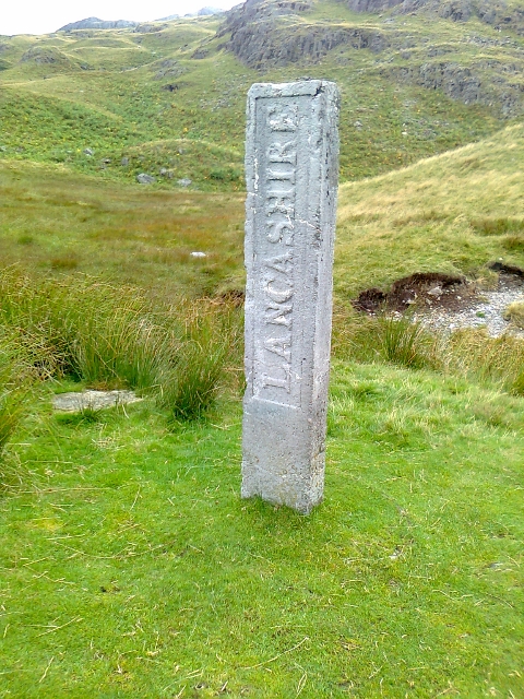
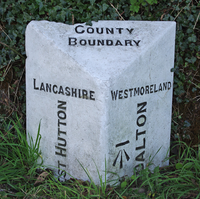
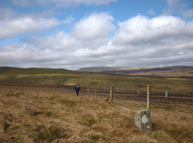
Three Shires Stone, Wrynose Pass
- Overview Map Street View The Three Shires Stone, at the top of Wrynose Pass near Little Langdale, marks the historic boundary of the old counties of Lancashire, Cumberland and Westmorland. …
Co-Curate Page
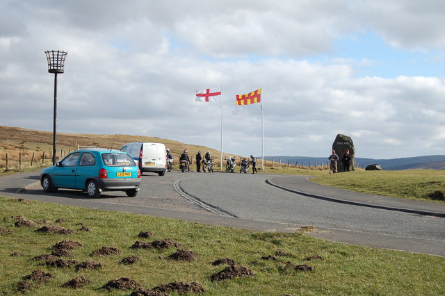
Carter Bar
- Overview Map Street View Aerial View Carter Bar is located on the England - Scotland border, at the highpoint of Redesdale in the Cheviot Hills. The A68 road crosses the …
Co-Curate Page
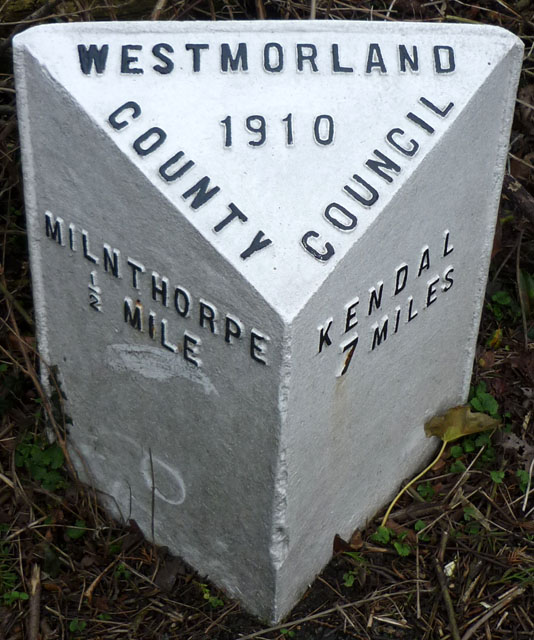
Milestone
- A milestone is a marker placed on a route, such as a road, railway line, or canal - usually indicating the distance to major towns. Milestones were used by the …
Co-Curate Page
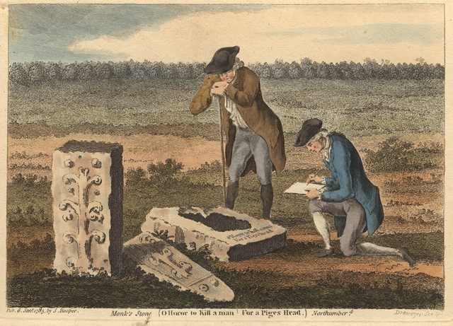
The Monk's Stone
- The Monk's Stone is the column from an old stone cross which originally stood north-west of Tynemouth on the ancient road to Tynemouth Priory close to Monk House Farm.[1] The …
Co-Curate Page
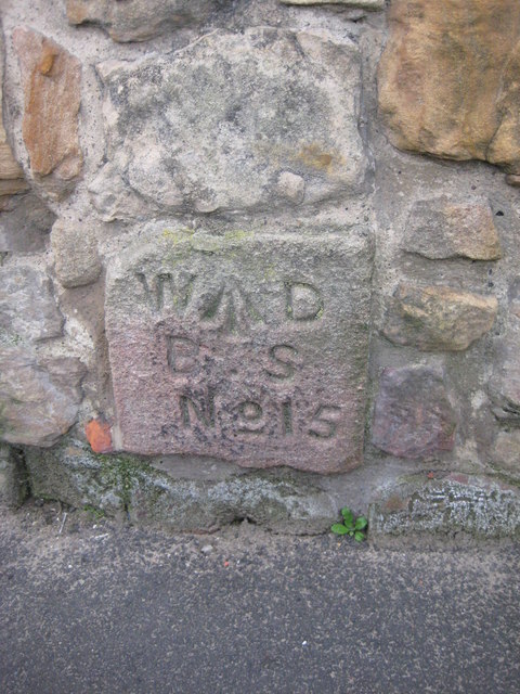
Old Carlisle City Boundary Stone, Whiteclosegate
- Overview Map Street View There is an old Carlisle City boundary stone by the B6264, outside No. 2 Whiteclosegate, just north of the B6264 junction with Longlands Road. The boundary …
Co-Curate Page
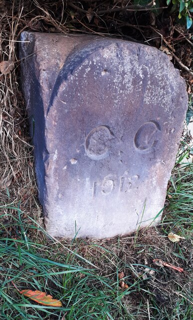
Old Carlisle City Boundary Stone, Harraby
- There is an old Carlisle City boundary stone is located between Nos. 417 and 419, London Road (A6), in Harraby. The boundary stone is marked "CC 1912". The stone was …
Co-Curate Page
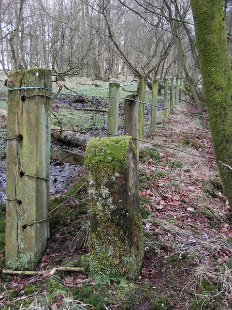
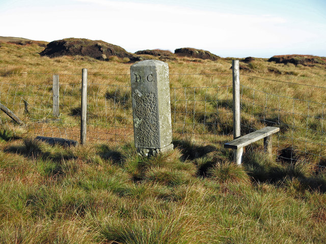
Old Boundary Marker on Scraith Head
- This is one of a series of 5 sandstone boundry markers on the border of County Durham and Cumbria. They date from c.1850 and inscribed "GH" on the west face …

Co-Curate Page
Town Moor Boundary Stone, Poneland Road, Fenham
- Overview Map Street View There is an old Town Moor Boundary Stone, next to the north gatepier of Millmount (house) on Poneland Road in Fenham, Newcastle - near Nun's Moor …
Co-Curate Page
City boundary stone, Weavers Bank, Carlisle
- Overview Map This old city boundary stone is located by Weavers Bank in Bitts Park, Carlisle. It dates from the 1830s or 1840s and is inscribed on 2 faces "C.C." …
Co-Curate Page
Boundary Post, B6385, by Main Line Industrial Estate
- Overview Map Street View There is an old stone boundary post, located a short distance north of the Main Line Industrial Estate. It is inscribed "M H", marking the boundary …
Co-Curate Page
Town Moor boundary stone, Higbury, Jesmond
- Overview Map Street View This Town Moor boundary stone is located opposite No.73, Highbury in Jesmond, by the footpath to Jesmond Dene Road. The boundary stone dates from the 18th …
Co-Curate Page
Town Moor Boundary Stone, Barras Bridge
- Overview Map Street View This old Town Moor Boundary Stone is located by the Civic Centre at Barras Bridge, Newcastle. The boundary marker was originally sited at the junction of …
Co-Curate Page
Old Parish Boundary Post, Ackenthwaite
- Overview Map Street View There is an old boundary post at the junction of the B6384 with Paradise Lane, between Ackenthwaite and Whasset. It marked the boundary between the parishes …
Co-Curate Page
Old Boundary Post, Barrows Green
- Overview Map Street View This old boundary post is located by the A65 road on a garden wall of a house located about 200 yrds north of the Punch Bowl …
Co-Curate Page
Three Shires Stone, Wrynose Pass
- Overview Map Street View The Three Shires Stone, at the top of Wrynose Pass near Little Langdale, marks the historic boundary of the old counties of Lancashire, Cumberland and Westmorland. …
Co-Curate Page
Carter Bar
- Overview Map Street View Aerial View Carter Bar is located on the England - Scotland border, at the highpoint of Redesdale in the Cheviot Hills. The A68 road crosses the …
Co-Curate Page
Milestone
- A milestone is a marker placed on a route, such as a road, railway line, or canal - usually indicating the distance to major towns. Milestones were used by the …
Co-Curate Page
The Monk's Stone
- The Monk's Stone is the column from an old stone cross which originally stood north-west of Tynemouth on the ancient road to Tynemouth Priory close to Monk House Farm.[1] The …
Co-Curate Page
Old Carlisle City Boundary Stone, Whiteclosegate
- Overview Map Street View There is an old Carlisle City boundary stone by the B6264, outside No. 2 Whiteclosegate, just north of the B6264 junction with Longlands Road. The boundary …
Co-Curate Page
Old Carlisle City Boundary Stone, Harraby
- There is an old Carlisle City boundary stone is located between Nos. 417 and 419, London Road (A6), in Harraby. The boundary stone is marked "CC 1912". The stone was …


")
