Topics > Civil Parishes in Cumbria > Bewcastle Civil Parish > Bewcastle Parish, Historical Account, 1848
Bewcastle Parish, Historical Account, 1848
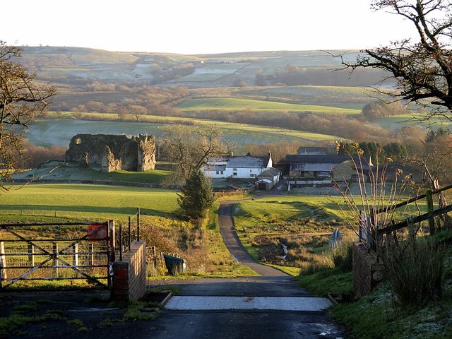
BEWCASTLE (St. Cuthbert), a parish, in the union of Longtown, Eskdale ward, E. division of Cumberland, 10 miles (N.N.E.) from Brampton; comprising the townships of Bailie, Bellbank, Bewcastle, and Nixons; and containing 1,274 inhabitants, of whom 181 are in the township of Bewcastle. This place, which was a Roman station on the Maiden-way, derived its name from a fortress erected here soon after the Conquest by Bueth, lord of Gilsland, and in which, in the reign of Elizabeth, and also in 1639, a border garrison was placed; during the civil war the castle was demolished by the parliamentarians, and only some slight vestiges of it now remain. The parish comprises about 41,221 acres, of which 21,221 are rateable, and about 20,000 undivided common; it abounds with richly varied and picturesque scenery, and within its limits the Leven or Line and the Irthing have their sources. The substrata are chiefly limestone and coal, and lead-ore is found in abundance. In the 7th of Edward I., license was granted to John Swinburn, to hold a weekly market and an annual fair. The living is a rectory, rated in the king's books at £2, and in the patronage of the Dean and Chapter of Carlisle, with a net income of £120. The rectorial tithes for the township of Bewcastle have been commuted for £60; and there are 40 acres of glebe. In the churchyard is a curious antique cross composed of a single stone, bearing Runic inscriptions which have been variously interpreted, and some curious devices supposed to be emblematical of the conversion of the Danes to Christianity, and commemorative of the death and interment of one of their kings. Here is a place of worship for Presbyterians. Many coins, inscribed stones, and other relics of Roman occupation have been found, and there are various relics of antiquity in the vicinity. The parish contains two mineral springs, one sulphureous, the other chalybeate; and at Low Grange, a quarter of a mile to the east of the church, is a petrifying spring.
Extract from: A Topographical Dictionary of England comprising the several counties, cities, boroughs, corporate and market towns, parishes, and townships..... 7th Edition, by Samuel Lewis, London, 1848.

from https://openlibrary.org/books…
A topographical dictionary of England, Samuel Lewis, 7th Ed., 1848
- A topographical dictionary of England
comprising the several counties, cities, boroughs, corporate and market towns, parishes, and townships, and the islands of Guernsey, Jersey, and Man, with historical and statistical …
Added by
Simon Cotterill
Co-Curate Page
Bewcastle
- Overview About Bewcastle Map Street View Bewcastle is located in the City of Carlisle district of Cumbria. Historically, Bewcastle was an ancient parish in the county of Cumberland. Today it …
Co-Curate Page
Bailey
- Overview Map Street View Bailey is an area in the north-east of Cumbria, around the valley of Bailey Water, extending up to the border with Scotland. Historically, Bailey (aka Bailie) …
Co-Curate Page
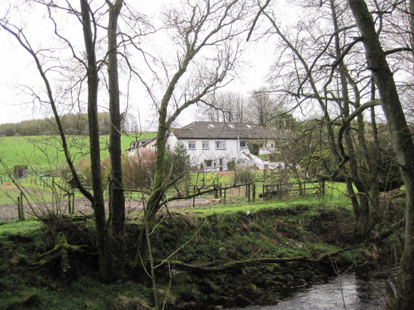
Bellbank, Bewcastle
- Overview Map Bellbank is a farm in the City of Carlisle district of Cumbria, located by the White Lyne (river) and about 2½ miles south-west of Bewcastle and 12 miles …

from https://openlibrary.org/books…
A topographical dictionary of England, Samuel Lewis, 7th Ed., 1848
- A topographical dictionary of England
comprising the several counties, cities, boroughs, corporate and market towns, parishes, and townships, and the islands of Guernsey, Jersey, and Man, with historical and statistical …
Added by
Simon Cotterill
Co-Curate Page
Bewcastle
- Overview About Bewcastle Map Street View Bewcastle is located in the City of Carlisle district of Cumbria. Historically, Bewcastle was an ancient parish in the county of Cumberland. Today it …
Co-Curate Page
Bailey
- Overview Map Street View Bailey is an area in the north-east of Cumbria, around the valley of Bailey Water, extending up to the border with Scotland. Historically, Bailey (aka Bailie) …


