Topics > Geography > Rivers > River Derwent (Tyne) > Beldon Burn
Beldon Burn
Beldon Burn is a tributary of the River Derwent (Tyne) in Northumberland. There was lead mining in the valley of the burn at Beldon Shield during the 18th and 19th centuries.
from Geograph (geograph)
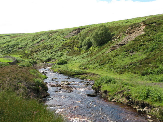
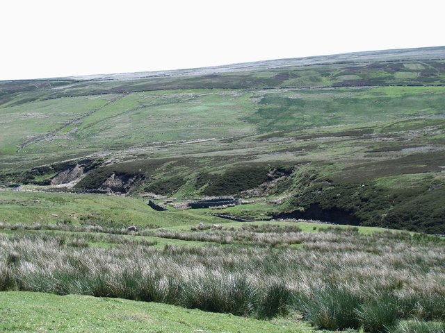
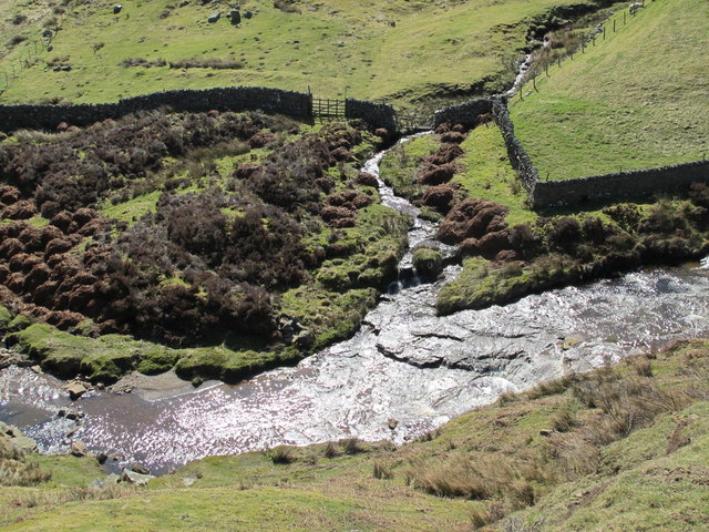
The valley of Beldon Burn below Riddlehamhope Fell
Pinned by Simon Cotterill
from Geograph (geograph)
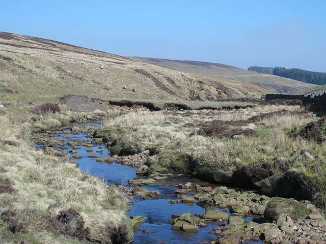
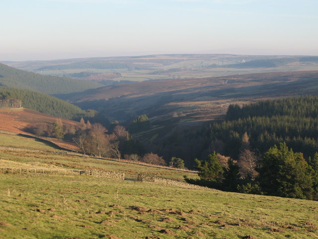
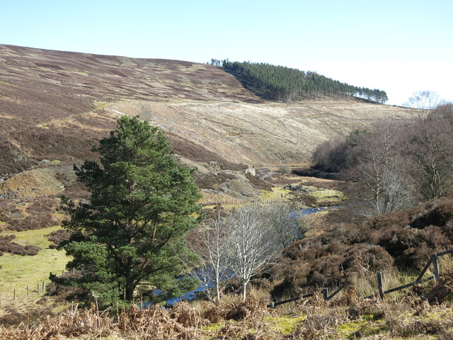
The cleugh of Beldon Burn with Heatheryburn Moor beyond
Pinned by Simon Cotterill
Co-Curate Page
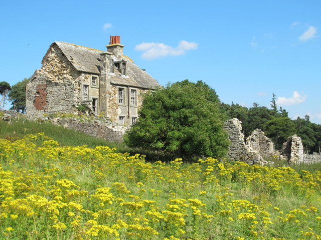
Riddlehamhope
- Overview Map On the east side of Riddlehamhope Fell in Northumberland, near Beldon Burn, stood Riddlehamhope Hall. The buildng was originally a bastle and later converted for use as a …
Co-Curate Page
Heatheryburn, Northumberland
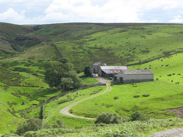
- Overview Map Heatheryburn is a farm in Northumberland, located by Riddlehamhope Fell, near the confluence of Heathery Burn and Beldon Burn.
Co-Curate Page
Beldon Shield
- Beldon Shield is a romote location by Newbiggin Fell, to the west of Blanchland in Northumberland. It is situated by Beldon Burn and was the site of Beldon lead mine …
Co-Curate Page
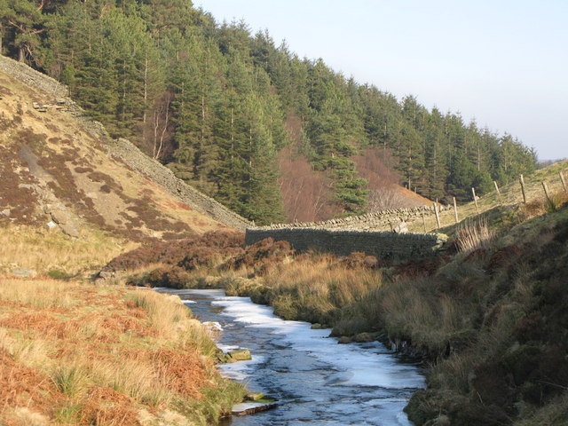
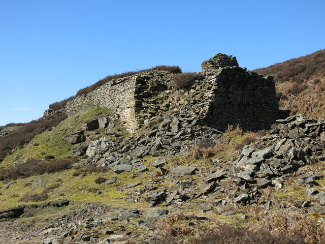
Beldon lead mine and ore works
- Overview Map The remains of Beldon lead mine and ore works are situated on two levels in the valley of Beldon Burn at Beldon Shield. The visible remains of the …

from Geograph (geograph)
The valley of Beldon Burn below Riddlehamhope Fell
Pinned by Simon Cotterill
from Geograph (geograph)
The cleugh of Beldon Burn with Heatheryburn Moor beyond
Pinned by Simon Cotterill
Co-Curate Page
Riddlehamhope
- Overview Map On the east side of Riddlehamhope Fell in Northumberland, near Beldon Burn, stood Riddlehamhope Hall. The buildng was originally a bastle and later converted for use as a …
Co-Curate Page
Heatheryburn, Northumberland
- Overview Map Heatheryburn is a farm in Northumberland, located by Riddlehamhope Fell, near the confluence of Heathery Burn and Beldon Burn.
Co-Curate Page
Beldon Shield
- Beldon Shield is a romote location by Newbiggin Fell, to the west of Blanchland in Northumberland. It is situated by Beldon Burn and was the site of Beldon lead mine …