Topics > Northumberland > Civil Parishes in Northumberland > West Allen Civil Parish > Appletree Shield (ruins)

Appletree Shield (ruins)


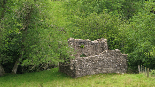
The castlesque ruins of the former Appletree Shield farm, by Wellhope Burn, are located about 2 miles south-west of Ninebanks in West Allen. Whellan's 1855 directory of Northumberland lists Appletree Shield under the grieveship of High West Allen in the ancient parish of Allendale, and the farmer at that time was Mary Walton.[1]

West Allen Civil Parish Wellhope Burn High Forest and Low Forest (Allendale), 1848 Former Farm Appletree Shield Chapel
from Geograph (geograph)
Appletree Shield

Pinned by Simon Cotterill
from Geograph (geograph)
Appletree Shield

Pinned by Simon Cotterill
from Geograph (geograph)
Appletree Shield

Pinned by Simon Cotterill
from Geograph (geograph)
Appletree Shield

Pinned by Simon Cotterill
from Geograph (geograph)
Ruined building at confluence of Mohope and Wellhope Burns

Pinned by Simon Cotterill

Comments

Add a comment or share a memory.

Login to add a comment. Sign-up if you don't already have an account.


ABOUT US

Co-Curate is a project which brings together online collections, museums, universities, schools and community groups to make and re-make stories and images from North East England and Cumbria. Co-Curate is a trans-disciplinary project that will open up 'official' museum and 'un-officia'l co-created community-based collections and archives through innovative collaborative approaches using social media and open archives/data.

LATEST SHARED RESOURCES