Topics > Historical Periods > 18th Century > 1770s > 1771
1771
In Northern England:
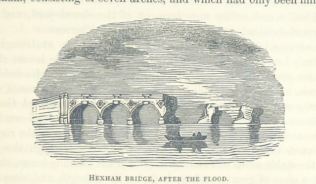
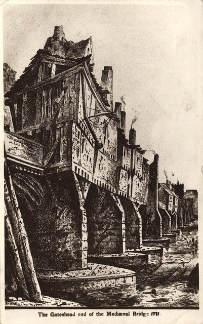
- 17th of November 1771; the old Tyne Bridge damaged by floods.

Co-Curate Page
Tyne Bridge Damaged by Floods, 1771
- "On Sunday Morning the 17th of November 1771 an unprecedented inundation of the Tyne occurred by which the bridge at Newcastle with the shops and houses thereon were carried away …
from Newcastle libraries (flickr)
068215:Tyne Bridge Newcastle upon Tyne Unknown 1771
Pinned by Simon Cotterill
from Newcastle libraries (flickr)
066525:Tyne Bridge Newcastle upon Tyne Unknown 1771
Pinned by Simon Cotterill
Co-Curate Page
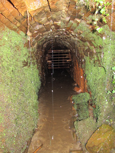
Tynebottom Mine, near Garrigill
- Tynebottom is a former lead mine at Redwig by the River South Tyne, about half a mile north-west of Garrigill in Cumbria - seen from the route of the Pennine Way. Tynebottom …
Co-Curate Page
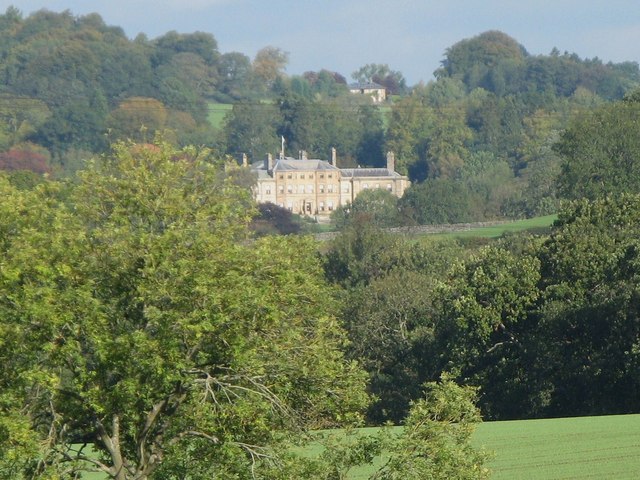
Chesters, Humshaugh
- Overview About Chesters Map Chesters is a country house near Humshaugh in Northumberland. It was built in 1771 by John Carr for John Errington of Walwick Grange. In 1796 the …

Co-Curate Page
Tyne Bridge Damaged by Floods, 1771
- "On Sunday Morning the 17th of November 1771 an unprecedented inundation of the Tyne occurred by which the bridge at Newcastle with the shops and houses thereon were carried away …
from Newcastle libraries (flickr)
068215:Tyne Bridge Newcastle upon Tyne Unknown 1771
Pinned by Simon Cotterill
from Newcastle libraries (flickr)
066525:Tyne Bridge Newcastle upon Tyne Unknown 1771
Pinned by Simon Cotterill
Co-Curate Page
Tynebottom Mine, near Garrigill
- Tynebottom is a former lead mine at Redwig by the River South Tyne, about half a mile north-west of Garrigill in Cumbria - seen from the route of the Pennine Way. Tynebottom …