Topics > Northumberland > Well Hill, Stannington
Well Hill, Stannington
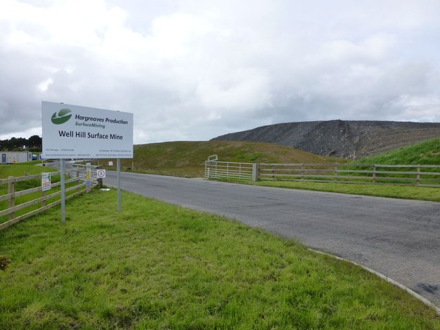
Well Hill Farm is located on Bets Lane and is located about 2½ miles north-west of the village of Stannington in Northumberland. As well as the farm, there are a couple of houses close by, on 'The Drive'. The remains of a probable Iron Age farmstead were discovered here during excavations in 2014.[1] An old well head is also located to the south of the farm[2] (possibly the place name relates to this). The present farmhouse dates from the 18th century, with later alterations. Well Hill Surface Mine was located to the south of the farm; in 2012, Hargreaves Services was granted permission to open the mine, with an aim of extracting 130,000 tonnes of coal over a two-year period. Well Hill is part of Stannington Civil Parish.

from https://keystothepast.info/se…
Iron Age farmstead, Well Hill (Stannington)
- Remains of a probable Iron Age farmstead were discovered during excavations in 2014. A series of large ditches was revealed which appear to form two or more enclosures. Overlying the …
Added by
Simon Cotterill

from https://keystothepast.info/se…
Well head, Well Hill Farm (Stannington)
- "The remains of a well head lie in a field south of Well Hill Farm. It is shown on the first edition Ordnance Survey map of 1860 and was still …
Added by
Simon Cotterill


from https://keystothepast.info/se…
Iron Age farmstead, Well Hill (Stannington)
- Remains of a probable Iron Age farmstead were discovered during excavations in 2014. A series of large ditches was revealed which appear to form two or more enclosures. Overlying the …
Added by
Simon Cotterill

from https://keystothepast.info/se…
Well head, Well Hill Farm (Stannington)
- "The remains of a well head lie in a field south of Well Hill Farm. It is shown on the first edition Ordnance Survey map of 1860 and was still …
Added by
Simon Cotterill


