Topics > Heritage Sites > Hadrian's Wall > Wall Mile 76
Wall Mile 76
Hadrian's Wall - Wall Mile 76
Hadrian's Wall stretches from the east to west coast of England and was an important frontier of the Roman Empire. Building of the wall began in AD 122 and took six years to complete it’s 84 mile (80 Roman mile) length. Soldiers were garrisoned along the line of the wall in large forts, smaller milecastles, and intervening turrets. The Vallum, a large ditch with mounds on either side, ran along the south side of the wall, protecting the rear of the frontier. Hadrian's Wall was designated as a World Heritage Site in 1987.
Wall mile 76 was originally part of the turf wall, later replaced by stone. From Milecastle 49 to the western end of Hadrian's Wall on the Solway Firth, the wall was originally constructed from turf, possibly due to the absence of limestone. Subsequently, the turf wall was demolished and replaced with a stone wall.
Wall Mile 76:
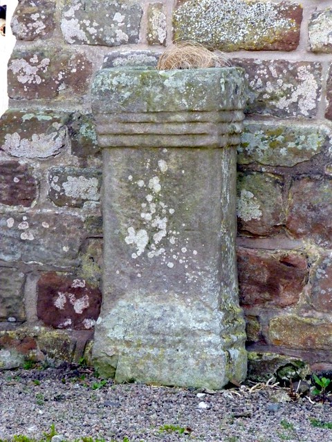
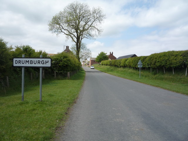
- Milecastle 76 (Drumburgh)
- Turret 76a (Drumburgh)
- Turret 76b - exact location unknown
- Drumburgh Roman fort (Congavata)
Scheduled Monument (#1014699): Drumburgh Roman fort and Hadrian's Wall between Burgh Marsh and Westfield House in wall miles 76 and 77
Click the headings below to expand (selected extracts from the Historic England scheduling)
Map showing the buried remains of Hadrian's Wall and Drumburgh Roman fort in this section (Scheduled Monument area).
%
Hadrian's Wall survives as a buried feature throughout the whole of this section. Excavations by Haverfield in 1899 located the Wall between Burgh Marsh and Drumburgh fort. The Wall measured 2.95m wide and the wall ditch was 8.9m wide and lay 8m north of the wall. Excavations by Charlesworth in 1973 confirmed the course of the Wall north of Glasson. Geophysical survey has also located the line of the Wall or wall ditch to the north east of Glasson.
The exact location of milecastle 76 has not yet been confirmed. A faint irregular platform 200m east of Drumburgh Roman fort amongst ridge and furrow could possibly be the remains of the milecastle platform, however this is not certain and its position still needs confirmation.
Turret 76a was located in 1948 just east of Drumburgh schoolhouse by Simpson, Hodgson and Richmond. Its remains survive as buried features with no traces visible above ground.
The exact locations of turrets 76b, 77a and 77b have not yet been confirmed. On the basis of the usual spacing turret 76b is expected to be located about 90m south of where the dismantled railway crosses Hadrian's Wall east of Glasson and turret 77a approximately 140m south east of Lowtown House. Turret 77b is believed to be beneath Westfield House or its yard
The course of the Roman road known as the Military Way, which ran along the corridor between the Wall and vallum linking turrets, milecastles and forts, has not been confirmed in this section. It is expected to run parallel to the course of the Wall set back a few metres to the south.
Drumburgh Roman fort, known to the Romans as Congavata, commanded an outlook to the north and east over the Inner Solway. There has been very little archaeological work carried out on this fort, and it remains one of the least well known Wall forts.
Small scale excavations were carried out in 1899 by Haverfield who located the remains of a small stone fort. A subsequent excavation in 1947 by Simpson and Richmond showed that the stone fort lay within an earlier and larger turf and timber fort with ramparts made from the readily available alluvial clay. Pottery finds attested an occupation continuing into the late Roman period.
The remains of the fort survive as buried features. The right angled ditch west of Drumburgh House is was at one time thought to be the ditch of the Roman fort. The excavations in 1899 however discovered it to be a medieval ditch, although its association has not been confirmed.
Scheduled Monument (#1014700): Hadrian's Wall vallum between the watercourse 400m south east of Glasson and the access road to Glendale caravan park in wall miles 76 and 77
Click the headings below to expand (selected extracts from the Historic England scheduling)
Map showing the buried remains of Hadrian's Wall vallum in this section (Scheduled Monument area).
%
The vallum survives as a feature visible on the ground throughout most of this section. At the eastern end of the monument the vallum ditch is utilised by a modern drainage ditch 5.7m wide and 2m deep. The course of the vallum between the watercourse 400m south east of Glasson and Burgh Marsh has not yet been confirmed and is therefore not included in the scheduling.
West of Glasson the line of the vallum ditch is visible as a faint shallow depression but at the west end of the monument it survives in the field immediately east of the access track to Glendale caravan park as a more obvious earthwork up to 0.8m in depth.


from https://historicengland.org.u…
Drumburgh Roman fort and Hadrian's Wall between Burgh Marsh and Westfield House in wall miles 76 and 77
- ...Drumburgh Roman fort, Hadrian's Wall and its associated features between Burgh Marsh and Westfield House survive as a series of buried remains. The Roman fort and section of Wall have …
Added by
Simon Cotterill
from https://historicengland.org.u…
Hadrian's Wall vallum between the watercourse 400m south east of Glasson and the access road to Glendale caravan park in wall miles 76 and 77 - List Entry
- ...Hadrian's Wall vallum between the watercourse 400m south east of Glasson and the access road to Glendale caravan park survives well as a series of buried remains. Significant information on …
Added by
Simon Cotterill


from https://perlineamvalli.wordpr…
Wall Mile 76
- Wall Mile 76 (September 11, 2011). Mike Bishop's PLV blog about walking Hadrian’s Wall written from an archaeologist’s point of view. "Nothing much interesting happens between Glasson and Drumburgh if …
Added by
Simon Cotterill

from https://historicengland.org.u…
Drumburgh Roman fort and Hadrian's Wall between Burgh Marsh and Westfield House in wall miles 76 and 77
- ...Drumburgh Roman fort, Hadrian's Wall and its associated features between Burgh Marsh and Westfield House survive as a series of buried remains. The Roman fort and section of Wall have …
Added by
Simon Cotterill
from https://historicengland.org.u…
Hadrian's Wall vallum between the watercourse 400m south east of Glasson and the access road to Glendale caravan park in wall miles 76 and 77 - List Entry
- ...Hadrian's Wall vallum between the watercourse 400m south east of Glasson and the access road to Glendale caravan park survives well as a series of buried remains. Significant information on …
Added by
Simon Cotterill
from https://perlineamvalli.wordpr…
Wall Mile 76
- Wall Mile 76 (September 11, 2011). Mike Bishop's PLV blog about walking Hadrian’s Wall written from an archaeologist’s point of view. "Nothing much interesting happens between Glasson and Drumburgh if …
Added by
Simon Cotterill


")