Topics > Heritage Sites > Hadrian's Wall > Wall Mile 71
Wall Mile 71
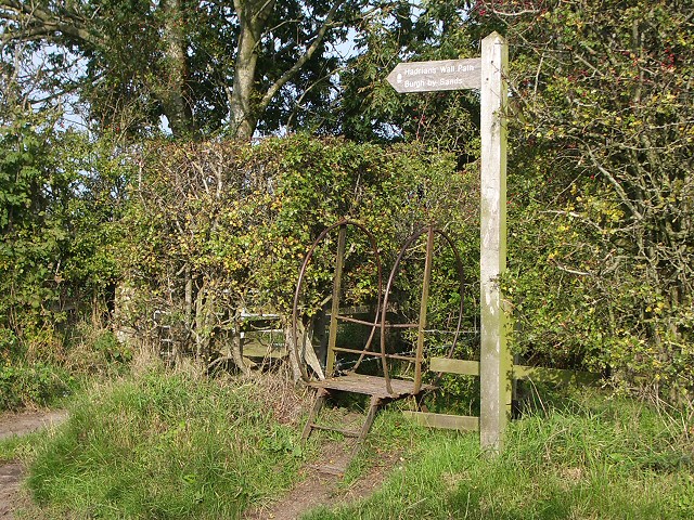
Hadrian's Wall - Wall Mile 71
Hadrian's Wall stretches from the east to west coast of England and was an important frontier of the Roman Empire. Building of the wall began in AD 122 and took six years to complete it’s 84 mile (80 Roman mile) length. Soldiers were garrisoned along the line of the wall in large forts, smaller milecastles, and intervening turrets. The Vallum, a large ditch with mounds on either side, ran along the south side of the wall, protecting the rear of the frontier. Hadrian's Wall was designated as a World Heritage Site in 1987.
Wall mile 71 was originally a turf wall, later replaced by stone. From Milecastle 49 to the western end of Hadrian's Wall on the Solway Firth, the wall was originally constructed from turf, possibly due to the absence of limestone. Subsequently, the turf wall was demolished and replaced with a stone wall.
Wall Mile 71:
- Milecastle 71 (Wormanby)
- Turret 71a
- Turret 71b
- Burgh Roman Fort (Aballava)
- Beaumont Temporary Roman Camp
Scheduled Monument (#1018457): Burgh by Sands Roman fort, Beaumont camp, Burgh Castle and Hadrian's Wall from boundary west of churchyard, Beaumont to Burgh Head in wall miles 70 and 71
Click the headings below to expand (selected extracts from the Historic England scheduling)
Map showing the buried remains of Hadrian's Wall, fort and Beaumont camp, in this section (Scheduled Monument area).
%
The monument includes Hadrian's Wall and its associated features between the field boundary at the west side of the churchyard belonging to St Mary's Church at Beaumont in the east and Burgh Head in Burgh by Sands in the west, as well as Burgh by Sands Roman fort, Beaumont temporary camp south of Hadrian's Wall and the site of a medieval earthwork castle known as Burgh Castle.
Hadrian's Wall survives as a buried feature throughout the whole of this section. Its course in the area of Burgh Castle, south east of Speergarth Holes, has been confirmed by excavation by Hogg in 1950. The wall ditch was also confirmed to survive as a buried feature north of the Wall in the 1950 excavation. In addition a further length of the Wall line was confirmed west of Burgh Castle by geophysical survey in 1991. The results of this survey indicate that there are two lines taken by the Wall, the southern one representing the primary Turf Wall running close to the modern road, while the second line heads north west from Burgh Castle and meets the north east corner of the fort, also identified in the geophysical survey. This more northern line is thought to represent a realignment of the Wall when the fort was built so that the fort lay wholly to the rear of the Wall and did not partly project north of it. This realignment may have been carried out as late as the third century AD.
Milecastle 71 survives as a buried feature. Its position was located in 1960 by Bartle although this has not been confirmed since. According to Bartle it is situated south east of the western end of Milldikes Lane.
The precise locations of turrets 70b, 71a and 71b have not yet been confirmed. On the basis of the usual spacing, turret 70b is expected to be located about 540m west of St Mary's Church to the south of Milldikes Lane, turret 71a near to the footbridge over Greathill Beck, and turret 71b is probably under the site of Burgh fort in the area of the modern graveyard
The course of the Roman road known as the Military Way, which ran along the corridor between the Wall and vallum linking turrets, milecastles and forts, has not yet been confirmed in this section. A length of road, 8m wide, is known approximately 60m east of the fort from excavations in 1980 by Jones, but it is uncertain if this was the Military Way or another street within the extra-mural civil settlement.
A Roman temporary camp has been identified 80m to the south of the west end of Milldikes Lane 40m south of the course of Hadrian's Wall on the gently sloping south facing side of a spur overlooking the Powburgh Beck. Although only the eastern segment of the camp was recorded from crop marks visible on aerial photographs, sufficient remains were identified to allow the full extent of the site to be postulated. The only complete side identified is the east side. The site of the camp is overlain by narrow ridge and furrow, the product of medieval or later cultivation on the site.
The Wall fort at Burgh, known to the Romans as Aballava, lies astride the southern of the two lines of Hadrian's Wall. Excavation in 1922 by Collingwood confirmed the position of the east wall and gateway as well as observing the stone footings of barrack blocks. Geophysical survey in 1991 provided further confirmation of the north and east sides of the fort as well as indicating that Hadrian's Wall was realigned to meet the north east corner of the fort. Excavations in 1993 by Flynn confirmed the primary line of the wall ditch at Demesne Farm, 6m wide and 2.2m deep, which was later infilled and buildings associated with the fort constructed on clay and cobble foundations.
A Roman altar found at Beaumont in 1934 shows that in the third century the fort was garrisoned by Aurelian Moors. The full extent of the fort is unknown as the west and south sides of its defences have not been confirmed.
The remains of an extra-mural settlement, usually known as a vicus, were discovered beyond the east side of the fort during in 1980 and 1982 by Jones in the garden of the former vicarage. The remains included the foundations of buildings fronting onto a road running east-west. The recovery of large quantities of slag and charcoal indicate that metalworking was taking place. Further indications of vicus buildings were revealed by the geophysical survey in 1991 east of the fort, north of the modern road in the area between the primary wall ditch and the realignment of the Wall to meet the north east corner of the fort. It is likely that the vicus was extensive and extended round both the southern and eastern sides of the fort.
The course of the vallum in this section is known both from observations in the adjacent sections of Hadrian's Wall to the east and west. A substantial ditch to the south of the former vicarage was discovered in excavations in 1980 by Jones, and, although its full extent was not examined, it is likely to have been the ditch of the vallum. If this is so, the vallum in this section of the monument runs slightly to the north of the line depicted by the Ordnance Survey. There are no indications of the earthwork visible on the ground and it survives entirely as buried remains.
Scheduled Monument (1014697): Hadrian's Wall vallum between the dismantled railway west of Kirkandrews Farm and the dismantled railway south east of Burgh by Sands in wall miles 70 and 71
Click the headings below to expand (selected extracts from the Historic England scheduling)
Map showing the buried remains of Hadrian's Wall vallum in this section (Scheduled Monument area).
%
The vallum survives intermittently as a feature visible on the ground. However, its surface remains are generally slight and most of the remains survive as buried features. Where visible, the ditch is generally a slight depression averaging 15m wide. However to the west of Greathill Beck it survives up to 2.5m deep.
Scheduled Monument (#1018308): Hadrian's Wall Vallum between West End, Burgh by Sands and the eastern boundary of Dykesfield
Click the headings below to expand (selected extracts from the Historic England scheduling)
Map showing the buried remains of Hadrian's Wall vallum in this section (Scheduled Monument area).
%
for much of its length in this section, the Vallum survives as a buried feature about 40m across. Its course and survival has been confirmed by small-scale excavation and a series of LiDAR images, the latter clearly showing the central ditch as an infilled, buried feature about 6m across; an archaeological evaluation in 2015 revealed the central ditch to be about 7.5m across. At two locations very slight surface remains are visible: to the west of West End a slight fold in the ground is considered to represent the Vallum ditch, and in woodland immediately to the east of Dykesfield surface traces of the north mound and the extremely slight indications of the Vallum ditch have been noted.
Scheduled Monument (#1018458): Hadrian's Wall vallum between east side of road at Burgh Head, and boundary south of Ash Tree Square, Burgh-by-Sands in wall miles 71 and 72
Click the headings below to expand (selected extracts from the Historic England scheduling)
Map showing the buried remains of Hadrian's Wall vallum in this section (Scheduled Monument area).
%
The vallum survives as a buried feature throughout the length of this section. The course of the vallum ditch was confirmed immediately west of the north- south road during the trial trenching in 1977 by Austen and at the west end of the section during excavation in 1938 by Richmond.


from https://historicengland.org.u…
Burgh by Sands Roman fort, Beaumont camp, Burgh Castle and Hadrian's Wall from boundary west of churchyard, Beaumont to Burgh Head in wall miles 70 and 71 - List Entry
- ...Hadrian's Wall, Burgh Roman fort and a Roman temporary camp from the east end of St Mary's Church at Beaumont to Burgh Head, survive as a series of buried remains. …
Added by
Simon Cotterill
from https://historicengland.org.u…
Hadrian's Wall vallum between the dismantled railway west of Kirkandrews Farm and the dismantled railway south east of Burgh by Sands in wall miles 70 and 71 - List Entry
- ...Hadrian's Wall vallum between the dismantled railway west of Kirkandrews Farm and the dismantled railway south east of Burgh by Sands survives as a series of buried and upstanding features....The …
Added by
Simon Cotterill
from https://historicengland.org.u…
Hadrian's Wall Vallum between West End, Burgh by Sands and the eastern boundary of Dykesfield - List Entry
- ...The section of Hadrian's Wall vallum from West End, Burgh by Sands to the eastern boundary of Dykesfield is scheduled for the following principal reasons:
* Survival: LiDAR data and …
Added by
Simon Cotterill
from https://historicengland.org.u…
Hadrian's Wall vallum between east side of road at Burgh Head, and boundary south of Ash Tree Square, Burgh-by-Sands in wall miles 71 and 72 - List Entry
- ...Hadrian's Wall vallum and its associated features between Burgh Head and Ash Tree Square, Burgh-by-Sands, survive well as a series of buried remains. Significant information on the development of the …
Added by
Simon Cotterill

Co-Curate Page
Roman fort and watch tower, south of Burgh by Sands
- Overview Map The site of a Roman fort and watch tower are located just over ½mile south of Burgh by Sands (and the course of Hadrian's Wall, which ran through …

from https://www.cumbriacountyhist…
The first recorded African community in Britain was based at Burgh by Sands some 1,800 years ago.
- There was a fort on Hadrian's wall at Burgh by Sands, known to Romans as Aballava. In the 3rd century AD it was home to a contingent of troops from …
Added by
Simon Cotterill

from https://historicengland.org.u…
Burgh by Sands Roman fort, Beaumont camp, Burgh Castle and Hadrian's Wall from boundary west of churchyard, Beaumont to Burgh Head in wall miles 70 and 71 - List Entry
- ...Hadrian's Wall, Burgh Roman fort and a Roman temporary camp from the east end of St Mary's Church at Beaumont to Burgh Head, survive as a series of buried remains. …
Added by
Simon Cotterill
from https://historicengland.org.u…
Hadrian's Wall vallum between the dismantled railway west of Kirkandrews Farm and the dismantled railway south east of Burgh by Sands in wall miles 70 and 71 - List Entry
- ...Hadrian's Wall vallum between the dismantled railway west of Kirkandrews Farm and the dismantled railway south east of Burgh by Sands survives as a series of buried and upstanding features....The …
Added by
Simon Cotterill
from https://historicengland.org.u…
Hadrian's Wall Vallum between West End, Burgh by Sands and the eastern boundary of Dykesfield - List Entry
- ...The section of Hadrian's Wall vallum from West End, Burgh by Sands to the eastern boundary of Dykesfield is scheduled for the following principal reasons:
* Survival: LiDAR data and …
Added by
Simon Cotterill
from https://historicengland.org.u…
Hadrian's Wall vallum between east side of road at Burgh Head, and boundary south of Ash Tree Square, Burgh-by-Sands in wall miles 71 and 72 - List Entry
- ...Hadrian's Wall vallum and its associated features between Burgh Head and Ash Tree Square, Burgh-by-Sands, survive well as a series of buried remains. Significant information on the development of the …
Added by
Simon Cotterill
Co-Curate Page
Roman fort and watch tower, south of Burgh by Sands
- Overview Map The site of a Roman fort and watch tower are located just over ½mile south of Burgh by Sands (and the course of Hadrian's Wall, which ran through …
from https://www.cumbriacountyhist…
The first recorded African community in Britain was based at Burgh by Sands some 1,800 years ago.
- There was a fort on Hadrian's wall at Burgh by Sands, known to Romans as Aballava. In the 3rd century AD it was home to a contingent of troops from …
Added by
Simon Cotterill


