Topics > Heritage Sites > Hadrian's Wall > Wall Mile 64
Wall Mile 64
Hadrian's Wall - Wall Mile 64
Hadrian's Wall stretches from the east to west coast of England and was an important frontier of the Roman Empire. Building of the wall began in AD 122 and took six years to complete it’s 84 mile (80 Roman mile) length. Soldiers were garrisoned along the line of the wall in large forts, smaller milecastles, and intervening turrets. The Vallum, a large ditch with mounds on either side, ran along the south side of the wall, protecting the rear of the frontier. Hadrian's Wall was designated as a World Heritage Site in 1987.
Wall mile 64 was originally part of the turf wall, later replaced by stone. From Milecastle 49 to the western end of Hadrian's Wall on the Solway Firth, the wall was originally constructed from turf, possibly due to the absence of limestone. Subsequently, the turf wall was demolished and replaced with a stone wall.
Wall Mile 64:
- Milecastle 64 (Drawdykes)
- Turret 64a
- Turret 64b
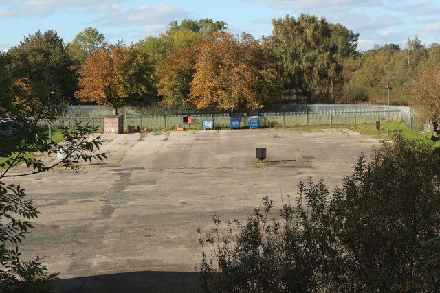
Scheduled Monument (#1017942): Hadrian's Wall between the M6 motorway and the property boundaries to the east of Houghton Road in wall mile 64
Click the headings below to expand (selected extracts from the Historic England scheduling)
Map showing the buried remains of Hadrian's Wall in this section.
%
Hadrian's Wall survives as a buried feature throughout this section with no remains visible above ground. The course of the Wall has been confirmed by observations by Simpson in 1941 during the construction of Hadrian's Camp, when the flag footings and the first course of masonry of the stone wall was found to survive.
At the same time the ditch north of the Wall was exposed and excavated, its depth being recorded as 3.96m. Subsequent excavations in 1961 by Colonel Fane Gladwin found that the building of the World War II army camp had not affected the remains of the Wall which lay approximately 0.25m below the surface of the modern turf cover. Hadrian's Wall in this section was initially built of turf before it was rebuilt in stone in the second half of the second century AD, and the 1961 excavations recorded remains of the turf surviving below the remains of the stone wall.
Milecastle 64 was located in 1962 during excavations by Fane Gladwin, 104m west of Brunstock Beck. It was of short axis type, being wider east-west than north-south, and measured internally 17.83m across east-west and 14.63m north- south. Its walls were found to have been extensively robbed but part of the north wall survived as far as the first course of facing stones. The north gateway, which was 3m wide, had been blocked at some stage. A cobbled road 5m wide ran through the centre of the milecastle, and outside the west wall was a cobbled area. The remains of Milecastle 64 survive below the turf cover as buried remains.
The precise location of turret 64a has not yet been confirmed but its remains are expected, on the basis of the usual spacing, to survive approximately 150m west of Centurion's Walk, where the Wall changes direction.
The course of the Roman road, known as the Military Way, which ran along the corridor between the Wall and vallum linking forts, milecastles and turrets, has not yet been confirmed in this section. However a cobbled road at least 9m wide was found in the excavations of 1961 by Fane Gladwin to the rear of the Wall which was thought to be medieval in date, but which may have been utilising the line of the Military Way. The remains of the Military Way are expected to survive below the turf cover as buried remains.
Scheduled Monument (#1017945): Hadrian's Wall between Houghton Road and Tarraby in wall mile 64
Click the headings below to expand (selected extracts from the Historic England scheduling)
%
Hadrian's Wall survives as a buried feature throughout this section.
The line of the wall ditch is visible for most of its length as a linear depression approximately 1m deep. A green lane runs along the centre of the ditch in the western part of this section.
The course of the Wall itself runs on the north edge of fields which have been subjected to ploughing in the past, which has removed any traces of the Wall on the ground and it survives only as a buried feature.
The precise location of turret 64b has not yet been confirmed, but on the basis of the usual spacing it is anticipated that its remains will survive as a buried feature approximately 100m east of the road from Whiteclosegate to Tarraby
The course of the Roman road known as the Military Way, which ran along the Wall corridor linking the forts, milecastles and turrets has not yet been confirmed in this section, but it is likely that it ran parallel to the Wall close to its south face. A metalled road in use in the medieval period which may have been using the line of the Military Way was found close to the south side of the Wall further west in excavations between Tarraby and Knowefield by Smith in 1976.
Scheduled Monument (#1017946): Hadrian's Wall between Tarraby and Beech Grove, Knowefield in wall miles 64 and 65
Click the headings below to expand (selected extracts from the Historic England scheduling)
Map showing the buried remains of Hadrian's Wall in this section.
%
Hadrian's Wall survives throughout this length solely as buried remains with no visible remains of the Wall itself above ground.
The ditch to the north of the Wall is however visible as a broad shallow depression up to 10m wide and 0.3m deep.
The remains of the Wall and ditch were confirmed to survive as buried remains by excavations carried out by Smith in 1976. Up to two courses of the foundations of the Wall together with core were found to survive. There were no remains however of the preceding Turf Wall apart from dispersed turf traces south of the Wall. The 1976 excavations established that there had been pre-Roman cultivation at Wall Knowe, which was shown by a grid of drainage ditches, one of which had been infilled where the Wall crossed it.
Scheduled Monument (#1017943): Hadrian's Wall vallum between the M6 motorway and Drawdykes Castle in wall mile 64
Click the headings below to expand (selected extracts from the Historic England scheduling)
Map showing the buried remains of Hadrian's Wall vallum in this section.
%
The course of the vallum is known in this section from visible sections to the east and west, although throughout this section it survives entirely as buried remains below the turf with no indications visible on the ground.
Scheduled Monument (#1017944): Hadrian's Wall vallum between Drawdykes Castle and Whiteclosegate in wall mile 64
Click the headings below to expand (selected extracts from the Historic England scheduling)
Map showing the buried remains of Hadrian's Wall vallum in this section.
%
The vallum is visible as an earthwork throughout this section, although the profile of the vallum has been reduced by cultivation in the past especially towards the western end. The ditch is visible as a broad linear depression up to 9m wide and 1m deep. The vallum banks have been reduced and dispersed by past ploughing and are faintly visible above ground as broad swellings either side of the vallum ditch. The mounds survive mainly as buried features.
Scheduled Monument (#1017947): Hadrian's Wall vallum between the boundaries north of the properties on Whiteclosegate and the field boundary west of Wall Knowe in wall miles 64 and 65
Click the headings below to expand (selected extracts from the Historic England scheduling)
Map showing the buried remains of Hadrian's Wall vallum in this section.
%
The vallum in this length runs through open fields on the south side of Wall Knowe, approximately 160m south of Hadrian's Wall. The line of the vallum ditch is visible in the eastern part of this section as a broad depression 10m wide and 0.5m deep. The vallum's banks have been reduced and dispersed by cultivation in the past and survive as buried remains.

from https://historicengland.org.u…
Hadrian's Wall between Tarraby and Beech Grove, Knowefield in wall miles 64 and 65 - List Entry
- ...Hadrian's Wall and its associated features between Tarraby and Beech Grove, Knowefield, survive well as buried remains and will contain significant information on the development of the frontier system over …
Added by
Simon Cotterill
from https://historicengland.org.u…
Hadrian's Wall vallum between the boundaries north of the properties on Whiteclosegate and the field boundary west of Wall Knowe in wall miles 64 and 65 - List Entry
- .....The section of Hadrian's Wall vallum between the boundaries north of the properties on Whiteclosegate and the field boundary west of Wall Knowe survives well as buried remains which will …
Added by
Simon Cotterill
from https://historicengland.org.u…
Hadrian's Wall between the M6 motorway and the property boundaries to the east of Houghton Road in wall mile 64 - List Entry
- ...Hadrian's Wall and its associated features between the M6 motorway and the property boundaries to the east of Houghton Road survive well as buried remains and will contain significant information …
Added by
Simon Cotterill
from https://historicengland.org.u…
Hadrian's Wall vallum between the M6 motorway and Drawdykes Castle in wall mile 64 - List Entry
- ....he section of Hadrian's Wall vallum between the M6 motorway and Drawdykes Castle survives well as buried remains which will preserve information on the development and operation of the Roman …
Added by
Simon Cotterill
from https://historicengland.org.u…
Hadrian's Wall between Houghton Road and Tarraby in wall mile 64 - List Entry
- ...Hadrian's Wall and its associated features between Houghton Road and Tarraby survive well as buried remains and will contain significant information on the development of the frontier system over time. …
Added by
Simon Cotterill
from https://historicengland.org.u…
Hadrian's Wall vallum between Drawdykes Castle and Whiteclosegate in wall mile 64 - List Entry
- ...The section of Hadrian's Wall vallum between Drawdykes Castle and Whiteclosegate survives well as buried remains which will preserve information on the development and operation of the Roman frontier over …
Added by
Simon Cotterill

from https://historicengland.org.u…
Hadrian's Wall between Tarraby and Beech Grove, Knowefield in wall miles 64 and 65 - List Entry
- ...Hadrian's Wall and its associated features between Tarraby and Beech Grove, Knowefield, survive well as buried remains and will contain significant information on the development of the frontier system over …
Added by
Simon Cotterill
from https://historicengland.org.u…
Hadrian's Wall vallum between the boundaries north of the properties on Whiteclosegate and the field boundary west of Wall Knowe in wall miles 64 and 65 - List Entry
- .....The section of Hadrian's Wall vallum between the boundaries north of the properties on Whiteclosegate and the field boundary west of Wall Knowe survives well as buried remains which will …
Added by
Simon Cotterill
from https://historicengland.org.u…
Hadrian's Wall between the M6 motorway and the property boundaries to the east of Houghton Road in wall mile 64 - List Entry
- ...Hadrian's Wall and its associated features between the M6 motorway and the property boundaries to the east of Houghton Road survive well as buried remains and will contain significant information …
Added by
Simon Cotterill
from https://historicengland.org.u…
Hadrian's Wall vallum between the M6 motorway and Drawdykes Castle in wall mile 64 - List Entry
- ....he section of Hadrian's Wall vallum between the M6 motorway and Drawdykes Castle survives well as buried remains which will preserve information on the development and operation of the Roman …
Added by
Simon Cotterill
from https://historicengland.org.u…
Hadrian's Wall between Houghton Road and Tarraby in wall mile 64 - List Entry
- ...Hadrian's Wall and its associated features between Houghton Road and Tarraby survive well as buried remains and will contain significant information on the development of the frontier system over time. …
Added by
Simon Cotterill
from https://historicengland.org.u…
Hadrian's Wall vallum between Drawdykes Castle and Whiteclosegate in wall mile 64 - List Entry
- ...The section of Hadrian's Wall vallum between Drawdykes Castle and Whiteclosegate survives well as buried remains which will preserve information on the development and operation of the Roman frontier over …
Added by
Simon Cotterill

")

