Topics > Heritage Sites > Hadrian's Wall > Wall Mile 56
Wall Mile 56
Hadrian's Wall - Wall Mile 56
Hadrian's Wall stretches from the east to west coast of England and was an important frontier of the Roman Empire. Building of the wall began in AD 122 and took six years to complete it’s 84 mile (80 Roman mile) length. Soldiers were garrisoned along the line of the wall in large forts, smaller milecastles, and intervening turrets. The Vallum, a large ditch with mounds on either side, ran along the south side of the wall, protecting the rear of the frontier. Hadrian's Wall was designated as a World Heritage Site in 1987.
Wall mile 56 was originally a turf wall, later replaced by stone. From Milecastle 49 to the western end of Hadrian's Wall on the Solway Firth, the wall was originally constructed from turf, possibly due to the absence of limestone. Subsequently, the turf wall was demolished and replaced with a stone wall.
Wall Mile 56:
In Wall Mile 56, Hadrian's Wall survives as a buried feature, with few traces visible above ground. In the woodland on the east and west sides of Sandysike, the Wall is visible as an earth covered bank, 5.6m wide and 0.3m-0.5m high. The wall ditch survives as an intermittent earthwork visible on the ground for some of this section.
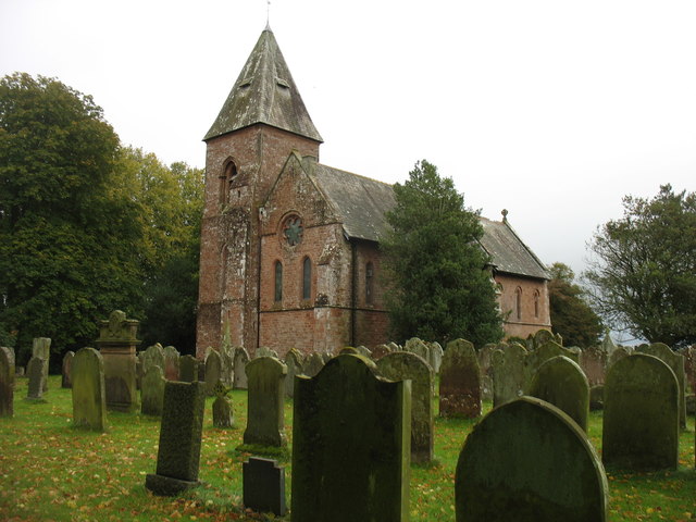
Walton has examples of buildings which were built using stone taken from the Roman wall, including Orchard House built in the 17th century (a listed building).
- Milecastle 56 (Walton) - no remains - thought to lie close to the site of the former Centurion Inn at Walton
- Turret 56a (Sandysike) - exact site unknown, thought to be just east of Sandysike farm; there is a Roman altar built into an outbuilding at the farm.
- Turret 56s (Cambeck) - no visible surface remains
- Camboglanna fort - site at Castlesteads, south of Turret 56b
- Roman bath house to the north east of Castlesteads
Scheduled Monument (#1010982): Hadrian's Wall between the road to Garthside and The Centurion Inn, Walton, in wall miles 54 and 55
Click the headings below to expand (selected extracts from the Historic England scheduling)
%
Milecastle 56 is located to the north east of the Centurion Inn at Walton. It survives as a buried feature with no traces visible above ground. MacLauchlan noted slight traces of the milecastle here in 1858 during his survey of the Wall.
Scheduled Monument (#1010984): Hadrian's Wall between Eden Vale house and the Cam Beck in wall mile 56
Click the headings below to expand (selected extracts from the Historic England scheduling)
%
Hadrian's Wall survives as a buried feature in the east half of this section with few traces visible above ground. In the woodland on the east and west sides of Sandysike the Wall is visible as an earth covered bank, 5.6m wide and 0.3m-0.5m high, with trees growing out of it. Richmond noted deep masonry foundations of the Wall near the stream at Sandysike in 1933. Either side of the Cam Beck there are no upstanding remains of the Wall. However, its course is known because there is an account of the part destruction of the Wall here in 1791 where it is stated to have been 2.5m thick.
The wall ditch survives as an intermittent earthwork visible on the ground throughout this section. East of Sandysike Wood the ditch is silted up leaving no surface traces. In the wood the ditch survives as a visible feature, averaging between 1.4m and 1.7m deep, with a drain occupying its base. West of the wood the ditch is partly overlain by a hedgeline before fading as it approaches the Cam Beck in boggy ground. The ditch upcast mound, usually referred to as the glacis, which lies to the north of the ditch has been ploughed out throughout most of this section.
The exact location of turret 56a has not been confirmed as there are no upstanding remains visible above ground. However, on the basis of the usual spacing it is expected to be located just to the east of Sandysike. Although not included in the scheduling, there is a Roman altar built into an outbuilding of Sandysike farm, 0.7m above ground level. It is made from red sandstone and measures 0.34m by 0.14m.
Turret 56b is situated about 140m east of the Cam Beck on a river terrace. It was located in 1933 by Simpson who ascribed it to the Turf Wall series. The turret survives as a buried feature with no remains visible above ground.
The exact course of the Roman road known as the Military Way, which ran along the corridor between the Wall and vallum linking turrets, milecastles and forts, has not been confirmed in this section. It is expected to be located parallel to the Wall, 20m-30m to the south of it. The track from Sandysike farm to Walton, which lies parallel to the Wall, may overlie the course of the Military Way. The survival of archaeological remains below it has not yet been confirmed...
Scheduled Monument (#1010986): Hadrian's Wall between the Cam Beck and Newtown Farm in wall miles 56 and 57
Click the headings below to expand (selected extracts from the Historic England scheduling)
%
Hadrian's Wall survives as a buried feature throughout this section with no remains visible above ground. Its course is indicated in this section by a broad swelling in the field to the south west of Cambeckhill farm and as occasional rises in hedgelines which cross its course. There is no surface trace at The Beck Farm or Heads Wood house.
The wall ditch survives as an intermittent earthwork visible on the ground. Where extant it averages 2m deep in the east half of the section and 1m deep in the west half. The ditch upcast mound, usually referred to as the glacis, has been ploughed out in this section and only survives faintly visible in the field south west of The Beck Farm.
Scheduled Monument (#1010983): The vallum between the road to Garthside and the track east of Castlesteads in wall miles 54, 55 and 56
Click the headings below to expand (selected extracts from the Historic England scheduling)
%
The vallum survives as buried feature throughout most of this section. It is best preserved to the west of Low Wall where the ditch is visible as a slight depression which deepens as it descends to the stream. Otherwise the only surface traces are slight rises and dips in hedgelines where they cross the ploughed down mounds and ditch of the vallum. Elsewhere the vallum mounds have been reduced by ploughing leaving no trace above ground. Similarly the vallum ditch has been entirely silted up leaving no obvious remains on the surface.
Where there are no surface traces the course of the vallum is known from excavations by Haverfield during 1900-1901. His trenches revealed the course of the vallum west of Howgill farm and to the south of Walton. About 30m east of the track to the east of Castlesteads, Haverfield's excavation in 1901 showed that there was a major realignment in the course of the vallum here. This sharp southward turn was made to encompass the Roman fort at Castlesteads within the military corridor between the Wall and vallum.
Scheduled Monument (#1010985): Castlesteads Roman fort and the vallum between the track to the east of Castlesteads fort and the Cam Beck in the west
Click the headings below to expand (selected extracts from the Historic England scheduling)
%
Castlesteads fort, known to the Romans as 'Camboglanna', is detached from the Wall line, being located 350m to the south of the Wall. This is accounted for by the strength of the position the fort occupies and also the need for the Wall line to take a more gentle descent of the gorge to cross the Cam Beck. The fort is situated on a high bluff and was built here to command the Cam Beck valley.
The fort survives as a low platform with most of its remains surviving as buried features. The surface remains of the fort were damaged by landscaping for Castlesteads house in 1791. The fort is now overlain by ornamental gardens. The stone fort measures about 114m square internally and encloses an area of at least 1.3ha. The north west side of the fort has been eroded by the Cam Beck so that the east and west gateways was now lie just 15m from the lip of the gorge.
Limited excavations were carried out by Richmond and Hodgson in 1934 who were able to locate the ramparts and east and west gateways and establish the existence of a berm, 3m wide, and an outer ditch 4.8m wide. Trenching at the south east angle revealed the remains of a turf rampart, at least 3m wide, resting on flagging and stones set in clay to the rear of the Stone Wall. This rampart base is probably the remains of an earlier turf and timber fort which occupied the site. An east facing scarp, 0.4m high, parallel to the east rampart was discovered during a survey by the Royal Commission on the Historical Monuments of England in 1991. This scarp may be the remains of the edge of the platform of this earlier and therefore larger fort, especially as a right-angled return to the south west can be traced for 10m before fading. A section of ditch thought to be associated with an annexe was also discovered during Richmond and Hodgson's excavations.
Inscriptions from the site show that the fort was garrisoned by the fourth cohort of Gauls in the second century AD and by the mounted second cohort of Tungrians in the third century AD. Large quantities of inscribed and sculptured stones have been found during the landscaping and stone robbing, many of which are housed in the summer house at the west side of the rose garden. These sculptured stones which are not included in the scheduling, include three altars dedicated to the Persian god Mithras and ten dedicated to the worship of official state gods. The bath house associated with the fort lies to the north east of the fort platform in dense woodland. It is the subject of a separate scheduling (SM 26081).
The remains of the civil settlement, or vicus, which is usually associated with Roman forts, are not visible as upstanding features at Castlesteads. However, a letter from a certain Richard Goodman writing to Gale in 1727 mentions traces of an extensive settlement on the slope at the south east front of the fort. He noted the existence of foundations of walls and streets which were being removed to construct new buildings and to allow the land to be ploughed. The remains of the vicus will survive as buried features below the ploughed field to the south and east of Castlesteads.
The vallum survives as a buried feature throughout this section with no remains visible above ground. Its course has been confirmed by Haverfield who cut trenches in 1898, 1901 and 1902 to determine its course. It was found to make a sweeping diversion to the south to encompass the fort at Castlesteads within the Wall-vallum zone. However, it makes the turn well before the stone fort implying that it was constructed to respect the earlier and larger turf and timber fort.
Scheduled Monument (#1015924): The Roman bath house to the north east of Castlesteads Roman fort in wall mile 56
Click the headings below to expand (selected extracts from the Historic England scheduling)
%
It is situated to the north east of the fort on artificial terraces cut into a south facing slope. Its remains survive as buried features below the turf cover and mature conifer trees. The bath house was located and partly excavated in 1741 by Susannah Maria Appleby. A series of rooms with hypocausts were uncovered which still had the supporting underfloor pillars and part of the flooring of white stone, 25cm thick. The site of the bath house was rediscovered by the Royal Commission on the Historical Monuments of England when they surveyed the fort at Castlesteads in 1991. Dressed stones, fragments of white quasi-marble slabs worked to an even thickness of 25cm and roof slate were found immediately south west of the artificial terraces which are located on the north side of a tributary stream.


from https://historicengland.org.u…
The vallum between the road to Garthside and the track east of Castlesteads in wall miles 54, 55 and 56 - List Entry
- ...The monument includes the section of vallum and its associated features between the road to Garthside in the east and the track to the east of Castlesteads in the west. …
Added by
Simon Cotterill
from https://historicengland.org.u…
Hadrian's Wall between Eden Vale house and the Cam Beck in wall mile 56 - List Entry
- ....The monument includes the section of Hadrian's Wall and its associated features between Eden Vale house at Walton in the east and the Cam Beck in the west. Hadrian's Wall …
Added by
Simon Cotterill
from https://historicengland.org.u…
The Roman bath house to the north east of Castlesteads Roman fort in wall mile 56
- ...The monument includes the Roman bath house outside the Roman fort at Castlesteads in wall mile 56. It is situated to the north east of the fort on artificial terraces …
Added by
Simon Cotterill
from https://historicengland.org.u…
Orchard House - Walton - List Entry
- House, public house in C19. Probably late C17 single storey cottage, built with
stone from the nearby Roman Wall, altered with brick first floor in early C19.
Painted rendered walls, …
Added by
Simon Cotterill
from https://historicengland.org.u…
Hadrian's Wall between the Cam Beck and Newtown Farm in wall miles 56 and 57 - List Entry
- ....Hadrian's Wall and its associated features between the Cam Beck and Newtown Farm survive well as a series of buried remains. Significant information on the development of the frontier system …
Added by
Simon Cotterill
from https://historicengland.org.u…
Castlesteads Roman fort and the vallum between the track to the east of Castlesteads fort and the Cam Beck in the west - List Entry
- ...Castlesteads Roman fort and its associated features and the section of vallum between the track to the east of Castlesteads and the Cam Beck survive well as a series of …
Added by
Simon Cotterill
from https://historicengland.org.u…
The Roman bath house to the north east of Castlesteads Roman fort in wall mile 56 - List Entry
- ....The monument includes the Roman bath house outside the Roman fort at Castlesteads in wall mile 56. It is situated to the north east of the fort on artificial terraces …
Added by
Simon Cotterill

from https://historicengland.org.u…
The vallum between the road to Garthside and the track east of Castlesteads in wall miles 54, 55 and 56 - List Entry
- ...The monument includes the section of vallum and its associated features between the road to Garthside in the east and the track to the east of Castlesteads in the west. …
Added by
Simon Cotterill
from https://historicengland.org.u…
Hadrian's Wall between Eden Vale house and the Cam Beck in wall mile 56 - List Entry
- ....The monument includes the section of Hadrian's Wall and its associated features between Eden Vale house at Walton in the east and the Cam Beck in the west. Hadrian's Wall …
Added by
Simon Cotterill
from https://historicengland.org.u…
The Roman bath house to the north east of Castlesteads Roman fort in wall mile 56
- ...The monument includes the Roman bath house outside the Roman fort at Castlesteads in wall mile 56. It is situated to the north east of the fort on artificial terraces …
Added by
Simon Cotterill
from https://historicengland.org.u…
Orchard House - Walton - List Entry
- House, public house in C19. Probably late C17 single storey cottage, built with
stone from the nearby Roman Wall, altered with brick first floor in early C19.
Painted rendered walls, …
Added by
Simon Cotterill
from https://historicengland.org.u…
Hadrian's Wall between the Cam Beck and Newtown Farm in wall miles 56 and 57 - List Entry
- ....Hadrian's Wall and its associated features between the Cam Beck and Newtown Farm survive well as a series of buried remains. Significant information on the development of the frontier system …
Added by
Simon Cotterill
from https://historicengland.org.u…
Castlesteads Roman fort and the vallum between the track to the east of Castlesteads fort and the Cam Beck in the west - List Entry
- ...Castlesteads Roman fort and its associated features and the section of vallum between the track to the east of Castlesteads and the Cam Beck survive well as a series of …
Added by
Simon Cotterill
from https://historicengland.org.u…
The Roman bath house to the north east of Castlesteads Roman fort in wall mile 56 - List Entry
- ....The monument includes the Roman bath house outside the Roman fort at Castlesteads in wall mile 56. It is situated to the north east of the fort on artificial terraces …
Added by
Simon Cotterill