Topics > Heritage Sites > Hadrian's Wall > Wall Mile 50
Wall Mile 50
Hadrian's Wall - Wall Mile 50
Hadrian's Wall stretches from the east to west coast of England and was an important frontier of the Roman Empire. Building of the wall began in AD 122 and took six years to complete it’s 84 mile (80 Roman mile) length. Soldiers were garrisoned along the line of the wall in large forts, smaller milecastles, and intervening turrets. The Vallum, a large ditch with mounds on either side, ran along the south side of the wall, protecting the rear of the frontier. Hadrian's Wall was designated as a World Heritage Site in 1987.
Wall mile 50 was originally a turf wall, later replaced by stone. From Milecastle 49 to the western end of Hadrian's Wall on the Solway Firth, the wall was originally constructed from turf, possibly due to the absence of limestone. Subsequently, the turf wall was demolished and replaced with a stone wall.This section of Hadrian's Wall is the most substantial stretch where the Turf Wall and later Stone Wall follow separate courses, and therefore survive as separate features.
Wall Mile 50:
- Milecastle 50 - limited earthwork remains of the Milecastle on the stone wall
- Turret 50a (High House) - limited visual remains
- Turret 50b (Appletree) - no surface remains
Scheduled Ancient Monument (#1010995): Hadrian's Wall and vallum between the field boundaries east of milecastle 50 and the boundary west of Coombe Crag in wall miles 50 and 51
Click the headings below to expand (selected extracts from the Historic England scheduling)
%
The monument includes the section of Turf and Stone Walls and vallum between the field boundaries east of milecastle 50 in the east and the field boundary west of Coombe Crag in the west.
The Turf Wall survives as a buried feature below grassland throughout this section. At the west end of this section its course is defined by a low broad mound, with a maximum height of 0.4m. Elsewhere there are no visible remains above ground. The Turf Wall ditch survives as an earthwork visible on the ground. It averages between 1.1m and 2m deep throughout this section. The ditch upcast mound, usually referred to as the glacis, also survives as a low mound to the north of the ditch. It measures up to 1.6m high in places.
Milecastle 50 on the Turf Wall is situated on a gentle west facing slope with the steep gorge of the Irthing to the south. The south part of the milecastle is marked out in the turf, but otherwise there are no remains visible on the ground. Its remains however survive as buried features below the turf cover. Excavations were carried out by Simpson in 1934 which identified a causeway across the Turf Wall ditch to the north. Turret 50a on the Turf Wall survives as a buried feature below the turf cover with no remains visible above ground. It is situated about 180m north west of High House. It was located in 1934 by Simpson.
Turret 50b on the Turf Wall also survives as a buried feature below the turf cover with no remains visible above ground. It is situated about 120m east of the Wall Burn. It was located and partly excavated by Simpson and Richmond in 1928.
The Stone Wall in this section survives as a buried feature below the ground immediately south of the modern road at the east end of this section and below the road surface itself throughout the rest of the section.
The ditch survives well as an earthwork visible on the ground immediately north of the modern road. It is well preserved measuring between 1.7m and 2.5m deep. The ditch upcast mound, or glacis, is visible to the north of the ditch. It survives as a low sinuous mound averaging 1m in height.
Milecastle 50 on the Stone Wall is situated about 170m north of milecastle 50 on the earlier Turf Wall. It survives as a ploughed down turf covered platform bounded on the east and the west sides by a spread scarp with a maximum height of 0.2m. Two distinct rises in the roadside wall define the position of the east and west walls. Excavations by Simpson took place in 1911. It measured 23.4m internally north to south by 18.5m across. Its walls were of narrow type measuring 2.3m across. The original internal buildings appear to have been timber structures. These were later replaced by stone buildings. Fragments of three legionary inscriptions were also found; two referring to the sixth legion and one to the second legion.
Turret 50a on the Stone Wall is situated about 50m west of the track to High House. There are no remains visible above ground. The north half survives below the road surface whereas the south half is recognisable as an amorphous swelling at the edge of the adjoining field. It was partly excavated by Simpson in 1911 who recovered two inscriptions to the sixth legion, who it seems were responsible for rebuilding the first five miles of the Turf Wall in stone.
Turret 50b on the Stone Wall is situated to the east of Appletree. It survives as a buried feature partly below the modern road and partly below the adjoining field to the south. The turret was located and partly excavated by Simpson in 1911. It was shown to have remained in use after the second century, and fragments of window glass imply that the turret's windows were glazed.
The course of the Roman road known as the Military Way, which ran along the corridor between the Wall and vallum linking turrets, milecastles and forts, is known throughout this section. It survives as a vague but detectable intermittent terrace or mound visible on the ground. It is best preserved to the west of Wall Burn where it survives as a linear causeway, 0.4m high.
The Vallum survives well as an upstanding earthwork in all but the easternmost part of this section where it survives as a shallow ditch and ploughed down earthwork. Elsewhere the ditch averages 1.5m deep, the north mound 2m high and the south mound 0.9m high. West of Turf Wall milecastle 50 the north mound reappears again abutting the west wall of the milecastle. Excavations at the milecastle in 1936 have shown that there is no north mound between milecastle 50 and Birdoswald fort, but rather a south mound twice the usual size. Outside Turf Wall milecastle 50 the south mound and ditch bend around the milecastle with a paved access road opposite the south gateway and a paved track along the south berm.


from Geograph (geograph)
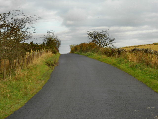
(The site of) Milecastle 50 (Stone Wall) (High House) (2)
Pinned by Simon Cotterill

from Geograph (geograph)
(The site of) Milecastle 50 (Stone Wall) (High House)
Pinned by Simon Cotterill

from Geograph (geograph)
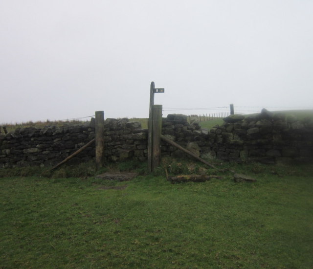
The north defensive ditch of Hadrian's Stone Wall north of High House Farm
Pinned by Simon Cotterill

from Geograph (geograph)
The north defensive ditch of Hadrian's Stone Wall north of High House Farm (2)
Pinned by Simon Cotterill


from Flickr (flickr)
MC50, Hadrians wall, Mile castle and vallum ditches (6)
Pinned by Simon Cotterill

from Flickr (flickr)
MC50, Hadrians wall, Mile castle and vallum ditches (5)
Pinned by Simon Cotterill

from Flickr (flickr)
MC50, Hadrians wall, Mile castle and vallum ditches (8)
Pinned by Simon Cotterill

from Flickr (flickr)
MC50, Hadrians wall, Mile castle and vallum ditches (9)
Pinned by Simon Cotterill

from https://historicengland.org.u…
Hadrian's Wall and vallum between the field boundaries east of milecastle 50 and the boundary west of Coombe Crag in wall miles 50 and 51
- ....Hadrian's Wall and vallum and their associated features between the field boundaries east of milecastle 50 and the field boundary west of Coombe Crag survive as a series of buried …
Added by
Simon Cotterill

from https://perlineamvalli.wordpr…
Wall Mile 50
- Wall Mile 50 (December 10, 2011). Mike Bishop's PLV blog about walking Hadrian’s Wall written from an archaeologist’s point of view. "It might justifiably be argued that this is one …
Added by
Simon Cotterill

from Geograph (geograph)
(The site of) Milecastle 50 (Stone Wall) (High House) (2)
Pinned by Simon Cotterill
from Geograph (geograph)
(The site of) Milecastle 50 (Stone Wall) (High House)
Pinned by Simon Cotterill
from Geograph (geograph)
The north defensive ditch of Hadrian's Stone Wall north of High House Farm
Pinned by Simon Cotterill
from Geograph (geograph)
The north defensive ditch of Hadrian's Stone Wall north of High House Farm (2)
Pinned by Simon Cotterill
from Flickr (flickr)
MC50, Hadrians wall, Mile castle and vallum ditches (6)
Pinned by Simon Cotterill
from Flickr (flickr)
MC50, Hadrians wall, Mile castle and vallum ditches (5)
Pinned by Simon Cotterill
from Flickr (flickr)
MC50, Hadrians wall, Mile castle and vallum ditches (8)
Pinned by Simon Cotterill
from Flickr (flickr)
MC50, Hadrians wall, Mile castle and vallum ditches (9)
Pinned by Simon Cotterill
from https://historicengland.org.u…
Hadrian's Wall and vallum between the field boundaries east of milecastle 50 and the boundary west of Coombe Crag in wall miles 50 and 51
- ....Hadrian's Wall and vallum and their associated features between the field boundaries east of milecastle 50 and the field boundary west of Coombe Crag survive as a series of buried …
Added by
Simon Cotterill
from https://perlineamvalli.wordpr…
Wall Mile 50
- Wall Mile 50 (December 10, 2011). Mike Bishop's PLV blog about walking Hadrian’s Wall written from an archaeologist’s point of view. "It might justifiably be argued that this is one …
Added by
Simon Cotterill


")