Topics > Heritage Sites > Hadrian's Wall > Wall Mile 30
Wall Mile 30
Hadrian's Wall - Wall Mile 30
Hadrian's Wall stretches from the east to west coast of England and was an important frontier of the Roman Empire. Building of the wall began in AD 122 and took six years to complete it’s 84 mile (80 Roman mile) length. Soldiers were garrisoned along the line of the wall in large forts, smaller milecastles, and intervening turrets. The Vallum, a large ditch with mounds on either side, ran along the south side of the wall, protecting the rear of the frontier. Hadrian's Wall was designated as a World Heritage Site in 1987.
Wall Mile 30:
- Milecastle 30 (Limestone Corner)
- Turret 30a (Carrawburgh East)
- Turret 30b (Carrawburgh West)
Scheduled Monument (#101096): Hadrian's Wall and vallum between the road to Simonburn and the field boundary east of Carrawburgh car park in wall miles 29, 30 and 31
Click the headings below to expand (selected extracts from the Historic England scheduling)
Map showing the Scheduled Monument area (Historic England data).
%
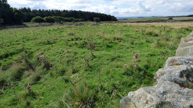
The monument includes the section of Hadrian's Wall and associated features between the minor road to Simonburn in the east and the field boundary to the east of Carrawburgh car park in the west. This section of the Wall follows an alignment straight from the North Tyne to the high point at Limestone Corner where it changes to a more westerly direction and occupies the gentle west facing slope all the way to Carrawburgh. There are good views to the north and south all along this section, and in particular from Limestone Corner. All the upstanding remains of Hadrian's Wall, the milecastles and turrets in this scheduling are Listed Grade I. The Wall survives as a buried feature for most of this section, except for the two well preserved sections west of the minor road to Simonburn.
The Wall survives as a buried feature for most of this section, except for the two well preserved sections west of the minor road to Simonburn. The two upstanding sections of Wall are consolidated and in the care of the Secretary of State. The east section is about 122m long and reaches a maximum height of 1.8m. The west section is about 48m in length and slightly lower. Elsewhere the Wall is visible as a low stony bank with a maximum height of 1m, or as a trench with spoil heaps either side of it. These trenches are the result of excavation in 1951 to either side of milecastle 30, when it was shown that the Wall in this section was narrow wall on a broad wall foundation. Beyond Limestone Corner the line of the Wall is overlain by the B6318 road and there are no upstanding remains visible.
The outer ditch survives well throughout this section and averages over 2m deep. The ditch is most impressive at Limestone Corner where it has been cut through the bedrock to a maximum depth of 2.8m. To the east of Limestone Corner the rock-cut ditch was left unfinished. The upcast mound from the ditch, known as the glacis, survives intermittently throughout this section. It is best preserved west of Limestone Corner where it attains a height of 2.7m.
Milecastle 30 is situated on the high ground of Limestone Corner with commanding views in all directions. It survives as a turf covered platform up to 0.8m high. Excavation by Simpson during 1927 showed that it measured 20.2m from north to south. Part of the east wall is upstanding, measuring 3.1m long and 0.6m high. The Military Way survives as a turf covered causeway leading up to the south gateway of the milecastle.
Turret 30a is situated about 400m east of Carrawbrough Farm below the B6318 road. It was located during 1912, though there are no surface remains visible now.
Turret 30b is located about 50m west of the drive to Carrawbrough Farm partly below the B6318 road. The south side of the turret is visible in the field to the south of the road as a turf covered scarp, 0.5m high.
The course of the Roman road known as the Military Way, which ran along the corridor between the Wall and the vallum linking turrets, milecastles and forts, is not known with certainty for most of this section. However, according to the observations of Horsley made in the 1730s and trial excavations by Newbold in the early 1900s, it is generally considered that the Military Way overlay the north mound of the vallum for most of this section. Further excavations in 1911 confirmed this interpretation. For this reason it is believed that the B6318 road overlies it between Chesters and Limestone Corner. At Limestone Corner the Military Way is visible as a low causeway, 0.6m high, leading to the south gateway of milecastle 30. Beyond the milecastle it rejoins the north mound of the well preserved vallum. Excavations during 1911 confirmed this to be the case.
The vallum is very well preserved throughout this section. It survives as a series of upstanding earthworks and an impressive rock cut ditch around Limestone Corner. The north mound averages 1.2m for most of its length where it is not overlain by the B6318. The south mound averages about 1m in height with crossings identifiable about every 42m. The ditch is mainly rock cut in the east half of this section with sheer sides and depths of up to 3.5m. In the west half of this section the ditch also survives well and averages 1.9m in depth.
Listed Buildfing, Grade I (#1045249): Hadrian's wall, Milecastles and Turrets
Includes Hadrian's wall; milecastles 30, 31, 34 and 35; turrets 29B, 30A, 30B, 33B, 34A and 35A.


from Geograph (geograph)
The north defensive ditch of Hadrian's Wall at Limestone Corner (10)
Pinned by Simon Cotterill

from Geograph (geograph)
Massive limestone blocks excavated by the Romans (2)
Pinned by Simon Cotterill


from https://historicengland.org.u…
HADRIANS WALL, MILCASTLES AND TURRETS - List Entry
- "Hadrian's wall; milecastles 30, 31, 34 and 35; turrets 29B, 30A, 30B, 33B, 34A and 35A. AD 122, reconstructed AD 205. Rubble core with dressed stone faces. Course of wall …
Added by
Simon Cotterill
from https://historicengland.org.u…
Hadrian's Wall and vallum between the road to Simonburn and the field boundary east of Carrawburgh car park in wall miles 29, 30 and 31 - List Entry
- ...Hadrian's Wall and its associated works between the minor road to Simonburn and the field boundary east of Carrawburgh car park survive well as upstanding and buried features for most …
Added by
Simon Cotterill

from Geograph (geograph)
The north defensive ditch of Hadrian's Wall at Limestone Corner (10)
Pinned by Simon Cotterill
from Geograph (geograph)
Massive limestone blocks excavated by the Romans (2)
Pinned by Simon Cotterill
from https://historicengland.org.u…
HADRIANS WALL, MILCASTLES AND TURRETS - List Entry
- "Hadrian's wall; milecastles 30, 31, 34 and 35; turrets 29B, 30A, 30B, 33B, 34A and 35A. AD 122, reconstructed AD 205. Rubble core with dressed stone faces. Course of wall …
Added by
Simon Cotterill
from https://historicengland.org.u…
Hadrian's Wall and vallum between the road to Simonburn and the field boundary east of Carrawburgh car park in wall miles 29, 30 and 31 - List Entry
- ...Hadrian's Wall and its associated works between the minor road to Simonburn and the field boundary east of Carrawburgh car park survive well as upstanding and buried features for most …
Added by
Simon Cotterill


