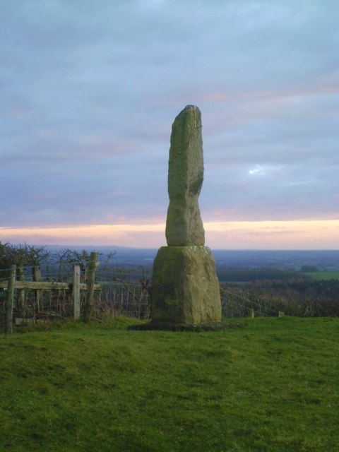
Topics > Heritage Sites > Hadrian's Wall > Wall Mile 22
Wall Mile 22
Hadrian's Wall - Wall Mile 22
Hadrian's Wall stretches from the east to west coast of England and was an important frontier of the Roman Empire. Building of the wall began in AD 122 and took six years to complete it’s 84 mile (80 Roman mile) length. Soldiers were garrisoned along the line of the wall in large forts, smaller milecastles, and intervening turrets. The Vallum, a large ditch with mounds on either side, ran along the south side of the wall, protecting the rear of the frontier. Hadrian's Wall was designated as a World Heritage Site in 1987.
Wall Mile 22:
- Milecastle 22 (Portgate)
- Turret 22a (Portgate)
- Turret 22b (Stanley)
Hadrian's Wall runs beneath the B6318 Military Road for most of of this Wall Mile.
Scheduled Monument (#1010625): Hadrian's Wall and vallum between the Fence Burn and the track to Portgate Cottage in wall miles 21 and 22
Click the headings below to expand (selected extracts from the Historic England scheduling)
%
The monument includes the section of Hadrian's Wall between the Fence Burn in the east and the west side of the track to Portgate Cottage in the west. This section of the Wall occupies an east facing slope with limited views in all directions. The Wall survives as a buried feature below the B6318 road for most of this section.
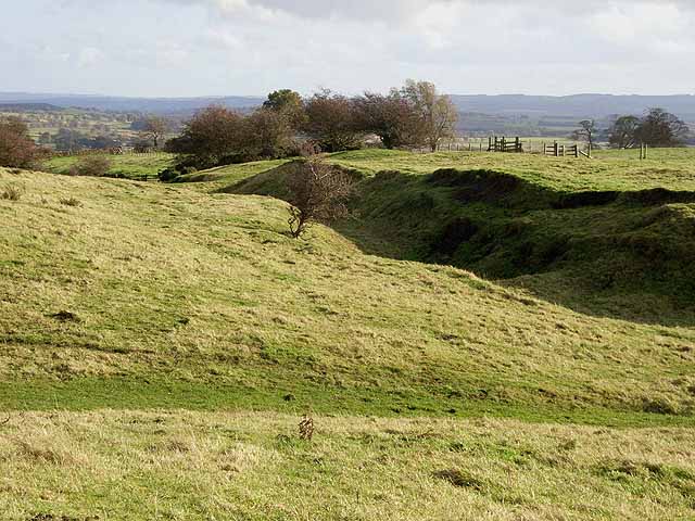
The Wall survives as a buried feature below the B6318 road for most of this section. The stretch of Wall 220m east to 320m west of the course of the A68, where the B6318 swings north to a roundabout, lies below the 18th century metalled road which is now disused. The wall ditch survives as a buried feature for most of this section; however, towards the west end of the section it survives as a visible earthwork. The maximum height of its south scarp is 4m and the maximum height of its north scarp is 2m. There are slight traces of the upcast mound, known as the `glacis', to the north of the ditch.
Milecastle 22 is located about 220m east of the junction of the B6318 and the A68 on an east facing slope. It survives as a square turf covered platform, 0.5m high on its east side. The milecastle was partly excavated in 1930, when its internal width was shown to be about 17.5m, while the walls were 2.45m thick. The north gateway had been blocked early on, probably because the gateway carrying Dere Street Roman road through the line of the Wall was near enough to serve all purposes for which a milecastle gateway could be used.The course of the Roman road known as the Military Way, which ran along the corridor between the Wall and the vallum linking the turrets, milecastles and forts, survives intermittently throughout this section. East of milecastle 22 there is a 170m stretch of the road which survives as an upstanding ridge, in a field which also has extensive ridge and furrow earthworks. The road here survives to a maximum height of 0.3m. Further west its remains were traced as parchmarks in the soil during dry conditions. Elsewhere in this section its course has not yet been confirmed.
Turret 22a is situated about 200m west of the Port Gate roundabout on an east facing slope. It was located and partly excavated in 1930. There are no upstanding remains.
The vallum survives intermittently as an upstanding earthwork throughout this section. Where it is best preserved, between the Fence Burn and the A68, the ditch reaches a maximum depth of 0.9m, the north mound a height of 0.7m and the south mound a height of 0.3m. Elsewhere the mounds have been damaged and spread by ridge and furrow cultivation and the ditch has silted up to varying degrees.
The Roman road known as Dere Street which ran from York into Scotland crossed the line of the Wall in this section. The course of the A68 road follows that of Dere Street along this part of its course. Immediately south of the vallum, for 150m, there is an overgrown mound beside the west verge of the A68, representing part of the Roman road which was not built directly over.
An excavation in 1966 revealed that where Dere Street crossed the Wall, a gatehouse, formed of massive masonry blocks which projected northwards from the Wall by 3.6m had been constructed. The site of the gateway lies within the protected area.
Scheduled Monument (#1010626): Hadrian's Wall and vallum between the track to Portgate Cottage and the field boundary east of milecastle 24 in wall miles 22 and 23
Click the headings below to expand (selected extracts from the Historic England scheduling)
%
This section follows a straight alignment throughout its length and links the crests of the high ground along this length. Hadrian's Wall runs beneath the B6318 road for the entire length of this section.
The wall ditch and upcast mound to the north survive well as upstanding earthworks for most of the length of this section. The ditch averages 2m deep throughout, though it reaches a maximum of 2.8m in places. The upcast mound from the ditch, usually known as the 'glacis', survives up to a maximum of 1m in height to the north of the ditch.
Turret 22b is located about 10m west of the track to Portgate House and Cottage off the B6318 road. It survives as a buried feature beneath the B6318 road. It was partly excavated during 1930.
The Roman road known as the Military Way, which ran along the corridor between the Wall and the vallum linking turrets, milecastles and forts, occupies the north mound of the vallum throughout the whole length of this section. It survives well and is visible as an upstanding earthwork.
The vallum runs parallel to the Wall throughout this section. It survives very well for most of this section and is clearly visible as an upstanding earthwork. The north and south mounds reach a height of 1.8m, while the vallum ditch reaches a depth of 3m in places. There was limited excavation of the vallum during 1952 near milecastle 23 when it was shown that the north mound was broken by a gap giving access to the milecastle. A causeway across the vallum ditch would also have been required at this point. The ditch, however, appeared to have been recut, indicating that the access route to the milecastle changed through the main period of use of the Wall.


from https://historicengland.org.u…
Hadrian's Wall and vallum between the track to Portgate Cottage and the field boundary east of milecastle 24 in wall miles 22 and 23 - List Entry
- ....Hadrian's Wall and vallum and their associated features between the track to Portgate Cottage and the field boundary east of milecastle 24 survive well as a series of buried and …
Added by
Simon Cotterill
from https://historicengland.org.u…
Hadrian's Wall and vallum between the Fence Burn and the track to Portgate Cottage in wall miles 21 and 22 - List Entry
- ....Hadrian's Wall and its associated features between the Fence Burn and the track to Portgate Cottage survive as a series of buried and upstanding remains. Significant information on the development …
Added by
Simon Cotterill

Co-Curate Page
Dere Street
- Overview About Dere Street Dere Street was the Roman road which ran north from Eboracum (York) to Hadrian's Wall and beyond to the Antonine Wall in Scotland. The road connected …

from https://historicengland.org.u…
Hadrian's Wall and vallum between the track to Portgate Cottage and the field boundary east of milecastle 24 in wall miles 22 and 23 - List Entry
- ....Hadrian's Wall and vallum and their associated features between the track to Portgate Cottage and the field boundary east of milecastle 24 survive well as a series of buried and …
Added by
Simon Cotterill
from https://historicengland.org.u…
Hadrian's Wall and vallum between the Fence Burn and the track to Portgate Cottage in wall miles 21 and 22 - List Entry
- ....Hadrian's Wall and its associated features between the Fence Burn and the track to Portgate Cottage survive as a series of buried and upstanding remains. Significant information on the development …
Added by
Simon Cotterill
Co-Curate Page
Dere Street
- Overview About Dere Street Dere Street was the Roman road which ran north from Eboracum (York) to Hadrian's Wall and beyond to the Antonine Wall in Scotland. The road connected …


