Ruined buildings of former colliery, Blaydon Burn

-
Description
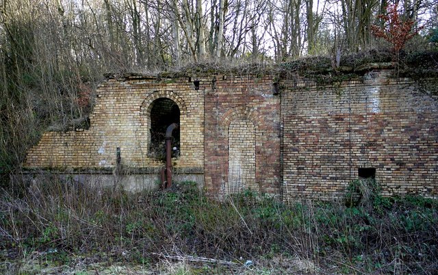
"The west end of the Nature Reserve, where the burn meets the road, was formerly the railhead of the valley line [[2817291]]. The ruined buildings shown here lie between the upper and lower sections of the railhead. The most notable is a large section of retaining wall showing numerous phases of build and construction types. The wall includes a number of arched openings and cast-iron pipework, of unknown function, but probably associated with adjacent coal screens to the north-east. There is another photo here [[2191820]]" Photo by Andrew Curtis, 2012. -
Owner
Andrew Curtis -
Source
Geograph (Geograph) -
License
What does this mean? Creative Commons License
-
Further information
Link: http://www.geograph.org.uk/photo/2817076
Resource type: Image
Added by: Simon Cotterill
Last modified: 8 years, 1 month ago
Viewed: 924 times
Picture Taken: 2012-02-19 -
Co-Curate tags


