Blaydon Burn

-
Description
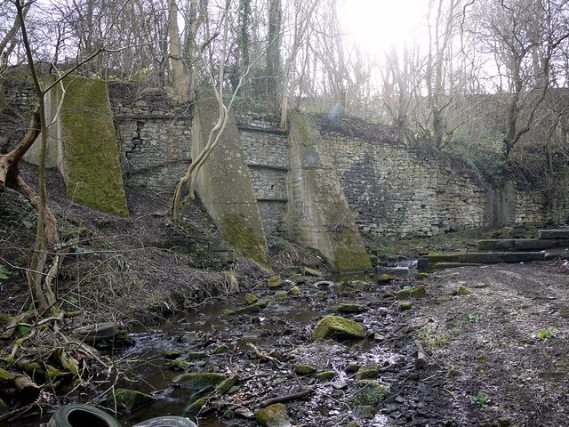
"The east bank of Blaydon Burn, downstream from the site Massey’s Forge, is reinforced by a high stone retaining wall, strengthened at a later time by concrete buttresses. The large sandstone blocks extending from the right are thought to have been part of a former weir or sluice. Old maps show a mill race downstream for one of the burn's C18th watermills, known as Rennison’s or Pickering’s Mill, all remains of which disappeared under Cowen's Low Yard around 1830." Photo by Andrew Curtis, 2012. -
Owner
Andrew Curtis -
Source
Geograph (Geograph) -
License
What does this mean? Creative Commons License
-
Further information
Link: http://www.geograph.org.uk/photo/2819309
Resource type: Image
Added by: Simon Cotterill
Last modified: 8 years ago
Viewed: 858 times
Picture Taken: 2012-02-24 -
Co-Curate tags


