Milecastle 48, Gilsland

-
Description
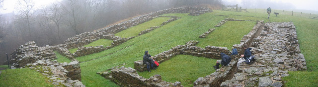
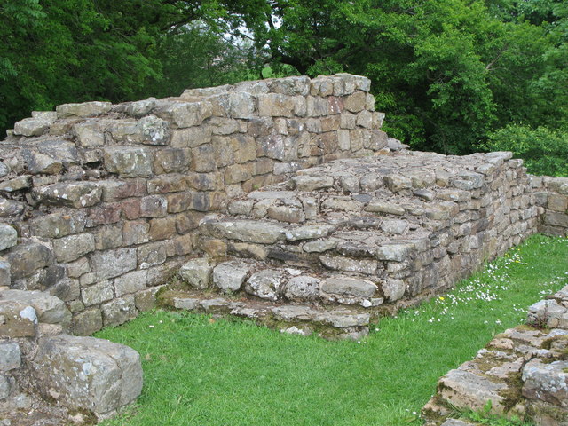
"Roman Milecastle: Handbook to the Roman Wall by J Collingwood 1957: Immediately west of the railway station the wooded gorge of Poltross Burn divides Northumberland and Cumberland… The milecastle measures seventy feet north to south and sixty feet nine inches from east to west." Photo by Les Hull, 2006. -
Owner
Les Hull -
Source
Geograph (Geograph) -
License
What does this mean? Creative Commons License
-
Further information
Link: http://www.geograph.org.uk/photo/108054
Resource type: Image
Added by: Simon Cotterill
Last modified: 8 years, 10 months ago
Viewed: 897 times
Picture Taken: 2006-01-18 -
Co-Curate tags


