Devil's Causeway crossing Rimside Moor


-
Description
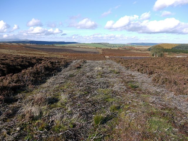
"Although now accentuated by deep heather cutting, the line of the Roman road known as the Devil's Causeway is clearly visible running in a straight line over the heather moorland, north of the Longframlington parish boundary. The cut area in the foreground makes up the raised agger of the former road, a ridge constructed from material dug from parallel ditches on each side. The arrangement was designed to improve water run-off and drainage http://www.battleoffulford.org.uk/ev_roman_rd_constrct.htm On the right two trees stand close to the ruined farmstead named as Wheatfolds on old maps. In the distance, ahead, the Roman road crosses the current main road (A697), west of Wellhope, then turns towards Edlingham. The Devil's Causeway branches off Dere Street north of Corbridge and can be traced through Northumberland for about 55 miles (89 km) north to Berwick-upon-Tweed. Little is known about its particular military purpose or historic use http://en.wikipedia.org/wiki/Devil%27s_Causeway" Photo by Andrew Curtis, 2011. -
Owner
Andrew Curtis -
Source
Geograph (Geograph) -
License
What does this mean? Creative Commons License
-
Further information
Link: http://www.geograph.org.uk/photo/2675398
Resource type: Image
Added by: Simon Cotterill
Last modified: 9 years ago
Viewed: 1615 times
Picture Taken: 2011-10-26 -
Co-Curate tags


