Haswell to Hart railway path, near High Hesleden


-
Description
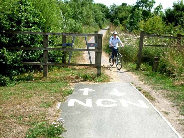
"This disused railway was converted to a railway path as part of the Turning the Tide project. http://www.turning-the-tide.org.uk/ The lettering NCN denotes that the path is part of the National Cycle Network route 1 (Inverness to Dover) http://www.sustrans.org.uk The A frame (partly hidden) is intended to deter motor cyclists, but as it adjoins a wide opening, it appears to be redundant. This photo is taken where the path crosses the lane from High Hesleden to Monk Hesleden." Photo by Oliver Dixon, 2006. -
Owner
Oliver Dixon -
Source
Geograph (Geograph) -
License
What does this mean? Creative Commons License
-
Further information
Link: http://www.geograph.org.uk/photo/208955
Resource type: Image
Added by: Simon Cotterill
Last modified: 9 years ago
Viewed: 1154 times
Picture Taken: 2006-07-24 -
Co-Curate tags


