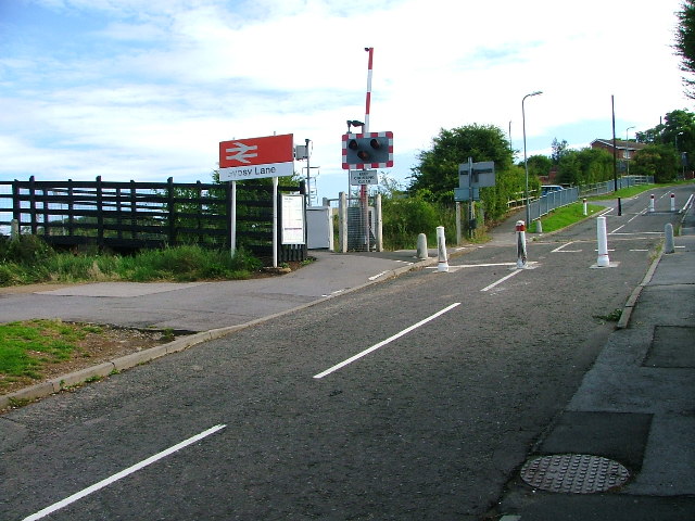
Gypsy Lane Crossing

-
Description
"This crossing was the cause of a lot of controversy before it was closed to traffic. Some residents of Gypsy Lane had complained about the road being used as a rat run. Others then objected to having to make a two mile detour. The Gypsy lane residents won. The railway marks the parish boundary between Nunthorpe and Ormesby and these parishes spelt the name Gypsy Lane differently. The Ormesby side spelt it with an 'i': Gipsy Lane. Officialdom has now caused this little peculiarity to be consigned to history." Photo by Mick Garratt, 2005, and licensed for reuse under a Creative Commons Licence. -
Owner
Geograph.org.uk -
Source
Geograph (Geograph) -
License
What does this mean? Attribution-ShareAlike 2.0 Generic (CC BY-SA 2.0)
-
Further information
Link: http://www.geograph.org.uk/photo/43363
Resource type: Text/Website
Added by: Simon Cotterill
Last modified: 9 years, 5 months ago
Viewed: 1450 times
Picture Taken: Unknown -
Co-Curate tags


