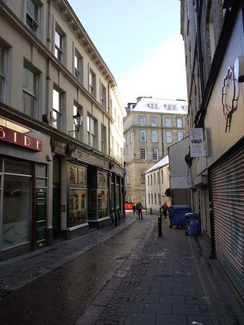
Pink Lane from Clayton Street West

-
Description
"Pink Lane was part of the system of narrow lanes (the 'pomerium') that used to run along the inside of the Town Walls, and on which no building was allowed. It was named from the Pink Tower, one of the Walls D-shaped, defensive towers, which was located near to the junction of Pink Lane and Clayton Street West." Photo by Andrew Curtis, 2010, and licensed for reuse under a Creative Commons Licence. -
Owner
Geograph.org.uk -
Source
Geograph (Geograph) -
License
What does this mean? Attribution-ShareAlike 2.0 Generic (CC BY-SA 2.0)
-
Further information
Link: http://www.geograph.org.uk/photo/1693925
Resource type: Text/Website
Added by: Pat Thomson
Last modified: 10 years, 6 months ago
Viewed: 1133 times
Picture Taken: Unknown -
Co-Curate tags


