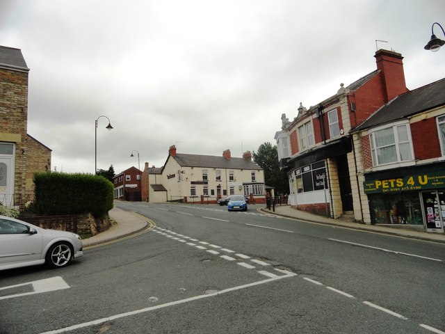
The village centre of Ushaw Moor


-
Description
"This is the junction of Cockhouse Lane with Durham Road in the centre of the village. Whitehouse Lane leads north up the middle of the picture. Ushaw Moor was founded in the mid 19th century as a colliery village. The pit closed in 1960. The village has survived better than most in the area, and still has a pub and plenty of shops." Photo by Robert Graham, 2013, and licensed for reuse under a Creative Commons Licence. -
Owner
Geograph.org.uk -
Source
Geograph (Geograph) -
License
What does this mean? Attribution-ShareAlike 2.0 Generic (CC BY-SA 2.0)
-
Further information
Link: http://www.geograph.org.uk/photo/3596948
Resource type: Text/Website
Added by: Pat Thomson
Last modified: 10 years, 9 months ago
Viewed: 1532 times
Picture Taken: Unknown -
Co-Curate tags


