The Cannon Inn, Earsdon

-
Description
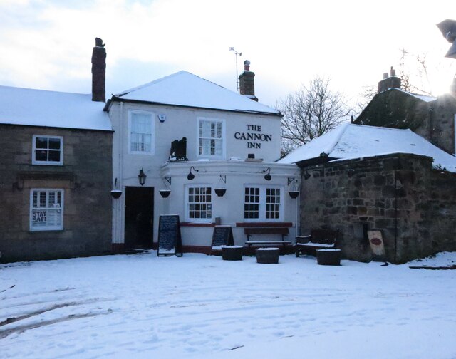
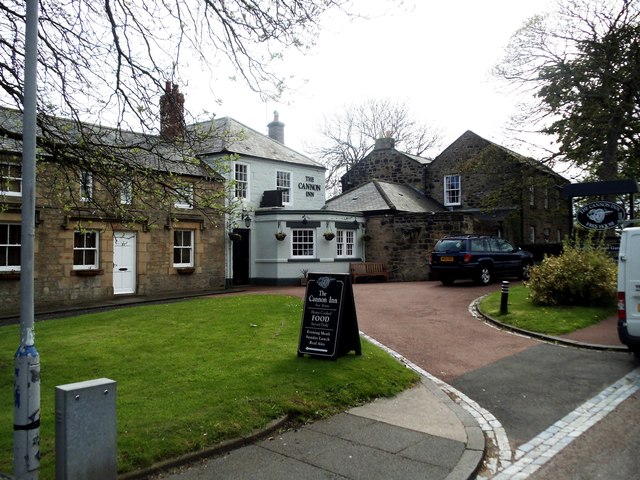
"When the first Ordnance Survey Six-Inch map of the area was published in 1865 (Surveyed in 1858), the Cannon Inn was clearly named on that map. Several French prisoners were held in Earsdon village during the Napoleonic Wars (1803-1815) after a French ship, its crew, and at least one cannon were captured on the nearby River Blyth. It is said that this was when The Spread Eagle in Earsdon changed its name to the Cannon Inn. For a selection of detailed free to download walking routes in the area visit www.northtynesidewalks.co.uk" Photo by Geoff Holland, 2021. -
Owner
Geoff Holland -
Source
Geograph (Geograph) -
License
What does this mean? Creative Commons License
-
Further information
Link: http://www.geograph.org.uk/photo/6751367
Resource type: Image
Added by: Peter Smith
Last modified: 4 years, 7 months ago
Viewed: 656 times
Picture Taken: 2021-02-10 -
Co-Curate tags


