Mayburgh Henge, northern part with standing-stone, Yanwath and Eamont Bridge

-
Description
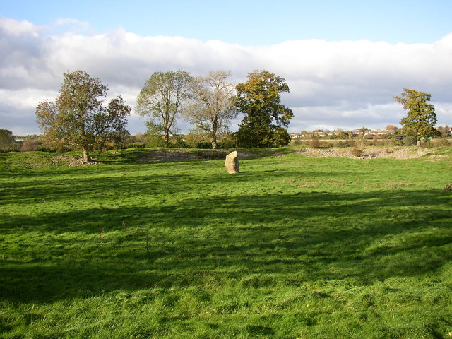
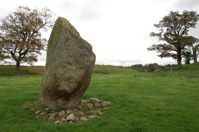
"Mayburgh Henge consists of a single circular bank, up to 6.5 metres high, and 50m across its base, with a single entrance and enclosing a level area 90m dia. It contains a single monolith 2.8m high, one of eight that existed in the 18C, four in the centre and four at the entrance. The other seven were destroyed using gunpowder. The henge probably dates from between 2000 and 1000BC, and may have been a meeting place or refuge for a large prehistoric community." Photo by Humphrey Bolton, 2006. -
Owner
Humphrey Bolton -
Source
Geograph (Geograph) -
License
What does this mean? Creative Commons License
-
Further information
Link: http://www.geograph.org.uk/photo/273923
Resource type: Image
Added by: Simon Cotterill
Last modified: 4 years, 9 months ago
Viewed: 627 times
Picture Taken: 2006-10-31 -
Co-Curate tags


