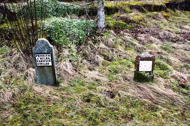
Old Boundary Marker

-
Description
"Parish Boundary Marker at the junction of an unclassified road to Penruddock and a lane and to right of milestone CU_PRKW06. HUTTON parish. Metal plate says TOWNSHIP / OF / HUTTON SOIL. See also http://www.geog.port.ac.uk/webmap/thelakes/photos/blp70.jpg Milestone Society National ID: CU_HUTT01pb" Photo by Roger Templeman, 2020. -
Owner
Roger Templeman -
Source
Geograph (Geograph) -
License
What does this mean? Creative Commons License
-
Further information
Link: http://www.geograph.org.uk/photo/6424136
Resource type: Image
Added by: Simon Cotterill
Last modified: 5 years, 3 months ago
Viewed: 501 times
Picture Taken: 2020-02-19 -
Co-Curate tags


