Myers Head lead mine


-
Description
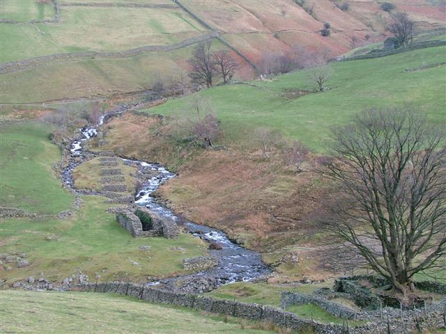
".....The monument includes the remains of Myers Head lead mine, a 19th century mine located approximately 800m south east of Hartsop at the confluence of Hayeswater Gill and Pasture Beck. The complex includes a mine shaft, two adits - that is horizontal tunnels driven into the hillside for access to the mineral vein - a wheelpit, the buried remains of a tailrace, a series of well preserved stone pillars which supported the launder used to carry water to power the wheel, spoil heaps, dressing waste, leats, and the site of a gin circle or horse-powered capstan for raising ore from the shaft. The shaft, now largely infilled, is situated on the west side of Pasture Beck....." -
Owner
Historic England -
Source
Local (Co-Curate) -
License
What does this mean? Unknown license check permission to reuse
-
Further information
Link: https://historicengland.org.uk/listing/the-list/list-entry/1015652
Resource type: Text/Website
Added by: Simon Cotterill
Last modified: 6 years, 9 months ago
Viewed: 635 times
Picture Taken: Unknown -
Co-Curate tags


