Topics > Northumberland > Murton, Northumberland > Murton High Crags Enclosure
Murton High Crags Enclosure
Scheduled Monument areas - based on Historic England data (Open Government Licence).
Scheduled Monument (#1006422): Murton High Crags settlements
Click the headings below to expand (selected extracts from the Historic England scheduling)
Defended settlements are a rare monument type. They were an important element of the later prehistoric settlement pattern of the northern uplands and are important for any study of the developing use of fortified settlements during this period. All well-preserved examples are believed to be of national importance.
Murton High Crags defended settlement, hut-circles and enclosure are reasonably well-preserved as cropmarks. Partial excavation has shown that the monument will contain archaeological deposits in features such as ditches, post-holes and the ring-grooves of hut-circles, which will inform us about the construction, use and abandonment of the monument and environmental deposits that will inform us about the use of the surrounding landscape. The monument provides insight into the character of settlement and subsistence during the Iron Age and the nature of settlement continuity in the Romano-British period.
The monument includes the remains of a defended settlement of Iron Age date, hut-circles of Iron Age and Romano-British date and an enclosure, situated on the hilltop of Murton High Crags, the crags themselves forming the steep scarp to the north west.
The most westerly remains relate to the defended settlement which is preserved as a cropmark and was partially excavated between 1979 and 1983. The excavation revealed the enclosure to be sub-circular with several constructional phases commencing with a concentric rock-cut double palisade encircling the hilltop. Following the palisade phase was a sequence of construction of ramparts associated with 2 shallow ditches with the latest phases of occupation involving a large paved area and a series of superimposed hut-circles.
The hut-circles, one of which lay outside of the defences of the settlement, were constructed sequentially with the earlier ones contemporary with the Iron Age defended settlement and the later ones reflecting continued settlement during the Romano-British period. Located about 250m to the ENE of the defended settlement is a second circular enclosure approximately 110m in diameter, preserved as a cropmark.
EN0586 Murton High Crags, Northumberland
Click the headings below to expand (selected extracts from the Atlas of Hillforts of Britain and Ireland)
The cropmarks of a multi-phased enclosure lying 500m to the SE of Longridge Towers, identified on an RAF aerial photograph taken in 1961. A lowland site, it lies on the crest of a hill at 83m OD. Excavations revealed two concentric lines of palisades which encircled the summit of the hill (Jobey and Jobey 1987). They were later succeeded by three, possibly four phases of earthen ramparts and two shallow ditches described as 'no more than a series of shallow linear scoops'. In the final, probably Romano-British phase, it was enclosed by a substantial sandstone wall, the stone partly shaped but not dressed. The palisaded enclosure was constructed in the early 2nd century BC and occupied until the late 2nd -3rd centuries AD.
Quarrying destroyed the entrance in the 19th century. Within the excavated area nine or ten round timber buildings were found within the inner palisade trench, with doorways facing S or SE. These are undated but overlain with a similar number of stone-built roundhouses, some superimposed, with associated paving which are probably Romano-British in date. Charred material from the timber-built house was dated 380 cal BC-cal AD 140 (ibid.). Wheat chaff from beneath the enclosure wall and above the filled inner ditch dated 200 cal BC-cal AD 140 and 170 cal BC-cal AD 230; from the floor area of the timber-built house 50 cal BC-cal AD 250. The ring-grooved hut circle outside the enclosure is earlier. Bronze Age burials found in the past. The site is not recorded on OS mapping. Scheduled as Murton High Crags settlements.
Source: Lock, Gary and Ralston, Ian. 2024. Atlas of Hillforts of Britain and Ireland. Available at: https://hillforts.arch.ox.ac.uk (CC BY-SA 4.0)

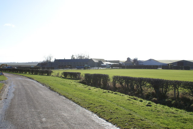
from https://www.geograph.org.uk/p…
Murton High Crags
- Cattle grazing peacefully on a sunny day, in the late afternoon. The "herd" said as he parked his quad and locked the gate "it's a lovely view", and that from …
Added by
Simon Cotterill

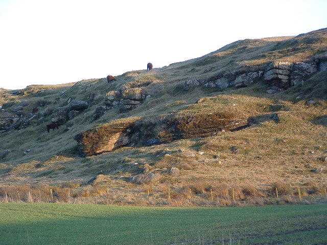
from https://keystothepast.info/se…
Murton High Crags settlement (Ord)
- ....NT 963496: Cropmarks of a multiphase hillfort at Murton Crags were excavated in the summer and autumn of 1979. A 0.25ha area was stripped on the west side of the …
Added by
Simon Cotterill
from https://keystothepast.info/se…
Ring ditch south of Murton High Crags (Ord)
- Traces of a Bronze Age ring ditch show up as cropmarks on an aerial photograph taken in 1972. It measures about 20m in diameter.....
Added by
Simon Cotterill

from https://historicengland.org.u…
Murton High Crags settlements
- During the earlier Iron Age (seventh to fifth centuries BC) a variety of different types of defensive settlements began to be constructed and occupied in the northern uplands of England. …
Added by
Simon Cotterill

from https://www.geograph.org.uk/p…
Murton High Crags
- Cattle grazing peacefully on a sunny day, in the late afternoon. The "herd" said as he parked his quad and locked the gate "it's a lovely view", and that from …
Added by
Simon Cotterill
from https://keystothepast.info/se…
Murton High Crags settlement (Ord)
- ....NT 963496: Cropmarks of a multiphase hillfort at Murton Crags were excavated in the summer and autumn of 1979. A 0.25ha area was stripped on the west side of the …
Added by
Simon Cotterill
from https://keystothepast.info/se…
Ring ditch south of Murton High Crags (Ord)
- Traces of a Bronze Age ring ditch show up as cropmarks on an aerial photograph taken in 1972. It measures about 20m in diameter.....
Added by
Simon Cotterill
from https://historicengland.org.u…
Murton High Crags settlements
- During the earlier Iron Age (seventh to fifth centuries BC) a variety of different types of defensive settlements began to be constructed and occupied in the northern uplands of England. …
Added by
Simon Cotterill