Topics > Tyne and Wear > North Tyneside > Monkseaton > Monkseaton township
Monkseaton township
MONKSEATON, a township, in the parish and union of Tynemouth, E. division of Castle ward, S. division of the county of Northumberland, 3 miles (N.W.) from Tynemouth; containing 581 inhabitants. The township comprises 1,238 acres of arable land; the soil is a good loam, and the subsoil clay. A colliery was opened in 1819, and coal is wrought in considerable quantity, and conveyed from the pit near Whitley by a railway to the lower part of Shields, whence it is exported; there is also a portion of Whitley lime-quarry in the township. The impropriate tithes have been commuted for £298. Here is a place of worship for Wesleyans. On Monkhouse farm are the remains of a stone, called the Monk's stone, with this inscription, "O horror, to kill a man for a pig's head!" concerning which a curious tradition prevails. A monk of Tynemouth, it is said, was scourged on the spot by a Mr. Delaval for having cut off a pig's head whilst roasting in the kitchen of the latter; and dying within a year and a day, his brethren fixed a charge of murder on Mr. Delaval, who, in order to obtain absolution, assigned to the monastery the manor of Elswick and other estates, and erected an obelisk on the spot where he chastised the monk.
Extract from: A Topographical Dictionary of England comprising the several counties, cities, boroughs, corporate and market towns, parishes, and townships..... 7th Edition, by Samuel Lewis, London, 1848.
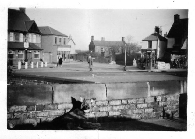
Monkseaton was a township in the ancient parish of Tynemouth in Northumberland. The township covered a much wider geographical area compared to the modern area of Monkseaton. Monkseaton township included: Burnt House, Hill Head, Monkseaton (village), Rake House, Red House, Murton Grange, Seaton Villa, Shiremoor Hill Top, and Shiremoor House.
Monkseaton became a civil parish (CP) in 1866, following the Poor Law Amendment Act. The population by the coast expanded rapidy with the arrival of the railways in the later 19th century, including the rapid growth of neighbouring Whitley Bay. In 1891, the population of Monkseaton CP was 564, but it had expanded more than 5-fold, to 2,971 at the time of the 1911 Census.[1] Whitley and Monkseaton Urban District was formed in 1894 and in 1913, Monkseaton CP was merged with Whitley CP, to create Whitley and Monkseaton Civil Parish. In 1974, as part of wider local government reorganisation, Monkseaton became an unparished area in the new metropolitan borough of North Tyneside.

Co-Curate Page
Monkseaton, 1855
- Extract from: History, Topography, and Directory of Northumberland...Whellan, William, & Co, 1855. MONKSEATON is a township and village in Tynemouth parish, containing 1,087 acres, the rateable value of which is …
Co-Curate Page
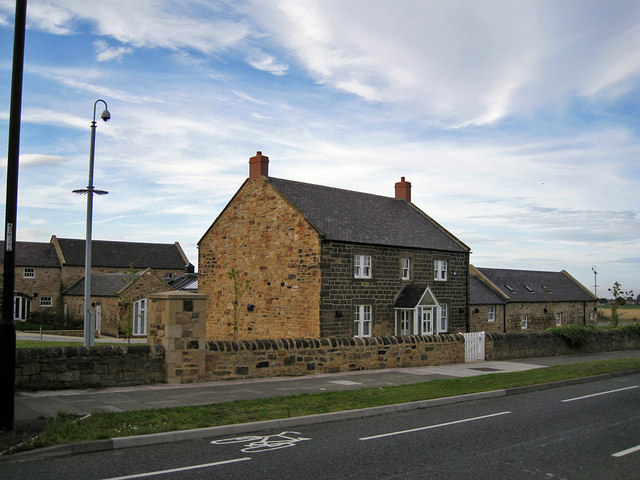
Rake House Farm
- Overview Map Street View Rake House is a small-business and office complex, based on a former farm on Rake Lane in Preston Grange, North Shields. The former farmhouse dates from …


Co-Curate Page
Monkseaton, 1855
- Extract from: History, Topography, and Directory of Northumberland...Whellan, William, & Co, 1855. MONKSEATON is a township and village in Tynemouth parish, containing 1,087 acres, the rateable value of which is …