Topics > Northumberland > Civil Parishes in Northumberland > Wooler Civil Parish > Historic Buildings and Monuments in Wooler Civil Parish
Historic Buildings and Monuments in Wooler Civil Parish
Listed buildings and scheduled monuments in Wooler Civil Parish, Northumberland, from the National Heritage List for England[1]. In the absence of a published 'local list', some other public buildings of interest may also be included. Use the Search (below) if looking for a specific building / monument.
| Structure | List No. | Grade | Built~ | Notes |
|---|---|---|---|---|
| Nos. 10-14, High Street | 1042335 | II | ||
| Barclays Bank | 1042336 | II | 1863 | 21 High Street, former bank |
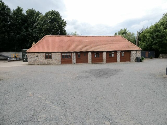
| Cart Shed and Forge Circa 30 Yards West of Towermartin Farmhouse | 1154915 | II | C18th | Tower Martin |
| Church of St Mary | 1042332 | II | 1765 | Enlarged 1835 |
| Dovecote Circa 100 Yards South East of Surrey House | 1042355 | II | C18th | Haugh Head |
| Garage and Workshop Circa 10 Yards North West of the Tankerville Arms | 1304051 | II | ||
| Garden Wall and Gatepiers East and South of Loreto Guest House | 1370941 | II | ||
| Gingang and Barn Circa 30 Yards North of Towermartin Farmhouse | 1042419 | II | C19th | Tower Martin |
| J Bryson and Sons | 1154033 | II | ||
| Loreto Guest House | 1042296 | II | ||
| Milepost by Millvale | 1042297 | II | C19th | Wooler, South Road |
| Milepost Circa 1/4 Mile North of Haugh Head | 1042329 | II | C19th | Haug Head, A697 |
| Millers Antiques | 1304072 | II | C17th | Wooler, Church Street |
| Nent House | 1042330 | II | ||
| Number 1 and Attached Garages | 1042295 | II | ||
| Police Station and Police House | 1042331 | II | 1850 | Church Street. Now a B&B. |
| Pringle and Company | 1304041 | II | ||
| Redpath | 1370919 | II | ||
| Roman Catholic Church of St Ninian | 1304105 | II | 1856 | |
| Sanderson Wines and J G Fairbairn | 1370918 | II | ||
| St Leonards | 1370940 | II | ||
| Surrey House | 1304328 | II | C19th | Haugh Head. Incorporating parts of C16th house. |
| Terrace Cafe and Grill Bar | 1304008 | II | ||
| Terrace Retaining Wall and Railings 5 Yards North of Numbers 14-18 | 1042338 | II | ||
| The Angel Inn | 1370917 | II | C18th | High Street |
| The Black Bull | 1153925 | II | C19th | High Street |
| The Masonic Hall | 1042337 | II | 1818 | |
| The Old Vicarage | 1042334 | II | ||
| The Red Lion (now No.1) | 1153963 | II | C17th | High Street |
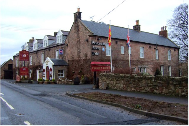
| The Tankerville Arms | 1042333 | II | C18th | |
| Towermartin Farmhouse | 1042418 | II | C18th | Tower Martin |
| W.J. Miller and Son | 1153939 | II | C19th | 6-8, High Street |
| War Memorial | 1153910 | II | 1920 | On Tower Hill |
| Wooler Mill | 1042298 | II | C18th | Wooler, South Road |
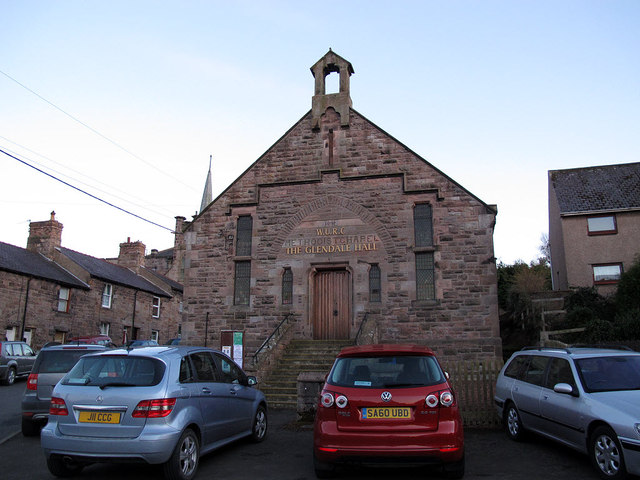
| Wooler United Reformed Church | 1392233 | II | 1784 | Built as a Presbyterian church. |
| Wooler Tower on east side of Church Street | 1018347 | n/a | C16th | Scheduled Monument. Remains |
| Prehistoric field system, cairnfield, round cairns and enclosed cremation cemetery on east slopes of Fredden Hill, 750m west of Wooler Common | 1018375 | n/a | Scheduled Monument | |
| Bronze Age cairnfield on north west slopes of Hart Heugh, 900m south west of Wooler Common | 1018376 | n/a | Scheduled Monument | |
| Coldmartin Tower, 260m north east of Tower Martin | 1018373 | n/a | Scheduled Monument | |
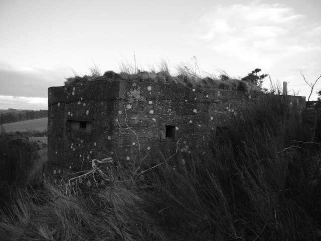
| Two pillboxes near Green Castle | 1006438 | n/a | 1940s | Scheduled Monument |
| Green Castle ringwork 320m south west of Humbleton Mill | 1019926 | n/a | Scheduled Monument | |
| Bronze Age field system on Fredden Hill | 1018023 | n/a | Scheduled Monument | |
| Bronze Age round house on Fredden Hill 880m south west of Bell's Valley | 1018021 | n/a | Scheduled Monument | |
| Prehistoric field system and cairnfield east of Watch Hill, 520m NNE of footbridge over Carey Burn | 1018374 | n/a | Scheduled Monument | |
| The Kettles univallate hillfort and enclosed settlement, 261m north west and 331m south west of King's Chair | 1006530 | n/a | Scheduled Monument | |
| Two Roman period native settlements and associated field system on Coldberry Hill | 1017043 | n/a | Scheduled Monument | |
| Battle of Homildon Hill 1402 | 1000014 | n/a | 1402 | Historic Battlefield. Partly in Akeld PC. |
| Glandale Poor Law Union Workhouse | not listed | n/a | 1839 | Now The Cheviot Centre |
| Wooler Conservation Area | - | n/a | Conservation Area |
Primary source: the National Heritage List for England - NHLE is the register of nationally protected historic buildings and sites in England, including listed buildings, scheduled monuments, protected wrecks, registered parks and gardens, and battlefields. The list is maintained by Historic England. Check NHLE for updates and new entries. Secondary sources: British Listed Buildings and Keys to the Past.
Co-Curate Page
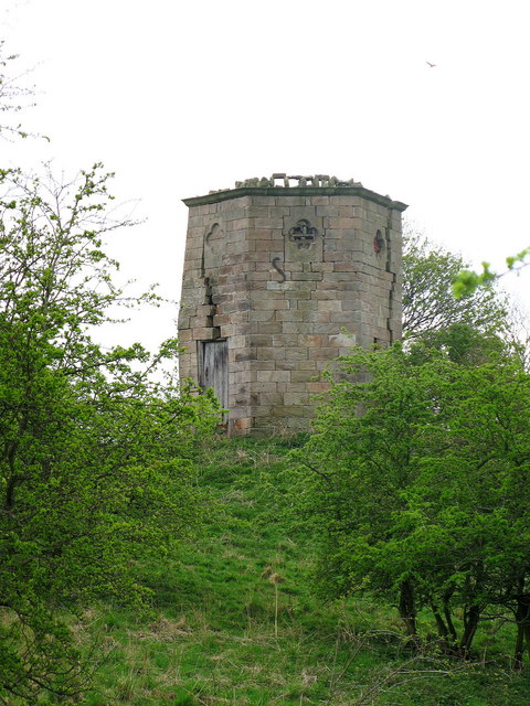
Wooler Tower (remains)
- Overview Map Street View There was a fortified stone tower, built in the early 16th century, on Tower Hill in Wooler. Only 3 large blocks of masonary survive, one near …
Co-Curate Page
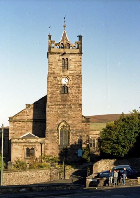
Church of St Mary
- Overview Map Street View St Mary's is the parish church in Wooler which was built in 1765. The church was enlarged 1835 and gothicized 1873 by F.R. Wilson.[1] The church …
Co-Curate Page
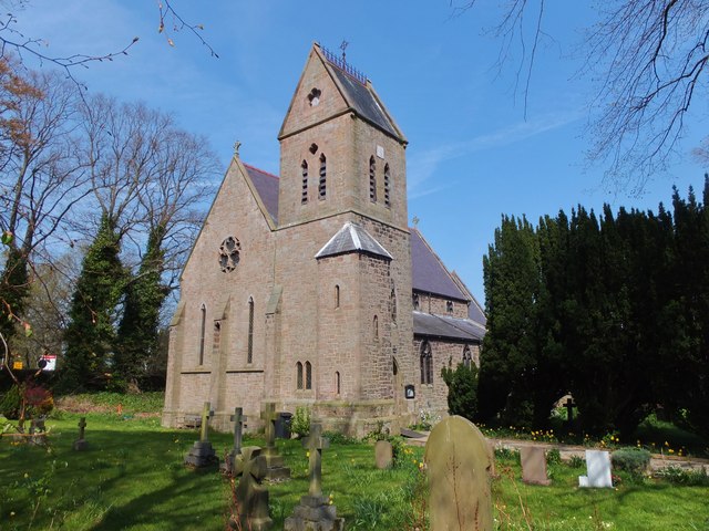
Church of St Ninian, RC
- Overview Map Street View St Ninian's is a Roman Catholic church in Wooler, Northumberland. It was designed by George Goldie and completed in 1856.[1] The church is Grade II listed …
Co-Curate Page
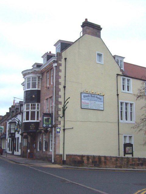
The Black Bull
- Overview Map Street View The Black Bull Hotel is located on the High Street, Wooler. It was a coaching inn from the 19th century and was substantially remodelled in 1910. …
Co-Curate Page
Former Masonic Hall
- Overview Map Former County Library and Masonic Hall, Wooler. This was formerly Western Chapel, an English Presbyterian church, built in 1818, with it's porch added in the 1830s. The building …
Co-Curate Page
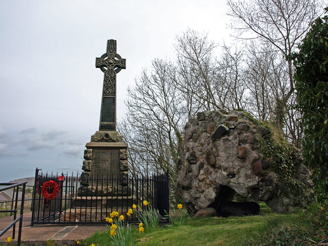
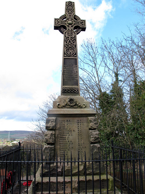
War Memorial
- Overview Map Street View The War Memorial in Wooler is located on Tower Hill. The memorial, built in c.1920, is a stone cross with a Celtic wheel-head design.[1] It was …
Co-Curate Page
Dovecote, Haugh Head
- Overview Map Street View There is a 2 storey hexagonal dovecote on high ground a 100 yards from Surrey House in Haugh Head, near Wooler in Northumberland. It was built …

Co-Curate Page
Surrey House, Haugh Head
- Overview Map Surrey House in Haugh Head lis located beside the A697 road about a mile from Wooler. It was was built in the mid-19th century. The building is a former coaching …
Co-Curate Page
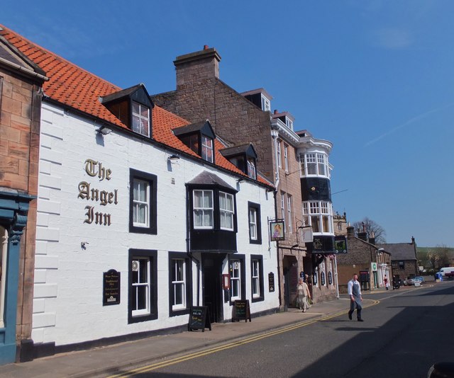
The Angel Inn, Wooler
- Overview Map Street View The Angel Inn on the High Street in Wooler dates from the 18th century. It is a Grade II listed building on the National Heritage List …
Co-Curate Page
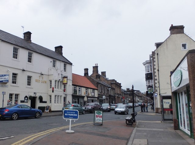
No.1, High Street, Wooler
- Overview Map Street View No.1 Hotel & Wine Lounge is located on the High Street in Wooler. It was formerly known as the Red Lion. The inn dates from the …
Co-Curate Page
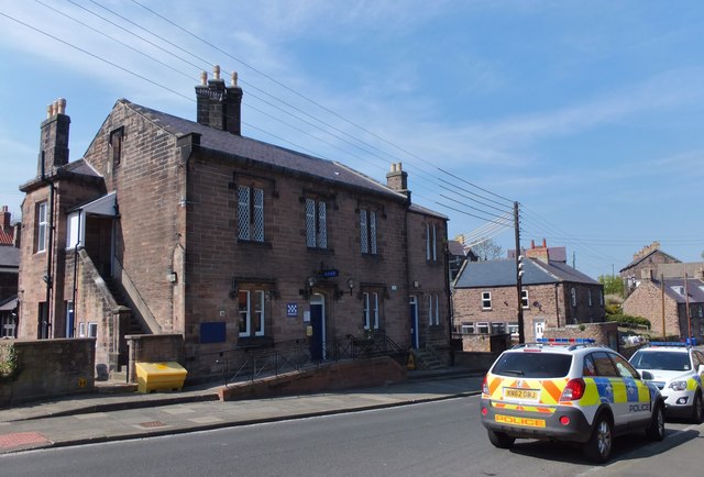
Former Police Station, Church Street, Wooler
- Overview Map Street View No. 17, Church Street in Wooler is a former police station and court house. The police station and police house were built in 1850, and enlarged …
Co-Curate Page
The Old Mill, Wooler
- Overview Map Street View The Old Mill located off South Road in Wooler, is a former flour mill, dating from the 18th or early 19th century. It is now a …
Co-Curate Page
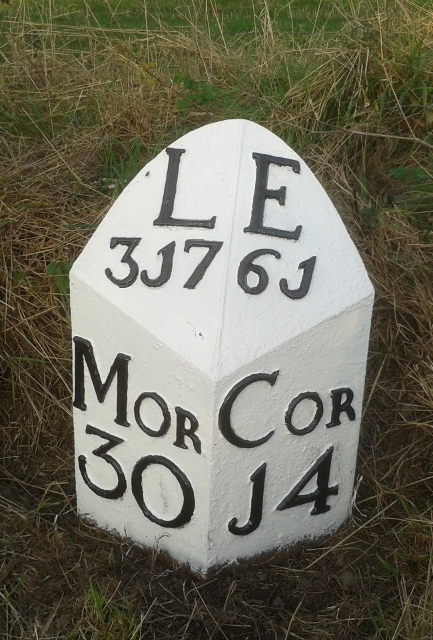
Old Milepost, South Road, Wooler
- Overview Map Street View There is an old milepost by a wall on the west side of South Road (A697) in Wooler. The cast iron milepost was erected by the …
Co-Curate Page
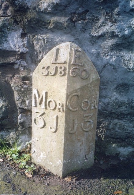
Old Milestone, Haugh Head
- Overview Map There is an old milepost on the A697 a short distance north of Haugh Head. The cast iron milepost was erected by the Percy's Cross to Millfield Turnpike …
Co-Curate Page
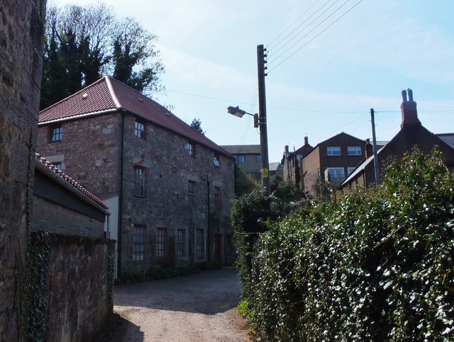
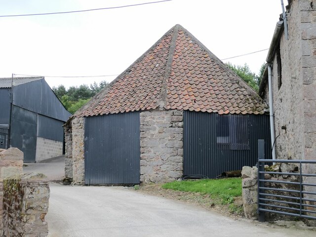
The Cart Shed, Tower Martin Farm
- Overview Map The former cart shed and blacksmith's forge at Tower Martin Farm near Wooler, dates from the late 18th century. The building has now been renovated and converted for …

Co-Curate Page
Battle of Homildon Hill, 1402
- Overview About Map of the Battlefield Street View In August 1402 a large Scottish force of around 10,000 men led by Archibald, Earl of Douglas, invaded England, going as far …

Co-Curate Page
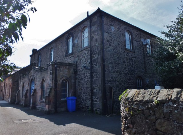
Glendale Poor Law Union
- Poor Law Unions were set-up across the country, following the 1834 Poor Law Amendment Act (the 'New Poor Law'). Glendale Poor Law Union in Northumberland was formally created on the …

Co-Curate Page
Wooler Tower (remains)
- Overview Map Street View There was a fortified stone tower, built in the early 16th century, on Tower Hill in Wooler. Only 3 large blocks of masonary survive, one near …
Co-Curate Page
Church of St Mary
- Overview Map Street View St Mary's is the parish church in Wooler which was built in 1765. The church was enlarged 1835 and gothicized 1873 by F.R. Wilson.[1] The church …
Co-Curate Page
Church of St Ninian, RC
- Overview Map Street View St Ninian's is a Roman Catholic church in Wooler, Northumberland. It was designed by George Goldie and completed in 1856.[1] The church is Grade II listed …
Co-Curate Page
The Black Bull
- Overview Map Street View The Black Bull Hotel is located on the High Street, Wooler. It was a coaching inn from the 19th century and was substantially remodelled in 1910. …
Co-Curate Page
Former Masonic Hall
- Overview Map Former County Library and Masonic Hall, Wooler. This was formerly Western Chapel, an English Presbyterian church, built in 1818, with it's porch added in the 1830s. The building …
Co-Curate Page
War Memorial
- Overview Map Street View The War Memorial in Wooler is located on Tower Hill. The memorial, built in c.1920, is a stone cross with a Celtic wheel-head design.[1] It was …
Co-Curate Page
Dovecote, Haugh Head
- Overview Map Street View There is a 2 storey hexagonal dovecote on high ground a 100 yards from Surrey House in Haugh Head, near Wooler in Northumberland. It was built …
Co-Curate Page
Surrey House, Haugh Head
- Overview Map Surrey House in Haugh Head lis located beside the A697 road about a mile from Wooler. It was was built in the mid-19th century. The building is a former coaching …
Co-Curate Page
The Angel Inn, Wooler
- Overview Map Street View The Angel Inn on the High Street in Wooler dates from the 18th century. It is a Grade II listed building on the National Heritage List …
Co-Curate Page
No.1, High Street, Wooler
- Overview Map Street View No.1 Hotel & Wine Lounge is located on the High Street in Wooler. It was formerly known as the Red Lion. The inn dates from the …
Co-Curate Page
Former Police Station, Church Street, Wooler
- Overview Map Street View No. 17, Church Street in Wooler is a former police station and court house. The police station and police house were built in 1850, and enlarged …
Co-Curate Page
The Old Mill, Wooler
- Overview Map Street View The Old Mill located off South Road in Wooler, is a former flour mill, dating from the 18th or early 19th century. It is now a …
Co-Curate Page
Old Milepost, South Road, Wooler
- Overview Map Street View There is an old milepost by a wall on the west side of South Road (A697) in Wooler. The cast iron milepost was erected by the …
Co-Curate Page
Old Milestone, Haugh Head
- Overview Map There is an old milepost on the A697 a short distance north of Haugh Head. The cast iron milepost was erected by the Percy's Cross to Millfield Turnpike …
Co-Curate Page
The Cart Shed, Tower Martin Farm
- Overview Map The former cart shed and blacksmith's forge at Tower Martin Farm near Wooler, dates from the late 18th century. The building has now been renovated and converted for …
Co-Curate Page
Battle of Homildon Hill, 1402
- Overview About Map of the Battlefield Street View In August 1402 a large Scottish force of around 10,000 men led by Archibald, Earl of Douglas, invaded England, going as far …