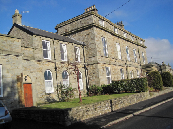
Topics > County Durham > Civil Parishes in County Durham > Middleton-in-Teesdale Civil Parish > Historic Buildings and Monuments in Middleton-in-Teesdale Civil Parish
Historic Buildings and Monuments in Middleton-in-Teesdale Civil Parish
Listed buildings and scheduled monuments in Middleton-in-Teesdale Civil Parish, Northumberland, from the National Heritage List for England[1]. Use the Search (below) if looking for a specific building / monument.
| Structure | List No. | Grade | Built~ | Notes |
|---|---|---|---|---|
| Nos. 1,2 and 3, Masterman Place | 1203544 | II | ||
| No. 16, Town End | 1121592 | II | ||
| 2 Tinkler Tombs Circa 12 Metres West of Porch of St Mary | 1322769 | II | ||
| 3 Lee Tombs to South West of Church of St Mary | 1203596 | II | ||
| No. 33, Town End | 1203571 | II | ||
| Nos. 38 and 39, Market Place | 1121587 | II | ||
| Nos. 4, 5 and 6, Hude | 1121583 | II | ||
| Nos. 42-44, Market Place | 1203537 | II | ||
| Nos. 49 and 50, Market Place | 1203542 | II | ||
| 5 Walton Tombs and One Bell Tomb Circa 14 Metres South of Porch of Church of St Mary | 1121596 | II | ||
| No. 55, Market Place | 1322804 | II | ||
| Nos. 9 and 10, Market Place | 1203522 | II | ||
| Allison Tomb Circa 14 Metres South of Porch of Church of St Mary | 1281595 | II | ||
| Archway | 1203547 | II | ||
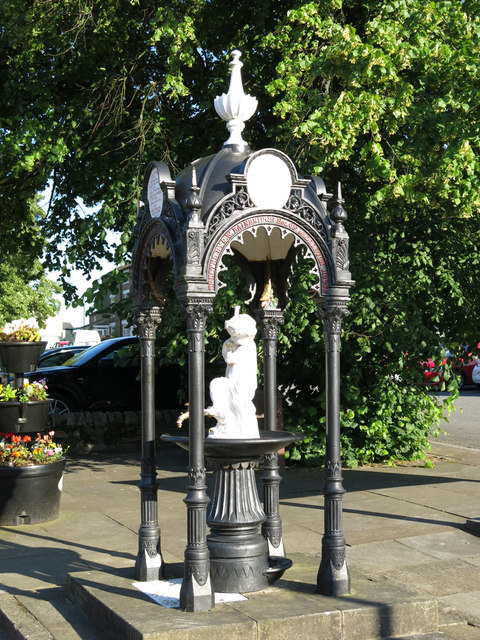
| Bainbridge Memorial Fountain | 1121579 | II | ||
| Barn Circa 60 Metres North East of Middle End Farmhouse | 1121578 | II | ||
| Bedal Tomb Circa 16 Metres South West of Church of St Mary | 1121595 | II | ||
| Belfry 100 Metres North of Church of St Mary | 1203582 | II | ||
| Bouse Hoppers 100 Metres North of Great Eggleshope Beck | 1322783 | II | ||
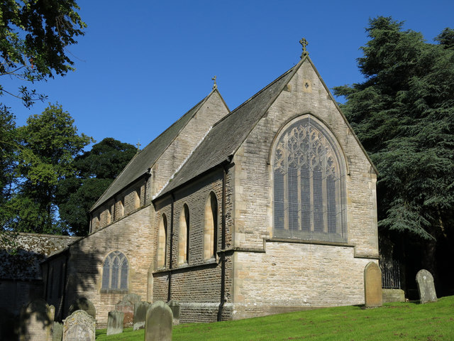
| Church of St Mary | 1322768 | II | 1878 | On the site of a C13th Church |
| Clock Tower, Weighbridge and Stables Adjoining | 1121580 | II | ||
| Community Centre | 1281746 | II | ||
| Elliott Tomb Circa 9 Metres South of Porch of Church of St Mary | 1322770 | II | ||
| Former Chapel with Front Walls and Steps | 1203562 | II | ||
| Former Explosives Store at South Side of Track | 1281694 | II | ||
| Former Mill | 1121581 | II | ||
| Gate Piers and Walls North of Community Centre | 1322781 | II | ||
| Gates, Piers and Walls South of Former Methodist Chapel | 1322767 | II | ||
| Grey Croft Farmhouse with Outbuilding and Farmbuilding Attached | 1203360 | II | ||
| Hodgson Tomb Circa One Metres South of Chancel of Church of St Mary | 1322772 | II | ||
| House and Wall Adjacent to Masterman Place Arch | 1121590 | II | ||
| Hude Bridge | 1121584 | II | ||
| Kipling Tomb Circa 6 Metres South East of Porch of Church of St Mary | 1121597 | II | ||
| Level Arch and Retaining Wall 25 Metres South of Mine Shop | 1121620 | II | ||
| Lind Tomb Circa 4.5 Metres South of Porch of Church of St Mary | 1203604 | II | ||
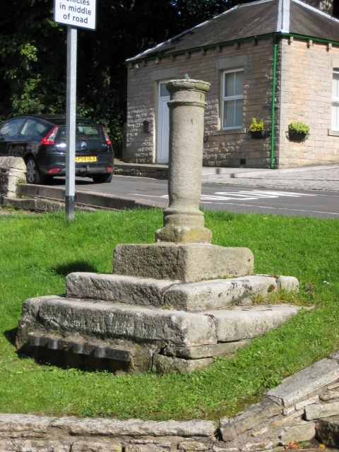
| Market Cross | 1121585 | II | C18th | |
| Marl Beck Mine Shop and Level | 1322802 | II | ||
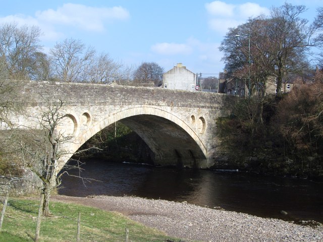
| Middleton Bridge | 1160160 | II* | c.1800 | Stone bridge over River Tees. |
| Middleton House | 1322803 | II | 1823 | By Ignatius Bonomi |
| Middleton Working Men's Club | 1121591 | II | ||
| Middleton-in-Teesdale War Memorial | 1439551 | II | ||
| Milestone 200 Metres East of Track to Stanhope Gate | 1203392 | II | ||
| Mill House | 1121589 | II | ||
| Mine Shop | 1121621 | II | ||
| Morton Tomb Circa 19 Metres South of Church of St Mary | 1322771 | II | ||
| Parkin Tombs Circa 12 Metres South West of Porch of Church of St Mary | 1281598 | II | ||
| Range of Outbuildings Circa 25 Metres South West of Number 42 | 1121588 | II | ||
| Robinson Tomb 2 Metres West of Church of St Mary | 1203597 | II | ||
| Robinson Tomb Circa 22 Metres South of Chancel of Church of St Mary | 1203620 | II | ||
| Robinson Tomb Circa 25 Metres South of Nave of Church of St Mary | 1253078 | II | ||
| Rutter Tomb Circa 25 Metres South of Church of St Mary | 1121598 | II | ||
| Stable 4 Metres East of Mine Shop | 1281727 | II | ||
| Stotley Hall | 1322782 | II* | ||
| Tap Housing Circa 10 Metres West of Number 8 | 1322766 | II | ||
| The Old Rectory | 1121593 | II | ||
| The Rectory | 1121582 | II | ||
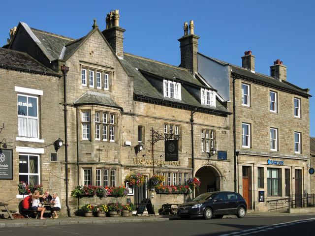
| The Teesdale Hotel | 1121586 | II | C19th | With C17th fragments. |
| Window Tracery Set in Graveyard, Circa 8 Metres South of Gateway | 1121594 | II | ||
| Wood Edge House and Byre | 1121619 | II | ||
| Coldberry lead mine and associated hushes | 1015863 | n/a | Scheduled Monument | |
| Two burnt mounds 350m north east of Stotley Grange | 1019459 | n/a | Scheduled Monument | |
| Burnt mound at Knott Well 370m north east of Stotley Grange | 1019460 | n/a | Scheduled Monument | |
| Burnt mound between Knottwell Sike and Bell Sike, 420m north east of Stotley Grange | 1019461 | n/a | Scheduled Monument | |
| Medieval farmstead 390m south of Lodge Sike Farm | 1019862 | n/a | Scheduled Monument |
Primary source: the National Heritage List for England - NHLE is the register of nationally protected historic buildings and sites in England, including listed buildings, scheduled monuments, protected wrecks, registered parks and gardens, and battlefields. The list is maintained by Historic England. Check NHLE for updates and new entries.
Secondary sources: British Listed Buildings and Keys to the Past.
Co-Curate Page
Middleton Bridge
- Overview Map Street View Middleton Bridge carries the B6277 road over the River Tees at Middleton-in-Teesdale. The stone bridge has a single high segmental arch. It was built in c.1800, …
Co-Curate Page
Church of St Mary
- Overview Map Street View Inside The Church of St Mary in Middleton-in-Teesdale was built in 1878 by C. Hodgson Fowler, on the site of a 13th century church.[1] The church has …
Co-Curate Page
The Teesdale Hotel
- Overview Map Street View The Teesdale Hotel is located in the Market Place in Middleton-in-Teesdale. The late 19th century hotel incorporates fragments of an earlier 17th century building. The Teesdale Hotel …
Co-Curate Page
Market Cross
- Overview Map Street View The market cross in Middleton-in-Teesdale is thought to date from the early 18th century. It is located on a green by the Market Place, at the …
Co-Curate Page
Bainbridge Memorial Fountain
- The Bainbridge Memorial Fountain is located in the Horse Market in Middleton-in-Teesdale. It was built in 1877, in honour of Robert Walton Bainbridge, on his retirement as superintendent of the …


Co-Curate Page
Middleton Bridge
- Overview Map Street View Middleton Bridge carries the B6277 road over the River Tees at Middleton-in-Teesdale. The stone bridge has a single high segmental arch. It was built in c.1800, …

Co-Curate Page
Church of St Mary
- Overview Map Street View Inside The Church of St Mary in Middleton-in-Teesdale was built in 1878 by C. Hodgson Fowler, on the site of a 13th century church.[1] The church has …

Co-Curate Page
The Teesdale Hotel
- Overview Map Street View The Teesdale Hotel is located in the Market Place in Middleton-in-Teesdale. The late 19th century hotel incorporates fragments of an earlier 17th century building. The Teesdale Hotel …

Co-Curate Page
Market Cross
- Overview Map Street View The market cross in Middleton-in-Teesdale is thought to date from the early 18th century. It is located on a green by the Market Place, at the …

