Topics > Northumberland > Civil Parishes in Northumberland > Earle Civil Parish > Historic Buildings and Monuments in Earle Civil Parish
Historic Buildings and Monuments in Earle Civil Parish
Listed buildings and scheduled monuments in Earle Civil Parish, Northumberland, from the National Heritage List for England[1]. Use the Search (below) if looking for a specific building / monument.
| Structure | List No. | Grade | Built~ | Notes |
|---|---|---|---|---|
| Boundary Stone Circa 20 Yards South of North Yearle Farm Buildings | 1370902 | II | C18th | |
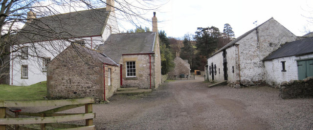
| Earle Mill | 1152971 | II | C18th | By Wooler Water. With C19th drying kiln |
| Earle Mill Cottage | 1042379 | II | C18th | |
| Farmbuilding Circa 50 Yards South of Middleton Hall | 1042339 | II | C18th | |
| Farmbuildings Circa 15 Yards West of Langleeford Farmhouse | 1042380 | II | C19th | |
| Langleeford Farmhouse | 1152979 | II | C18th | |
| Middleton Hall | 1370920 | II | 1807 | On the site of a medieval basstle. |
| Sundial Circa 30 Yards South of Middleton Hall | 1042340 | II | 1703 | |
| The Kettles univallate hillfort and enclosed settlement, 261m north west and 331m south west of King's Chair | 1006530 | n/a | Iron Age | Scheduled Monument |
| Roman period native settlement 400m WSW of Carey Burn Bridge | 1014928 | n/a | Scheduled Monument | |
| Tathey Crags prehistoric unenclosed hut circle settlement | 1015644 | n/a | Scheduled Monument | |
| Prehistoric unenclosed hut circle settlement south east of Long Crags | 1015645 | n/a | Scheduled Monument | |
| Roman period native farmstead north west of Long Crags, 600m south east of Langleeford | 1015646 | n/a | Scheduled Monument | |
| Roman period native settlement on south eastern slope of Hart Heugh, 490m north west of Carey Burn Bridge | 1016237 | n/a | Scheduled Monument | |
| Prehistoric unenclosed hut circle settlement and field system on Snear Hill, 700m west of the western edge of Coronation Wood | 1016243 | n/a | Scheduled Monument | |
| Roman period native enclosed settlement 360m south east of Broadstruther | 1016249 | n/a | Scheduled Monument | |
| Roman period native settlement 750m north west of Carey Burn Bridge | 1018440 | n/a | Scheduled Monument | |
| Prehistoric field system and unenclosed hut circle settlement on eastern slopes of Hart Heugh, 550m south west of Earlehillhead | 1018441 | n/a | Scheduled Monument | |
| Two prehistoric enclosures, field clearance cairns and unenclosed hut circle settlement north of Hart Heugh, 600m south west of Wooler Common | 1018442 | n/a | Scheduled Monument | |
| Bronze Age round cairn on summit of Hart Heugh, 780m south west of Earlehillhead | 1018446 | n/a | Scheduled Monument |
Primary source: the National Heritage List for England - NHLE is the register of nationally protected historic buildings and sites in England, including listed buildings, scheduled monuments, protected wrecks, registered parks and gardens, and battlefields. The list is maintained by Historic England. Check NHLE for updates and new entries.
Secondary sources: British Listed Buildings and Keys to the Past.
Co-Curate Page
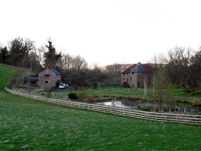
Earle Mill
- Overview Map Earle Mill is a watermill located by Wooler Water. It was built in the 18th century and has a distinctive 19th century drying kiln attached. It is aproximately …
Co-Curate Page
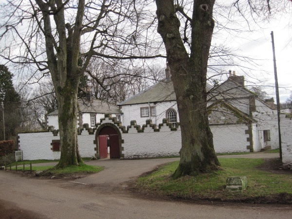
Middleton Hall, near Wooler
- Overview Map Street View Middleton Hall in Earle, near Wooler, was built in 1807. The hall was built on the site of a medieval basstle house and Middleton Hall (sometimes …
Co-Curate Page
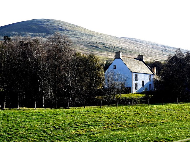
Langleeford Farmhouse
- Overview Map Street View Langleeford Farmhouse dates from around the mid 18th century. The farmhouse is Grade II listed on the National Heritage List for England. The poet Sir walter …
Co-Curate Page
Earle Mill Cottage
- Overview Map The cottage by Earle Mill dates from the 18th century and is Grade II listed on the National Heritage List for England. The cottage is close to Wooler …
Co-Curate Page
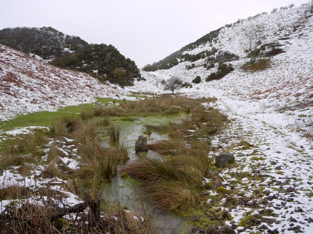
Kettles Hillfort, near Wooler
- The Kettles is the earwork remains of an Iron Age and Roman hill fort and settlement near Earle and Wooler in Northumberland.[1] The fort occupies a natural ridge protected on …
Co-Curate Page
Farmbuildings at Langleeford Farm
- The farmbuildings to the west of Langleeford farmhouse date from the 19th century and are a Grade II listed building.[1]

Co-Curate Page
Earle Mill
- Overview Map Earle Mill is a watermill located by Wooler Water. It was built in the 18th century and has a distinctive 19th century drying kiln attached. It is aproximately …
Co-Curate Page
Middleton Hall, near Wooler
- Overview Map Street View Middleton Hall in Earle, near Wooler, was built in 1807. The hall was built on the site of a medieval basstle house and Middleton Hall (sometimes …
Co-Curate Page
Langleeford Farmhouse
- Overview Map Street View Langleeford Farmhouse dates from around the mid 18th century. The farmhouse is Grade II listed on the National Heritage List for England. The poet Sir walter …
Co-Curate Page
Earle Mill Cottage
- Overview Map The cottage by Earle Mill dates from the 18th century and is Grade II listed on the National Heritage List for England. The cottage is close to Wooler …
Co-Curate Page
Kettles Hillfort, near Wooler
- The Kettles is the earwork remains of an Iron Age and Roman hill fort and settlement near Earle and Wooler in Northumberland.[1] The fort occupies a natural ridge protected on …


