Topics > Northumberland > Civil Parishes in Northumberland > Corsenside Civil Parish > Historic Buildings and Monuments in Corsenside Civil Parish
Historic Buildings and Monuments in Corsenside Civil Parish
Listed buildings and scheduled monuments in Corsenside Civil Parish, Northumberland, from the National Heritage List for England[1]. Use the Search (below) if looking for a specific building / monument.
| Structure | List No. | Grade | Built~ | Notes |
|---|---|---|---|---|
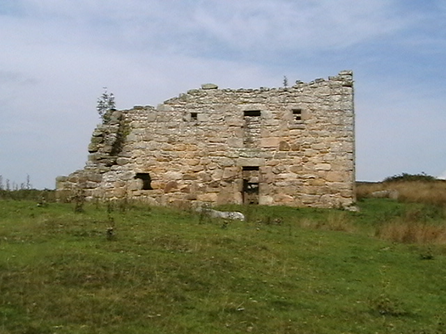
| Bastle 600 Yards North-North-East of Low Leam Farm | 1044976 | II | C16th | Ruined bastle. |
| Bastle House Attached to Brig Farmhouse | 1044972 | II | C16th | Bastle house, now store. |
| Bay Horse Inn | 1044974 | II | C18th | West Woodburn. |
| Broadgate | 1303957 | II | c.1840 | West Woodburn. House. |
| Chairford Bridge | 1370446 | II | C19th | East Woodburn |
| Cherry Trees | 1370448 | II | C16th | West Woodburn. Altered Bastle house. |
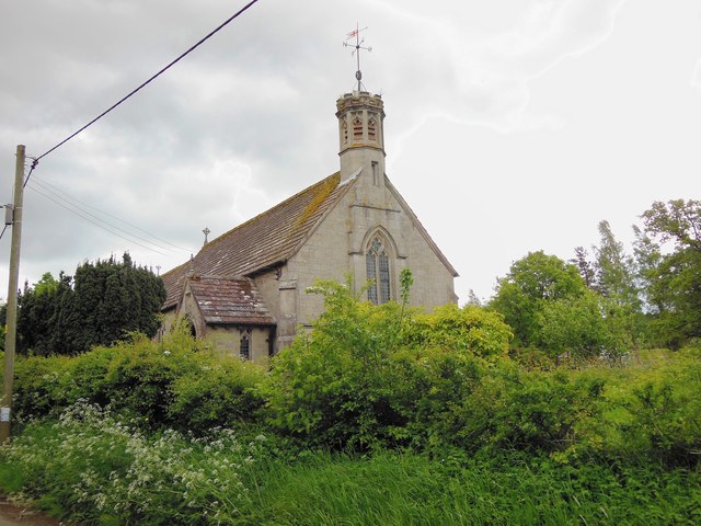
| Church of All Saints | 1304019 | II | 1906 | West Woodburn. By Hicks and Charlewood. |
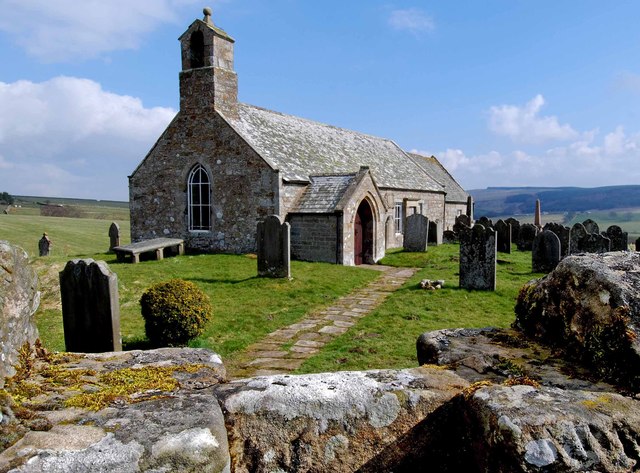
| Church of St Cuthbert | 1370445 | II | C12th | Corsenside |
| Corsenside | 1153920 | II | 1686 | Corsenside. Farmhouse |
| Corsenside Parish War Memorial, West Woodburn | 1441618 | II | 1921 | West Woodburn |
| Farmbuildings 20 Yards South-East of Townfoot Farmhouse | 1370447 | II | C18th | East Woodburn. Byres and granary. |
| Farmbuildings East of the Crag Farmhouse | 1044975 | II | C18th | West Woodburn |
| Farmbuildings to North and West of High Leam Farmhouse | 1303926 | II | High Leam | |
| Farmbuildings to North of Low Leam Farmhouse | 1303937 | II | C17th | Incorporates C17t bastle |
| Furnace House at Ridsdale Iron Works | 1304070 | II | 1836 | Corsenside |
| Harewalls | 1154021 | II | C16th | East Woodburn. Altered bastle house. |
| High Leam Farmhouse | 1044977 | II | C19th | High Leam |
| Low Park, no. 5 | 1154191 | II | 1753 | West Woodburn. House. |
| Low Park, no. 6 | 1370449 | II | C18th | West Woodburn. House. |
| Middle Woodburn House | 1303989 | II | ||
| The Crag Farmhouse and Attached Farmbuilding | 1154147 | II | ||
| The Old Farmhouse C50 Yards East of Coldtown Farmhouse | 1153976 | II | ||
| Townfoot Farmhouse and Attached Farm Buildings and Cottages | 1044973 | II | ||
| West Woodburn Bridge | 1044971 | II | C19th | Road bridge over River Rede |
| 'Robin of Risingham' Roman Rock Carving | 1012133 | n/a | Roman | Scheduled Monument |
| Ridsdale Ironworks | 1006420 | n/a | C19th | Scheduled Monument |
| Roman temporary camp, 350m south-west of Fourlaws | 1007522 | n/a | Scheduled Monument | |
| Round cairn, 580m north of Woodhouse | 1007523 | n/a | Scheduled Monument | |
| Bell Knowe round cairn, 200m north east of The Cragg | 1008268 | n/a | Scheduled Monument | |
| Bastle at Low Leam Farm | 1008269 | n/a | C17th | Scheduled Monument |
| Low Cleughs Bastle, 580m NNE of Low Leam Farm | 1008270 | n/a | C16th? | Scheduled Monument |
| Medieval cross, 150m west of Woodburnhill Farm | 1008423 | n/a | Scheduled Monument | |
| Fishponds, 200m south west of Townfoot Farm | 1008428 | n/a | Scheduled Monument | |
| Habitancum Roman fort and medieval settlement | 1008561 | n/a | Roman | Scheduled Monument |
Primary source: the National Heritage List for England - NHLE is the register of nationally protected historic buildings and sites in England, including listed buildings, scheduled monuments, protected wrecks, registered parks and gardens, and battlefields. The list is maintained by Historic England. Check NHLE for updates and new entries.
Secondary sources: British Listed Buildings and Keys to the Past.
Co-Curate Page
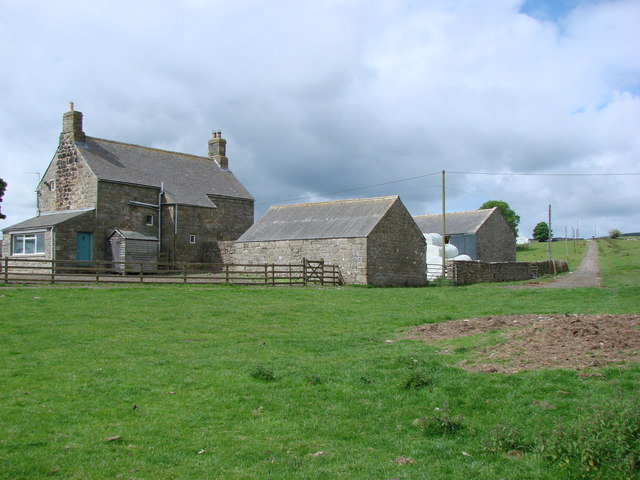
Corsenside (farm house)
- Overview Map Street View The stone farmhouse at Corsenside is dated 1686 above the door, with later alterations and extensions. The building forms part of the farmstead, which along with the …
Co-Curate Page
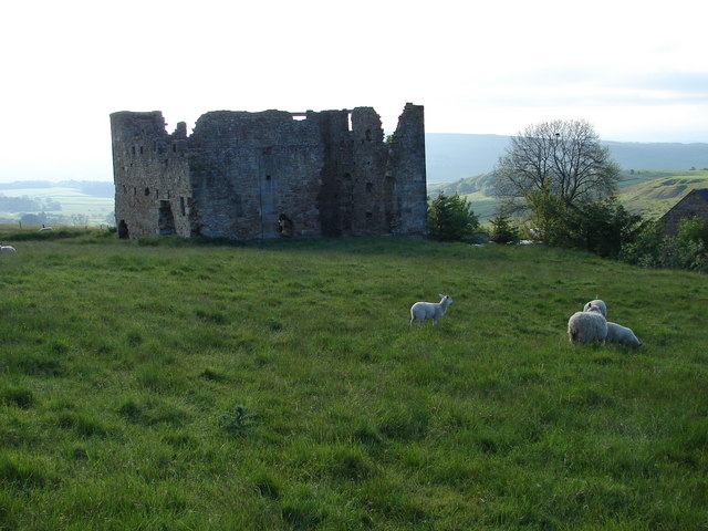
Engine House, Ridsdale Iron Works
- Overview Map Street View The remains of Ridsdale Iron Works are to the north of Ridsdale in Northumberland. Established in 1836, the works consisted of 3 furnaces, an engine house, coke …
Co-Curate Page
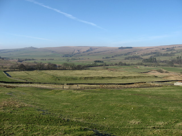
Habitancum Roman Fort
- Overview About Habitancum Habitancum was an ancient Roman fort (castra) located at Risingham, Northumberland, England. The fort was one of the defensive structures built along Dere Street, a Roman road …
Co-Curate Page
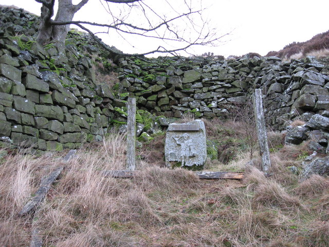
Robin of Risingham
- "Robin of Risingham" is a Roman rock carving located between Ridsdale and West Woodburn, and about ½ mile south-east of Habitancum Roman Fort. The carving of a figure holding a …
Co-Curate Page
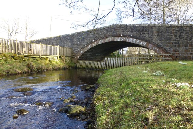
Chairford Bridge
- Overview Map Street View Chairford Bridge, in East Woodburn, carries the road over Lisles Burn. It is a stone hup-backed bridge, built in the early 19th century. Chairford Bridge is Grade …
Co-Curate Page
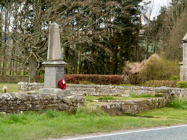
Corsenside Parish War Memorial
- Overview Map Street View Corsenside Parish War Memorial is located in a stone enclosure by the A68 road near West Woodburn. The obelisk was unveiled in 1921 in commemoration of 16 local …
Co-Curate Page
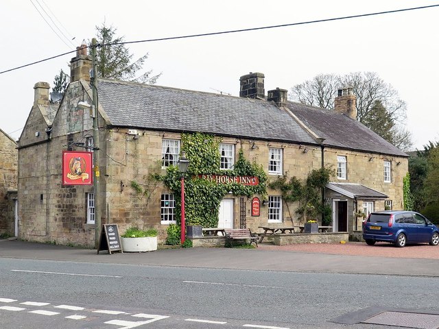
Bay Horse Inn, West Woodburn
- Overview Map Street View The Bay Horse Inn is located on the A68 road in West Woodburn. The former coaching inn dates from the 18th century, with later alterations, and …
Co-Curate Page
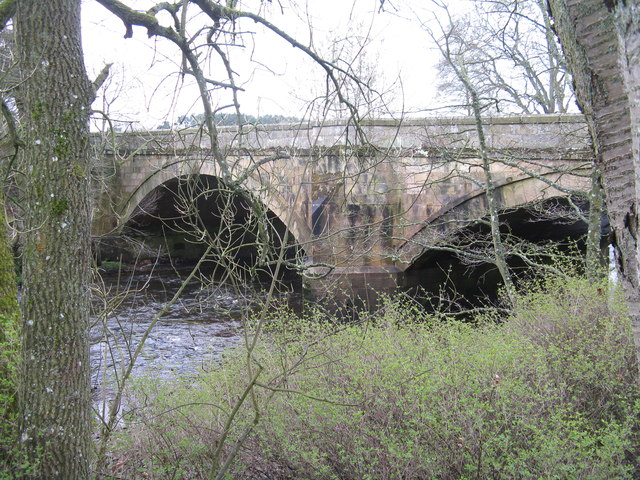
West Woodburn Bridge
- Overview Map Street View This stone bridge carries the A68 road over the River Rede at West Woodburn. The bridge was originally built in the early 19th century. It was …


Co-Curate Page
Corsenside (farm house)
- Overview Map Street View The stone farmhouse at Corsenside is dated 1686 above the door, with later alterations and extensions. The building forms part of the farmstead, which along with the …

Co-Curate Page
Engine House, Ridsdale Iron Works
- Overview Map Street View The remains of Ridsdale Iron Works are to the north of Ridsdale in Northumberland. Established in 1836, the works consisted of 3 furnaces, an engine house, coke …

Co-Curate Page
Habitancum Roman Fort
- Overview About Habitancum Habitancum was an ancient Roman fort (castra) located at Risingham, Northumberland, England. The fort was one of the defensive structures built along Dere Street, a Roman road …

Co-Curate Page
Robin of Risingham
- "Robin of Risingham" is a Roman rock carving located between Ridsdale and West Woodburn, and about ½ mile south-east of Habitancum Roman Fort. The carving of a figure holding a …

Co-Curate Page
Chairford Bridge
- Overview Map Street View Chairford Bridge, in East Woodburn, carries the road over Lisles Burn. It is a stone hup-backed bridge, built in the early 19th century. Chairford Bridge is Grade …

Co-Curate Page
Corsenside Parish War Memorial
- Overview Map Street View Corsenside Parish War Memorial is located in a stone enclosure by the A68 road near West Woodburn. The obelisk was unveiled in 1921 in commemoration of 16 local …

Co-Curate Page
Bay Horse Inn, West Woodburn
- Overview Map Street View The Bay Horse Inn is located on the A68 road in West Woodburn. The former coaching inn dates from the 18th century, with later alterations, and …

