Topics > Civil Parishes in Cumbria > Beetham Civil Parish > Historic Buildings and Monuments in Beetham Civil Parish
Historic Buildings and Monuments in Beetham Civil Parish
Listed buildings and scheduled monuments in Beetham Civil Parish, Cumbria, from the National Heritage List for England[1]. Use the Search (below) if looking for a specific building / monument.
| Structure | List No. | Grade | Built~ | Notes |
|---|---|---|---|---|
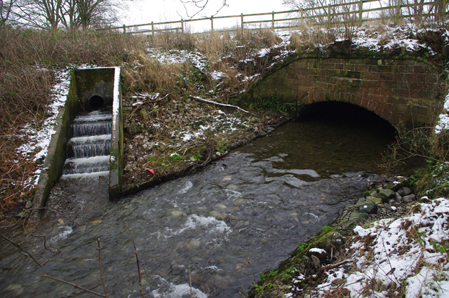
| Aqueduct Carrying Kendal/Lancaster Canal over Farleton Beck | 1312277 | II | c.1816 | Farleton |
| Arnside Signal Box | 1412051 | II | ||
| Ashton House | 1087330 | II* | ||
| Atkinson's Bridge over Kendal/Lancaster Canal | 1335712 | II | ||
| Bank Barn Approximately 20 Metres North of Farleton House | 1137773 | II | ||
| Barn Approximately 20 Metres North East of Beetham Hall | 1336114 | II | ||
| Beetham Hall and Attached Outbuildings | 1312254 | II* | Scheduled Monument (1007143) | |
| Boundary Post Approximately 650 Metres North East of Holme Parish Church | 1335710 | II | ||
| Boundary Stone on Farleton Bridge over Farleton Beck | 1086540 | II | ||
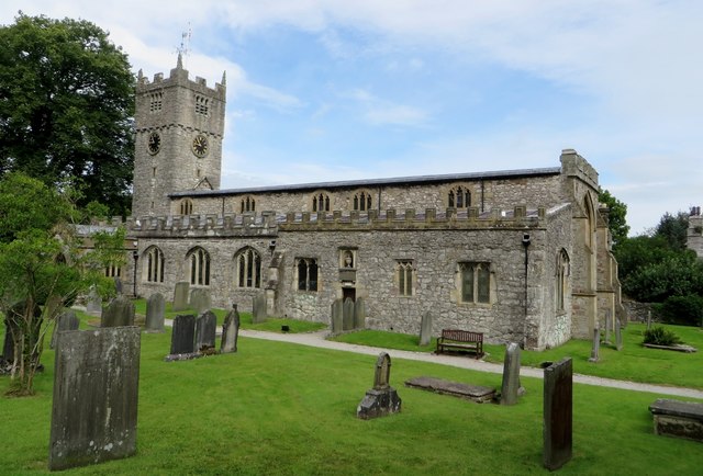
| Church of St Michael | 1137740 | I | C12th | Beetham |
| Coach House Approximately 10 Metres North West of Ashton House | 1137725 | II | ||
| Curtain Wall Approximately 30 Metres North of Beetham Hall | 1137542 | II* | ||
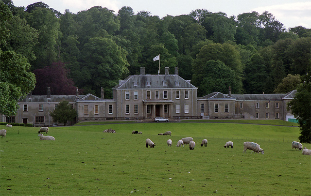
| Dallam Tower | 1086542 | I | 1722 | |
| Deer Shed Approximately 600 Metres South East of Dallam Tower | 1335709 | II | ||
| Dovecote Approximatley 50 Metres West South West of Parsonage Farmhouse | 1312287 | II | ||
| Duke's Bridge over Kendal/Lancaster Canal 170 Metres East North East of Townend Farm | 1137627 | II | ||
| Farleton Bridge over Farleton Beck | 1137552 | II | ||
| Farleton House | 1137762 | II | ||
| Farleton Turnpike Bridge over Kendal/Lancaster Canal | 1336115 | II | ||
| Former Brew and Bakehouse, Now Kitchens, Stores, and Living Accommodation Over, Attached to South Ea | 1086543 | II | ||
| Game Larder Approximately 4 Metres South East of Kitchens Attached to South East of Dallam Tower | 1335707 | II | ||
| Garden Gateway Approximately 200 Metres South of Dallam Tower at Entrance to Former Kitchen Garden | 1087327 | II | ||
| Garden Walls, End Piers, Railings and Gate, to Farleton House | 1087332 | II | ||
| Gate piers approximately 12 metres east of Parsonage Farmhouse | 1336113 | II | ||
| Gazebo Approximately 20 Metres North of Ashton House | 1335711 | II | ||
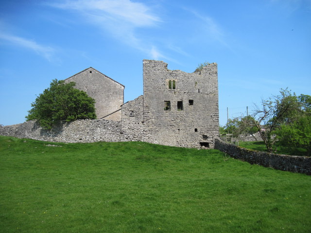
| Hazelslack Tower | 1137786 | II | C14th | Scheduled Monument (1007144) |
| Heron Corn Mill and Attached Mill Race | 1087334 | II* | ||
| Hodgson's Bridge over Kendal/Lancaster Canal | 1087329 | II | ||
| Ice House Approximately 200 Metres North West of Dallam Tower | 1087326 | II | ||
| Marsden Farmhouse | 1335713 | II | ||
| Milepost 80 Metres South of Entrance to Green Close | 1137616 | II | ||
| Milestone Approximately 150 Meters North North West of Junction with Paradise Lane North of Beetham | 1086537 | II | ||
| Milestone Approximately 350 Metres North West of Junction with Pye's Bridge Lane | 1086539 | II | ||
| Milestone Approximately 60 Metres South of Junction of A6 with Moss Lane | 1227715 | II | ||
| Milestone on Kendal/Lancaster Canal Approximately 300 Metres South South West of Duke's Bridge | 1086536 | II | ||
| Old School | 1335714 | II | ||
| Orangery Attached to South of Stables to North of Dallam Tower | 1087325 | I | ||
| Parsonage Farmhouse and Attached Stores to North | 1137509 | II | ||
| Stables and Linking Block Attached to North West End of Dallam Tower | 1137669 | II | ||
| Statue Approximately 5 Metres South of Orangery to Dallam Tower | 1335708 | I | ||
| Thompson's Bridge over Kendal/Lancaster Canal | 1312165 | II | ||
| Townend Farmhouse and Attached Outbuilding Now Part of House | 1087333 | II | ||
| War Memorial, Cross and Enclosing Walls Approximately 40 Metres North of Church of St Michael | 1086538 | II | ||
| Yew Tree House | 1087331 | II | ||
| Dallam Tower (grounds) | 1000664 | II | Listed Park and Garden | |
| Cappleside Hall medieval lordly residence 600m north east of Beetham House | 1021184 | n/a | Scheduled Monument | |
| Ringwork in Dallam Park 380m south east of Dallam Tower | 1021248 | n/a | Scheduled Monument | |
| Milnthorpe Bridge over River Bela | 1145656 | II | 1813 | Partly in this Parish |
| Footbridge over River Bela Approximately 400 Metres East-North-East of Milnthorpe Bridge | 1081522 | II | 1730 | Partly in this Parish |
| Boundary Post at Junction of B6384 with Paradise Lane Between Ackenthwaite and Whasset | 1081495 | II | c.1830 | Partly in this Parish |
Primary source: the National Heritage List for England - NHLE is the register of nationally protected historic buildings and sites in England, including listed buildings, scheduled monuments, protected wrecks, registered parks and gardens, and battlefields. The list is maintained by Historic England. Check NHLE for updates and new entries.
Secondary sources: British Listed Buildings and Keys to the Past.
Co-Curate Page
Dallam Tower, Milnthorpe
- Overview About Dallam Tower Map Dallam Tower is a grade I listed country house in Beetham parish, near Milnthorpe, South Lakeland, Cumbria, England. It is a member of the …
Co-Curate Page
Lancaster Canal Aqueduct, Farleton
- Overview Map Street View There is an aqueduct carrying the Lancaster Canal over Farleton Beck (aka Lupton Beck), at the village of Farleton. The aqueduct, built in c.1816, is Grade …
Co-Curate Page
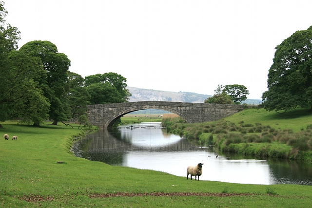
Milnthorpe Bridge
- Overview Map Street View Milnthorpe Bridge is a stone bridge, which carries the B5282 road over the River Bela, which is located about ½ mile west of Milnthorpe. The single …
Co-Curate Page
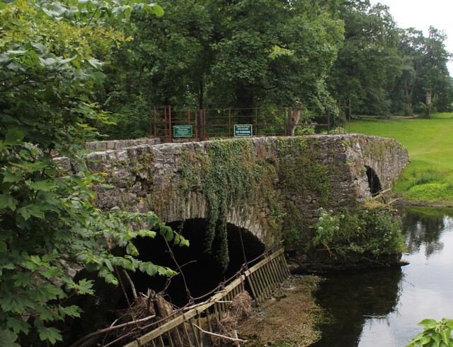
Old Bridge over River Bela, Milnthorpe
- Overview Map Street View The Old Bridge over the River Bela in Milnthorpe is a former road bridge, now a foot bridge. The stone bridge, with two segmental arches, was …


Co-Curate Page
Dallam Tower, Milnthorpe
- Overview About Dallam Tower Map Dallam Tower is a grade I listed country house in Beetham parish, near Milnthorpe, South Lakeland, Cumbria, England. It is a member of the …

Co-Curate Page
Lancaster Canal Aqueduct, Farleton
- Overview Map Street View There is an aqueduct carrying the Lancaster Canal over Farleton Beck (aka Lupton Beck), at the village of Farleton. The aqueduct, built in c.1816, is Grade …

Co-Curate Page
Milnthorpe Bridge
- Overview Map Street View Milnthorpe Bridge is a stone bridge, which carries the B5282 road over the River Bela, which is located about ½ mile west of Milnthorpe. The single …

