Topics > Northumberland > Horsley (Hexham)
Horsley (Hexham)
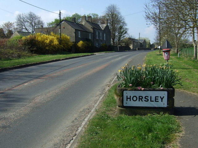
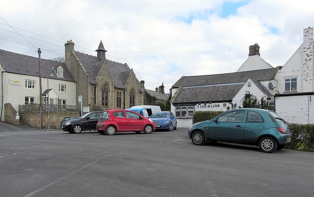
Horsley is a village in Northumberland, located about 9 miles west of Newcastle and 1.5 miles north-east of Ovingham. Historically, Horsley was a township in the ancient parish of Ovingham. Today the village and surrounding area form Horsley Civil Parish.
Not to be confused with Horsley near Otterburn, also in Northumberland.
HORSLEY, a township, in the parish of Ovingham, union of Hexham, E. division of Tindale ward, S. division of Northumberland, 9¾ miles (W. by N.) from Newcastle-upon-Tyne; containing 286 inhabitants. This township is chiefly the property of the Duke of Northumberland. The village, distant above a mile north from Ovingham, is built on each side of the Hexham road, and contains several farmholds, and an inn which terminates the first stage from Newcastle. It is situated on a declivity; the river Tyne pursues its course not far to the south, and the Roman wall lies on the north. The tithes have been commuted for £209. There is a place of worship for Independents.
Extract from: A Topographical Dictionary of England comprising the several counties, cities, boroughs, corporate and market towns, parishes, and townships..... 7th Edition, by Samuel Lewis, London, 1848.
Horsley is a small village in Northumberland. It is located around 11 miles (18 km) from Newcastle upon Tyne and 12 miles (19 km) from Hexham.
Nearby villages include Heddon-on-the-Wall, Ovingham, Ovington and Wylam.
Demography
The data below shows that 49.4% of the population in Horsley (Parish) are male and 50.6% are female, which is in line with that of the national average, as well as that of the county of Northumberland.
A total of 1.5% of the population were from a black, Asian and minority ethnic (BAME) group in Horsley (Parish). This figure is somewhat lower than that of the average in Northumberland , as well as being significantly lower than the national average .
Data from the Office for National Statistics found that the average life expectancy in the Bywell electoral ward is 81.4 years for men, and 83.0 years for women. These statics compare very favourably, when compared to the average life expectancy in the North East of England, of 77.4 and 81.4 years, for men and women respectively.
Car ownership is very high in Horsley (Parish), with a total of 92.9% households having access to at least one car. This is significantly higher than the average within Northumberland , as well as the national average .
Governance
Bywell is a local council ward in the county of Northumberland. This ward covers an area of around , and has a population of 4,534.
, the Bywell ward is served by Conservative Party councillor, Karen Rachel Quinn.
The village is located within the parliamentary constituency of Hexham, and is served by Conservative Party Member of Parliament (MP), Guy Opperman.
Landmarks
The site of Vindobala Roman Fort, of which little is now visible, lies around to the north-east of the village. Nearby is Rudchester Hall, a medieval pele tower, much altered and extended in Gothic style in the eighteenth and nineteenth centuries.Around to the north-west of the village are the remains of a medieval manor house and tower house at Welton Hall, now located within a farm complex. The tower house dates from the late fourteenth or early fifteenth-century and is roofless. The manor house is even older, but has been much altered and rebuilt.
Transport
Air
The nearest airport is Newcastle International Airport, which is around from the village by road. Carlisle Lake District Airport and Teesside International Airport are located around from the village respectively.
Bus
The village is served by two buses per hour to Hexham and Newcastle, with one bus per hour to Carlisle.
Rail
The nearest National Rail stations are located around from the village at Wylam and Prudhoe, both of which serve the Tyne Valley Line, with services operated by Northern Trains. From Wylam, there is an hourly service to both Hexham and Newcastle. There is a more regular service at Prudhoe, with three trains per hour to Hexham and Newcastle, as well as a twice-hourly service to Carlisle.
Road
The village is located near to the A69 road, which runs for , from Carlisle to the A1 at Denton Burn. The former route of the A69, now the B6528, used to run through the village to Heddon-on-the-Wall, but is now bypassed.
Visit the page: Horsley, Northumberland for references and further details. You can contribute to this article on Wikipedia.