Topics > Northumberland > Civil Parishes in Northumberland > Wark Civil Parish > Historic Buildings and Monuments in Wark Civil Parish
Historic Buildings and Monuments in Wark Civil Parish
Listed buildings and scheduled monuments in Wark Civil Parish, Northumberland, from the National Heritage List for England[1]. Use the Search (below) if looking for a specific building / monument.
| Structure | List No. | Grade | Built~ | Notes |
|---|---|---|---|---|
| 1 and 2, North Terrace | 1303620 | II | ||
| Bridge Adjacent to Ramshaw's Mill | 1044956 | II | ||
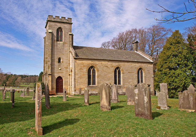
| Church of St Michael | 1154703 | II | 1818 | Wark-on-Tyne |
| Farmbuildings South of Low Stead Farmhouse | 1154823 | II | ||
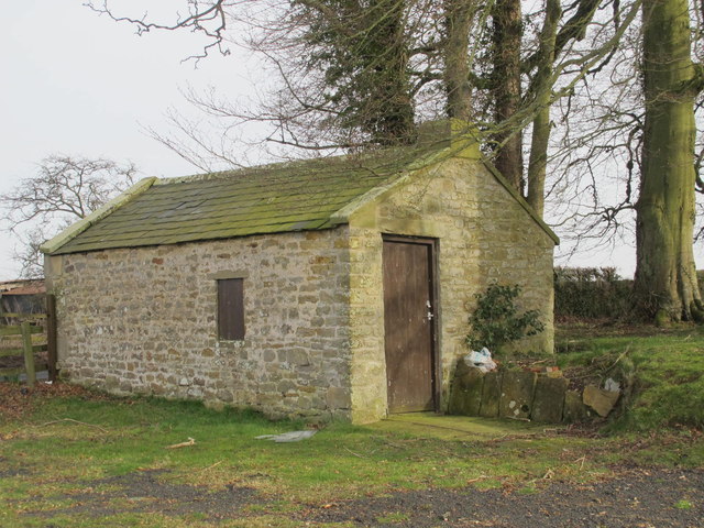
| Hearse House C 30 Yards North East of St Michaels Church | 1370477 | II | C19th | Wark-on-Tyne |
| High Moralee Farmhouse | 1154806 | II | ||
| Limekiln C 1/2 Mile North of Hetherington Farm | 1154720 | II | ||
| Limekiln C 200 Yards South of Newton Rigg | 1044955 | II | ||
| Low Stead Farmhouse and Attached Farm Buildings | 1370478 | II | ||
| Railings and Gate Piers C 5 Yards South of Nos 1 and 2 | 1370479 | II | ||
| Ramshaw's Mill and Farmhouse | 1154867 | II | ||
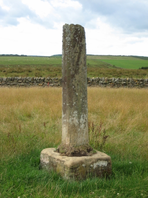
| Shitlington Cross C300 Yards West of Bridge House | 1370440 | II | Medieval | Shitlington |
| The Allgood Cottages | 1044958 | II | ||
| The Old School | 1044954 | II | ||
| The Pinfold | 1303601 | II | ||
| Town Hall | 1044953 | II | ||
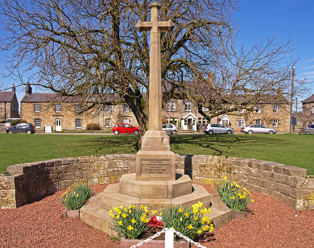
| War Memorial, Village Green | 1391547 | II | 1921 | Wark-on-Tyne |
| Willow Cottage | 1044957 | II | ||
| Bastle at Horneystead, 400m south west of The Ash | 1009674 | n/a | Scheduled Monument | |
| Romano-British farmstead, 400m north east of Hole House | 1008987 | n/a | Scheduled Monument | |
| Bastle immediately east of Mortley | 1021285 | n/a | Scheduled Monument | |
| Medieval wayside cross, 300m west of Bridge House | 1008565 | n/a | Scheduled Monument | |
| The Goatstones stone circle, 280m south west of Ravensheugh Crags | 1008566 | n/a | Scheduled Monument | |
| Romano-British farmstead and earlier palisaded settlement, 800m SSE of Bridge House | 1008984 | n/a | Scheduled Monument | |
| Romano-British farmstead, 500m north of Watergate | 1008990 | n/a | Scheduled Monument | |
| Unenclosed settlement 220m south west of Manor House | 1009381 | n/a | Scheduled Monument | |
| Blacka Burn shieling | 1010038 | n/a | Scheduled Monument | |
| Shieling and associated building 1.45km west of Blue Hemmel | 1010039 | n/a | Scheduled Monument |
Primary source: the National Heritage List for England - NHLE is the register of nationally protected historic buildings and sites in England, including listed buildings, scheduled monuments, protected wrecks, registered parks and gardens, and battlefields. The list is maintained by Historic England. Check NHLE for updates and new entries.
Secondary sources: British Listed Buildings and Keys to the Past.


