Topics > Northumberland > Civil Parishes in Northumberland > Rennington Civil Parish > Historic Buildings and Monuments in Rennington Civil Parish
Historic Buildings and Monuments in Rennington Civil Parish
Listed buildings and scheduled monuments in Rennington Civil Parish, Northumberland, from the National Heritage List for England[1]. Use the Search (below) if looking for a specific building / monument.
| Structure | List No. | Grade | Built~ | Notes |
|---|---|---|---|---|
| 10, 12 and 14, Rock Village | 1371217 | II | ||
| 11, Rock Village | 1371218 | II | ||
| 15 and 17, Rock Village | 1041761 | II | ||
| 19, Rock Village | 1154729 | II | ||
| 21 and 23, Rock Village | 1041762 | II | ||
| 9, Rock Village | 1303685 | II | ||
| Barn and Engine House on North Side of Main Farmbuilding Group | 1041755 | II | ||
| Bridge over Stream 50 Metres South of Church Saints Philip and James | 1303714 | II | ||
| Cartshed/Granary and Bothy 100 Metres North East of Rennington South East Farmhouse | 1303721 | II | ||
| Cartshed/Granary Opposite North Farmhouse | 1303753 | II | ||
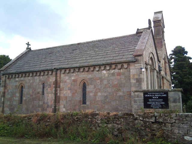
| Church of Saints Philip and James | 1041758 | II* | C12th | Rock |
| Covered Reservoir 100 Metres North of Rennington West Farmhouse | 1041757 | II | ||
| Dovecote 30 Metres South East of Rock Farmhouse | 1154696 | II | C19th | |
| Entrance Screen to Rock Hall | 1041721 | II | ||
| Limekiln South of Kiln Plantation 700 Metres South East of Rock Midstead | 1154647 | II | ||
| Mile Post 400 Metres South of Renington South East Farm | 1154619 | II | ||
| Milepost 300 Metres North of Denwick Lane End | 1041754 | II | ||
| North Farmhouse | 1371216 | II | ||
| Privy and Attached Wall Behind Bothy 100 Metres North East of Rennington South East Farmhouse | 1041753 | II | ||
| Rennington Moor Farmhouse and Attached Farmbuilding | 1041756 | II | ||
| Rennington South East Farmhouse | 1041752 | II | ||
| Rennington War Memorial | 1439711 | II | 1921 | In churchyard, All Saints. |
| Rock Farmhouse and Adjacent Estate Office | 1041759 | II | ||
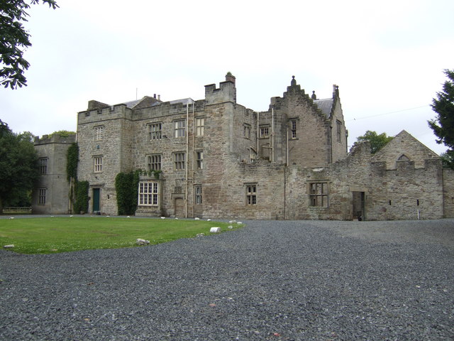
| Rock Hall | 1154734 | II* | C13th | |
| Signpost at Road Junction South of Rock Farm | 1041760 | II | ||
| Smithy at South East Corner of Main Farmbuilding Group | 1303729 | II | ||
| The Chapel Outbuildings and Yard Walls at North End of Rock Hall | 1371219 | II | ||
| Village Hall | 1154717 | II | 1855 | Rock. Originally a Sunday School. |
| Walls of Former Garden to North of Rock Hall | 1154762 | II | ||
| Yard Walls to South of Farmbuildings | 1154641 | II | ||
| Ellsnook round barrow, 175m north east of Heiferlaw Bridge | 1006564 | n/a | Bronze Age | Scheduled Monument |
| Rock Conservation Area | - | n/a | Conservation Area |
Primary source: the National Heritage List for England - NHLE is the register of nationally protected historic buildings and sites in England, including listed buildings, scheduled monuments, protected wrecks, registered parks and gardens, and battlefields. The list is maintained by Historic England. Check NHLE for updates and new entries. Secondary sources: British Listed Buildings and Keys to the Past.

Co-Curate Page
Rock Hall
- Overview About Rock Hall Map The Hall at Rock in Northumberland was originally built in the 13th or early 14th century. It's south wing was converted into a tower in …


