Topics > Northumberland > Civil Parishes in Northumberland > Kyloe Civil Parish > Historic Buildings and Monuments in Kyloe Civil Parish
Historic Buildings and Monuments in Kyloe Civil Parish
Listed buildings and scheduled monuments in Kyloe Civil Parish, Northumberland, from the National Heritage List for England[1]. Use the Search (below) if looking for a specific building / monument.
| Structure | List No. | Grade | Built~ | Notes |
|---|---|---|---|---|
| Beal House | 1042274 | II | ||
| Berrington House | 1370932 | II | ||
| Berrington Lodge | 1370930 | II | ||
| Berrington South Farmhouse | 1042278 | II | ||
| Buckton Farmhouse | 1155742 | II | C18th | |
| Byre and Granary C 30 Yards North-West of the Old Farmhouse | 1303175 | II | ||
| Cart Shed C 100 Yards East of Beal House | 1370931 | II | ||
| Cart Shed C 50 Yards North of the Old Farmhouse | 1042284 | II | ||
| Cartshed and Hen House C 50 Yards North-West of Fenwick Steads Farmhouse | 1042281 | II | ||
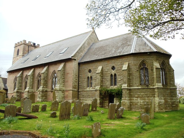
| Church of St Nicholas | 1370949 | II | 1792 | West Kyloe. Parish Church |
| Cottages and Stables C 35 Yards North-East of Fenwick Steads Farmhouse | 1303202 | II | ||
| Dovecote C 100 Yards South of East Kyloe Farmhouse | 1042280 | II | ||
| Dovecote C 200 Yards West of Beal House | 1042276 | II | C18th | |
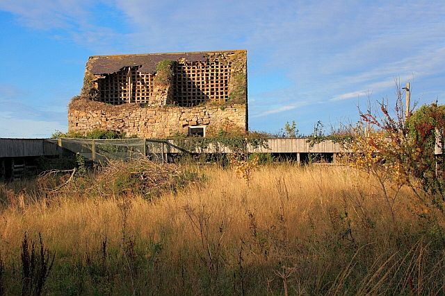
| Dovecote C 50 Yards North of Buckton House | 1042279 | II | Medieval | |
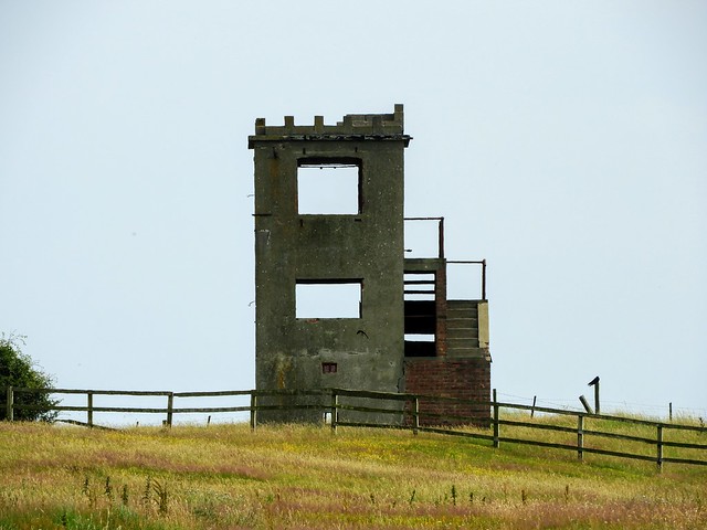
| East Kyloe Tower | 1303192 | II | ||
| Farmbuildings C 30 Yards East of Beal House | 1042275 | II | ||
| Fenham Farmhouse | 1370935 | II | 1830 | |
| Kyloe Cottage | 1042316 | II | ||
| Kyloe Old Vicarage | 1155766 | II | ||
| Lowlynn Bridge | 1155796 | II | C19th | Lowlynn |
| Lowlynn House | 1042282 | II | C18th | Lowlynn |
| Milepost 1/4 Mile North of West Mains | 1042315 | II | ||
| Milepost 1/4 Mile West of Kyloe | 1155590 | II | ||
| Milepost at Kyloe Vicarage | 1155584 | II | ||
| Milepost C 400 Yards South of Berrington Lodge | 1042273 | II | ||
| Milestone 200 Yards South of Junction with B6353 | 1303262 | II | ||
| Old Farmhouse | 1042283 | II | ||
| Outbuilding C 20 Yards West of Buckton Farmhouse | 1370934 | II | ||
| Stable and Granary C 40 Yards North of the Old Farmhouse | 1042285 | II | ||
| Stable Attached to Rear of Berrington House | 1042277 | II | ||
| Stable C 10 Yards North of the Old Farmhouse | 1155835 | II | ||
| Stables C 30 Yards East of Fenwick Steads Farmhouse | 1155785 | II | ||
| Stores and Garage C 50 Yards East of Fenwick Steads Farmhouse | 1370936 | II | ||
| Walled Garden and Well C 300 Yards South of Berrington House | 1370933 | II | ||
| Walled Garden, Stable and Coach House C 30 Yards North of Buckton House | 1155748 | II | ||
| Kyloe Hills promontory fort | 1006479 | n/a | Iron Age | Scheduled Monument |
| Kyloe tower house, East Kyloe | 1018444 | n/a | Scheduled Monument | |
| Buckton Moor North camp | 1006510 | n/a | Scheduled Monument | |
| Buckton Moor South camp | 1006511 | n/a | Scheduled Monument | |
| Buckton dovecote | 1006569 | n/a | Scheduled Monument | |
| Monastic Grange at Fenham | 1015631 | n/a | 1339 | Scheduled Monument |
Primary source: the National Heritage List for England - NHLE is the register of nationally protected historic buildings and sites in England, including listed buildings, scheduled monuments, protected wrecks, registered parks and gardens, and battlefields. The list is maintained by Historic England. Check NHLE for updates and new entries. Secondary sources: British Listed Buildings and Keys to the Past.
Co-Curate Page
Fenham Farmhouse
- Overview Map Street View The house at Fenham Farm was built 1820 - 1830, and is Grade II listed on the National Heritage List for England. The farm in Fenham, …
Co-Curate Page
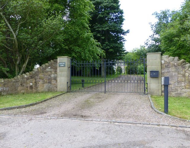
Farmhouse, Buckton
- Overview Map Street View The farmhouse at Buckton in Northumberland dates from the mid 18th century, located near the site of an earlier Medieval settlement. The farmhouse was refaced and …
Co-Curate Page
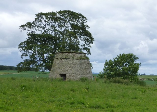
Dovecote, Buckton
- Overview Map Street View To the north of Buckton in Northumberland are the well preserved remains of a late medieval/early post-medieval dovecote, which was first documented in 1626.[1] The dovecote …
Co-Curate Page
Fenham Monastic Grange (ruins)
- Overview Map Aerial View % There are ruins of a monastic grange at Fenham in Northumberland - a farm complex owned by the Benedictine priory of Lindisfarne, on nearby Holy …
Co-Curate Page
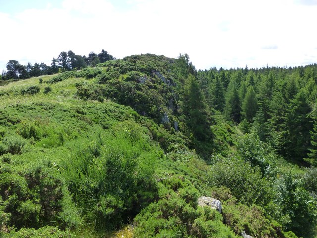
Kyloe Hills promontory fort
- "The monument includes the remains of an Iron Age promontory fort abutting a steep cliff to the south. The promontory fort is visible as a semi-circular enclosure measuring about 109m …
Co-Curate Page
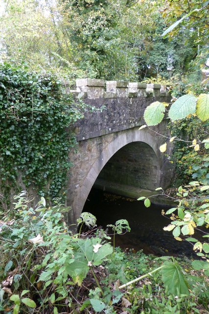
Lowlynn Bridge
- Overview Map Street View Lowlynn Bridge, located east of Lowlynn Mill, is a road bridge over South Low (river). It is a single segmental arch bridge, built in the early …

Co-Curate Page
Fenham Farmhouse
- Overview Map Street View The house at Fenham Farm was built 1820 - 1830, and is Grade II listed on the National Heritage List for England. The farm in Fenham, …
Co-Curate Page
Farmhouse, Buckton
- Overview Map Street View The farmhouse at Buckton in Northumberland dates from the mid 18th century, located near the site of an earlier Medieval settlement. The farmhouse was refaced and …
Co-Curate Page
Dovecote, Buckton
- Overview Map Street View To the north of Buckton in Northumberland are the well preserved remains of a late medieval/early post-medieval dovecote, which was first documented in 1626.[1] The dovecote …
Co-Curate Page
Fenham Monastic Grange (ruins)
- Overview Map Aerial View % There are ruins of a monastic grange at Fenham in Northumberland - a farm complex owned by the Benedictine priory of Lindisfarne, on nearby Holy …
Co-Curate Page
Kyloe Hills promontory fort
- "The monument includes the remains of an Iron Age promontory fort abutting a steep cliff to the south. The promontory fort is visible as a semi-circular enclosure measuring about 109m …