Topics > County Durham > Civil Parishes in County Durham > Holwick Civil Parish > Historic Buildings and Monuments in Holwick Civil Parish
Historic Buildings and Monuments in Holwick Civil Parish
Listed buildings and scheduled monuments in Holwick Civil Parish, County Durham, from the National Heritage List for England[1]. Use the Search (below) if looking for a specific building / monument.
| Structure | List No. | Grade | Built~ | Note |
|---|---|---|---|---|
| Former Farmhouse and Stable Range, 20 Metres North of Step Ends Farmhouse | 1121051 | II | ||
| Hungry Hall and Former Farm Buildings to Right | 1160180 | II | ||
| Lune Bridge | 1338576 | II | ||
| Middleton Bridge | 1160160 | II* | c.1800 | Partly in this parish |
| Wynch Bridge | 1121052 | II | 1820 | Over River Tees |
| A group of six shielings and tracks on Holwick Scars, 280m west of Hungry Hall | 1019458 | n/a | Scheduled Monument | |
| Burnt mound, cairnfield and bloomery at Eel Beck, 480m south of Blackmea Crag, Holwick Fell | 1017122 | n/a | Scheduled Monument | |
| Two Romano-British hut circles and three shielings on Holwick Scars 250m south of Hungry Hall | 1019455 | n/a | Scheduled Monument | |
| Roman period native settlement, medieval bloomery, building and track, and a charcoal pit at Keld Smithy Green, Holwick Fell | 1017121 | n/a | Scheduled Monument | |
| Burial cairns, burnt mound, Roman native settlement, medieval settlement with field system and iron industry remains, and five shielings on Holwick Fell | 1019860 | n/a | Scheduled Monument | |
| Group of eight shielings and a track on Crossthwaite Scars 675m north west of Park End | 1019454 | n/a | Scheduled Monument | |
| Two burnt mounds south of Blackmea Crag Sike, 590m south west of Castle House | 1017123 | n/a | Scheduled Monument | |
| Roman period native farmstead at Hind Gate, 140m south of Green House | 1017128 | n/a | Scheduled Monument | |
| Prehistoric settlement, two burnt mounds and a burial cairn on the north bank of Blackmea Crag Sike, 570m south west of Middle Farm | 1017127 | n/a | Scheduled Monument | |
| Romano-British and medieval settlement and field systems,leadmines and charcoal pit on Crossthwaite Common, south of Park End Quarry | 1019456 | n/a | Scheduled Monument | |
| Medieval iron industry and settlement and Bronze Age burial cairns extending from 260m north west of Eel Beck to 140m south east of Wash Beck | 1019453 | n/a | Scheduled Monument | |
| Roman period native settlement and a bloomery 160m north west of Bleabeck Force | 1017120 | n/a | Scheduled Monument | |
| Burnt mound on the south bank of Scar Beck, 510m south west of Mizzes House | 1017129 | n/a | Scheduled Monument | |
| Roman period native settlement and field system 260m west of Wynch Bridge | 1021094 | n/a | Scheduled Monument |
Primary source: the National Heritage List for England - NHLE is the register of nationally protected historic buildings and sites in England, including listed buildings, scheduled monuments, protected wrecks, registered parks and gardens, and battlefields. The list is maintained by Historic England. Check NHLE for updates and new entries. Secondary sources: British Listed Buildings and Keys to the Past.

Co-Curate Page
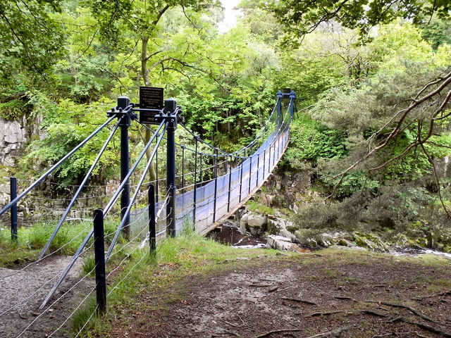
Winch Bridge, nr Holwick
- Overview Map Street View An iron suspension footbridge with planked walkway, over the River Tees, by the Low Force waterfalls, near Holwick and Newbiggin. The bridge was built c.1820 for the …

Co-Curate Page
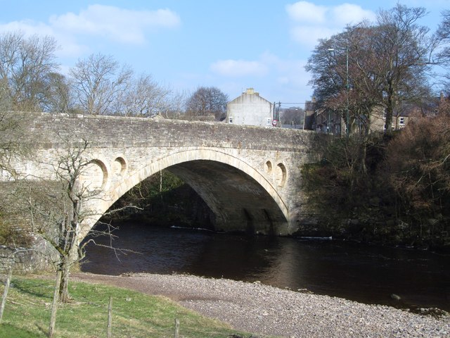
Middleton Bridge
- Overview Map Street View Middleton Bridge carries the B6277 road over the River Tees at Middleton-in-Teesdale. The stone bridge has a single high segmental arch. It was built in c.1800, …


Co-Curate Page
Winch Bridge, nr Holwick
- Overview Map Street View An iron suspension footbridge with planked walkway, over the River Tees, by the Low Force waterfalls, near Holwick and Newbiggin. The bridge was built c.1820 for the …


