Topics > Civil Parishes in Cumbria > Crosby Garrett Civil Parish > Historic Buildings and Monuments in Crosby Garrett Civil Parish
Historic Buildings and Monuments in Crosby Garrett Civil Parish
Listed buildings and scheduled monuments in Crosby Garrett Civil Parish, Cumbria, from the National Heritage List for England[1]. Use the Search (below) if looking for a specific building / monument.
| Structure | List No. | Grade | Built~ | Note |
|---|---|---|---|---|
| Barn to North East of Old Rectory | 1326925 | II | ||
| Boundary Stone South West of Leases Farmhouse | 1312431 | II | ||
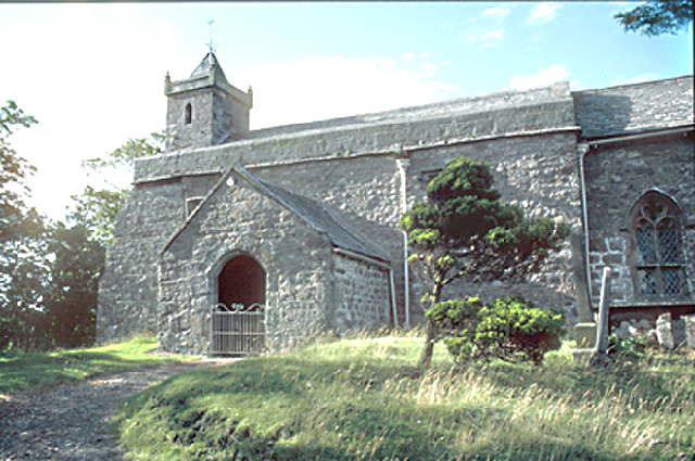
| Church of St Andrew | 1326924 | I | C11th | With later additions |
| Croft Farmhouse and Byre | 1326926 | II | ||
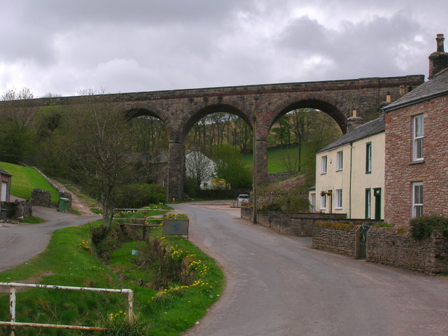
| Crosby Garrett Viaduct at NY727 093 (Network Rail structure number SAC/197) | 1326960 | II | 1875 | Railway viaduct |
| Crosby Mill Cottage | 1137267 | II | ||
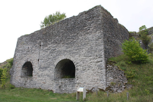
| Limekilns on West Side of Track South-West of Smardalegill Viaduct | 1145018 | II | c1860 | |
| Mains Farm, Barn | 1145026 | II | ||
| Mossgill House and Attached Barn | 1145024 | II | ||
| Rookery Farm | 1145025 | II | ||
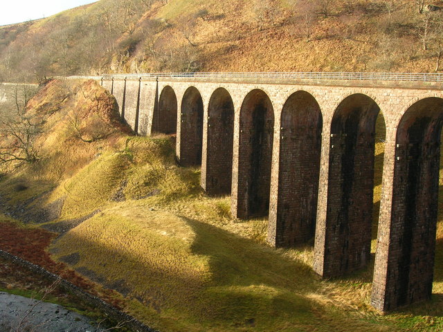
| Smardalegill Viaduct over Scandal Beck | 1137239 | II* | 1860 | Railway viaduct (disused) |
| Stables to North of Old Rectory with Gate Piers and Wall to Entrance | 1145023 | II | ||
| The Old Rectory | 1145022 | II* | ||
| Two round cairns, three Romano-British settlements and aggregate field systems at Severals and Intake, and Smardale Gill lime kilns and quarry | 1021107 | n/a | Scheduled Monument | |
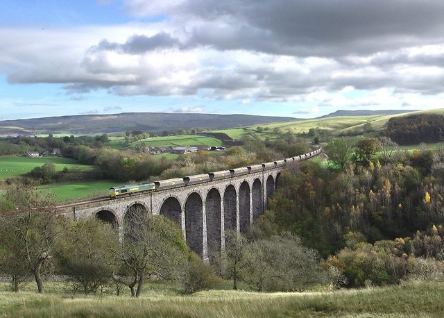
| Smardale railway viaduct | 1007241 | n/a | 1875 | Scheduled Monument. Partly in this parish. |
| Cosby Garrett Conservation Area | - | n/a | Conservation Area |
Primary source: the National Heritage List for England - NHLE is the register of nationally protected historic buildings and sites in England, including listed buildings, scheduled monuments, protected wrecks, registered parks and gardens, and battlefields. The list is maintained by Historic England. Check NHLE for updates and new entries. Secondary sources: British Listed Buildings.
Co-Curate Page
Church of St Andrew, Crosby Garrett
- Overview About St Andrew's Church Map Street View Inside St Andrew's Church is located on the summit of Arklow Hill at the north of Crosby Garrett. The oldest parts of the …
Co-Curate Page
Smardale Gill Viaduct
- Overview Map Street View Smardale Gill Viaduct is just over a mile south-west of the village of Smardale in Cumbria. The viaduct was built for the South Durham and Lancashire Union …
Co-Curate Page
Smardale Viaduct
- Overview Map Street View Smardale Viaduct was built from 1870 to 1875 to carry the Settle to Carlisle railway line over the steep sided valley of Scandal Beck. It built …
Co-Curate Page
Crosby Garrett Viaduct
- Overview Map Street View Crosby Garrett Viaduct was built in 1875 by J. S Crossley (Engineer) for the Midland Railway, as part of the Settle and Carlisle line. Located at the …

Co-Curate Page
Church of St Andrew, Crosby Garrett
- Overview About St Andrew's Church Map Street View Inside St Andrew's Church is located on the summit of Arklow Hill at the north of Crosby Garrett. The oldest parts of the …
Co-Curate Page
Smardale Gill Viaduct
- Overview Map Street View Smardale Gill Viaduct is just over a mile south-west of the village of Smardale in Cumbria. The viaduct was built for the South Durham and Lancashire Union …
Co-Curate Page
Smardale Viaduct
- Overview Map Street View Smardale Viaduct was built from 1870 to 1875 to carry the Settle to Carlisle railway line over the steep sided valley of Scandal Beck. It built …


