Topics > County Durham > Civil Parishes in County Durham > Bearpark Civil Parish > Historic Buildings and Monuments in Bearpark Civil Parish
Historic Buildings and Monuments in Bearpark Civil Parish
Listed buildings and scheduled monuments in Bearpark Civil Parish, County Durham, from the National Heritage List for England[1]. Use the Search (below) if looking for a specific building / monument.
| Structure | List No. | Grade | Built~ | Notes |
|---|---|---|---|---|
| Aldin Grange Bridge | 1323214 | II | C15th | Over River Browney, nr Bearpark |
| Barn and Attached Farm Buildings at Red House Farm | 1120719 | II | c.1860 | Woodland Road, Bearpark |
| Bearpark Hall Farmhouse | 1271967 | II | C17th | North of Bearpark |
| Beaurepaire Manor House | 1120721 | II | C13th | North of Bearpark |
| Boundary Wall Circa 200 Metres North of Beaurepaire Manor House | 1323213 | II | Medieval | |
| Bull Hole Byre to North of Lodge Farmhouse | 1120720 | II | C17th | Off Colliery Road |
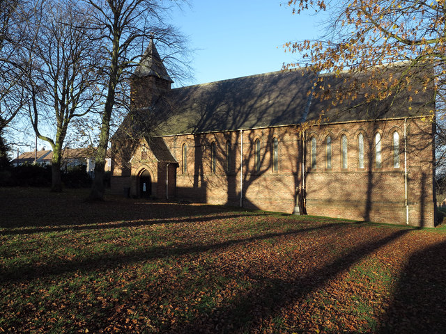
| Church of St Edmund | 1120718 | II | 1879 | |
| Gate-Piers, Walls and Gates South of Church of St Edmund | 1323211 | II | c.1879 | |
| Guidepost at South End | 1120722 | II | C19th | Colliery Road |
| Lodge Farmhouse and Attached Outbuildings | 1323212 | II | C18th | Off Colliery Road |
| Aldin Grange (or Bearpark) Bridge | 1002355 | n/a | C15th | Scheduled Monument |
| Battle of Neville's Cross 1346 | 1000024 | n/a | 1346 | Historic Battlefield. Partly in this parish |
| Grange and Chapel, Bear Park | 1002346 | n/a | C13th | Scheduled Monument |
Primary source: the National Heritage List for England - NHLE is the register of nationally protected historic buildings and sites in England, including listed buildings, scheduled monuments, protected wrecks, registered parks and gardens, and battlefields. The list is maintained by Historic England. Check NHLE for updates and new entries.
Secondary sources: British Listed Buildings and Keys to the Past.
Co-Curate Page
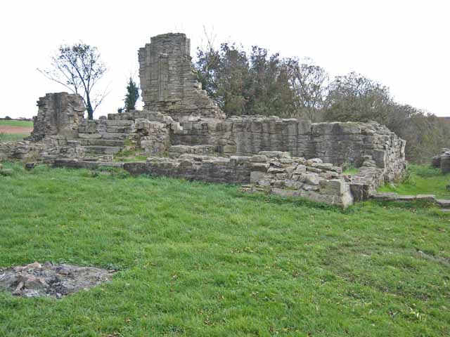
Beaurepaire
- Overview Map Street View Beaurepaire is located to the north of Bearpark. It is the ruins of the Prior's House and chapel of Beaurepaire or Bear Park, built in 1258 …

Co-Curate Page
Battle of Neville's Cross, 1346
- Overview About the Battle Map of the Battlefield The Battle of Neville's Cross took place close to Durham on 17 October 1346. King David II of Scotland invaded the north …
Co-Curate Page
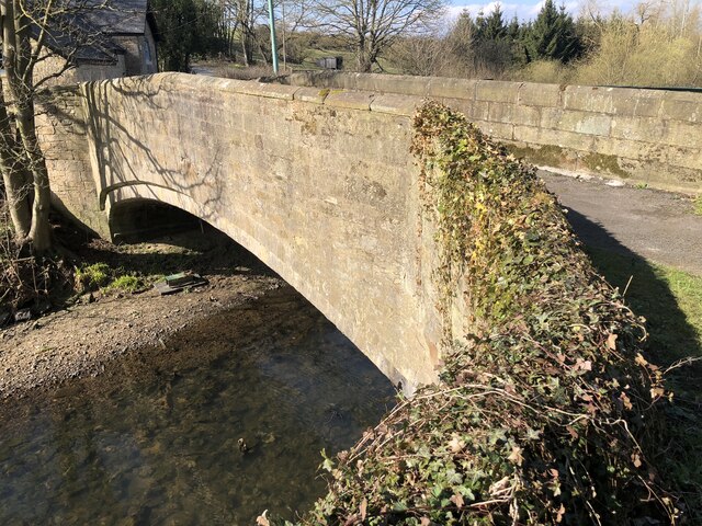
Aldin Grange Bridge
- Overview Map Street View Aldin Grange Bridge over the River Browney is located east of Bearpark. The bridge dates from the 15th century. It is now a pedestrian bridge, since …
Co-Curate Page
Bearpark Hall Farm
- Overview Map Bearpark Hall Farm is located off Colliery Road, north-east of Bearpark, and close to the ruins of Beaurepaire. The old farmhouse, now a farmbuilding, dates from the 17th …
Co-Curate Page
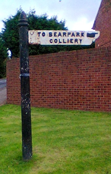
Old Signpost to Bearpark Colliery
- Overview Map Street View This original cast iron sign to Bearpark Colliery (sunk in 1872) is located at the south end of Colliery Road, by the junction with Auton Stile …

Co-Curate Page
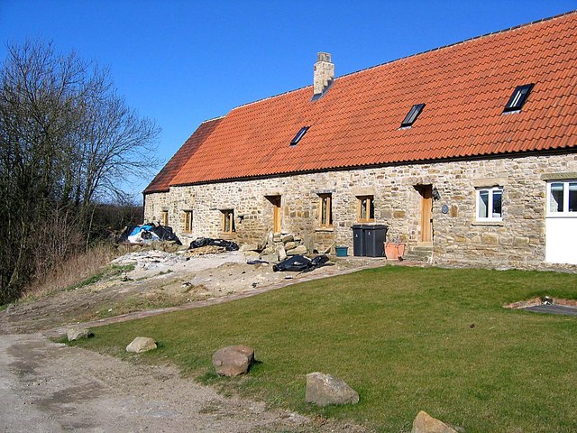
Red House Farm, Bearpark
- Overview Map Street View Red House Farm is located off Woodland Road, just west of Bearpark in County Durham. The barn and farm buildings, which form a courtyard, were built …

Co-Curate Page
Beaurepaire
- Overview Map Street View Beaurepaire is located to the north of Bearpark. It is the ruins of the Prior's House and chapel of Beaurepaire or Bear Park, built in 1258 …
Co-Curate Page
Battle of Neville's Cross, 1346
- Overview About the Battle Map of the Battlefield The Battle of Neville's Cross took place close to Durham on 17 October 1346. King David II of Scotland invaded the north …
Co-Curate Page
Aldin Grange Bridge
- Overview Map Street View Aldin Grange Bridge over the River Browney is located east of Bearpark. The bridge dates from the 15th century. It is now a pedestrian bridge, since …
Co-Curate Page
Bearpark Hall Farm
- Overview Map Bearpark Hall Farm is located off Colliery Road, north-east of Bearpark, and close to the ruins of Beaurepaire. The old farmhouse, now a farmbuilding, dates from the 17th …
Co-Curate Page
Old Signpost to Bearpark Colliery
- Overview Map Street View This original cast iron sign to Bearpark Colliery (sunk in 1872) is located at the south end of Colliery Road, by the junction with Auton Stile …


