Topics > Cumbria > Barrow-in-Furness > Hawcoat
Hawcoat
Hawcoat is an area in north of Barrow-in-Furness. The origins of Hawcoat are linked with the establishment of a monastic grange (farm), here on the Furness peninsula, by Furness Abbey (documented in monastic records in 1190 AD). Hawcoat developed as a separate village, and historically was also a division of the ancient parish of Dalton-in-Furness. The Division of Hawcoat covered a wide area, which extended south-west to include Walney Island, as well as the village of Hawcoat. However, the industrial town of Barrow grew rapidly in the 19th century, and Hawcoat was absorbed into the larger borough of Barrow-in-Furness in 1974.
from https://www.sankeyphotoarchiv…
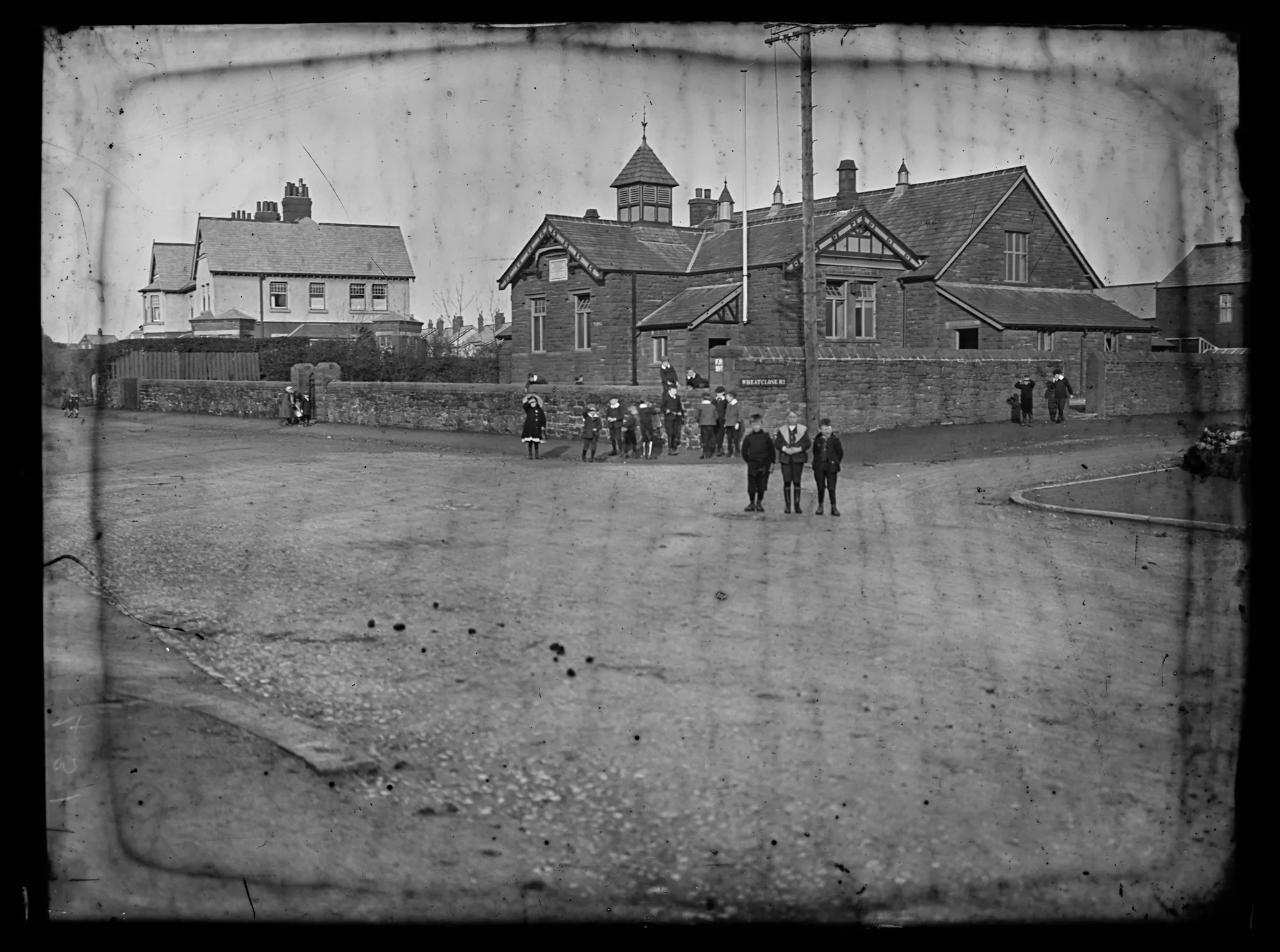
St Paul's School Hawcoat Lane Wheatclose Road - c. 1910
- Hawcoat Ward. Children in road looking at camera. School on corner of Hawcoat Lane and Wheatclose Road behind. Image from the Sankey Family Photograph Collection (c/o Cumbria Archives), available under …
Added by
Simon Cotterill

Co-Curate Page
Hawcoat, Division of Dalton-in-Furness Parish, 1848
- The ancient parish of Dalton-in-Furness was divided into quarters or ‘bierleys’: Hawcoat, Yarlside, Above Town, and Dalton[1]. The entry below relates to the Division of Hawcoat, rather than the Township …
from https://www.sankeyphotoarchiv…
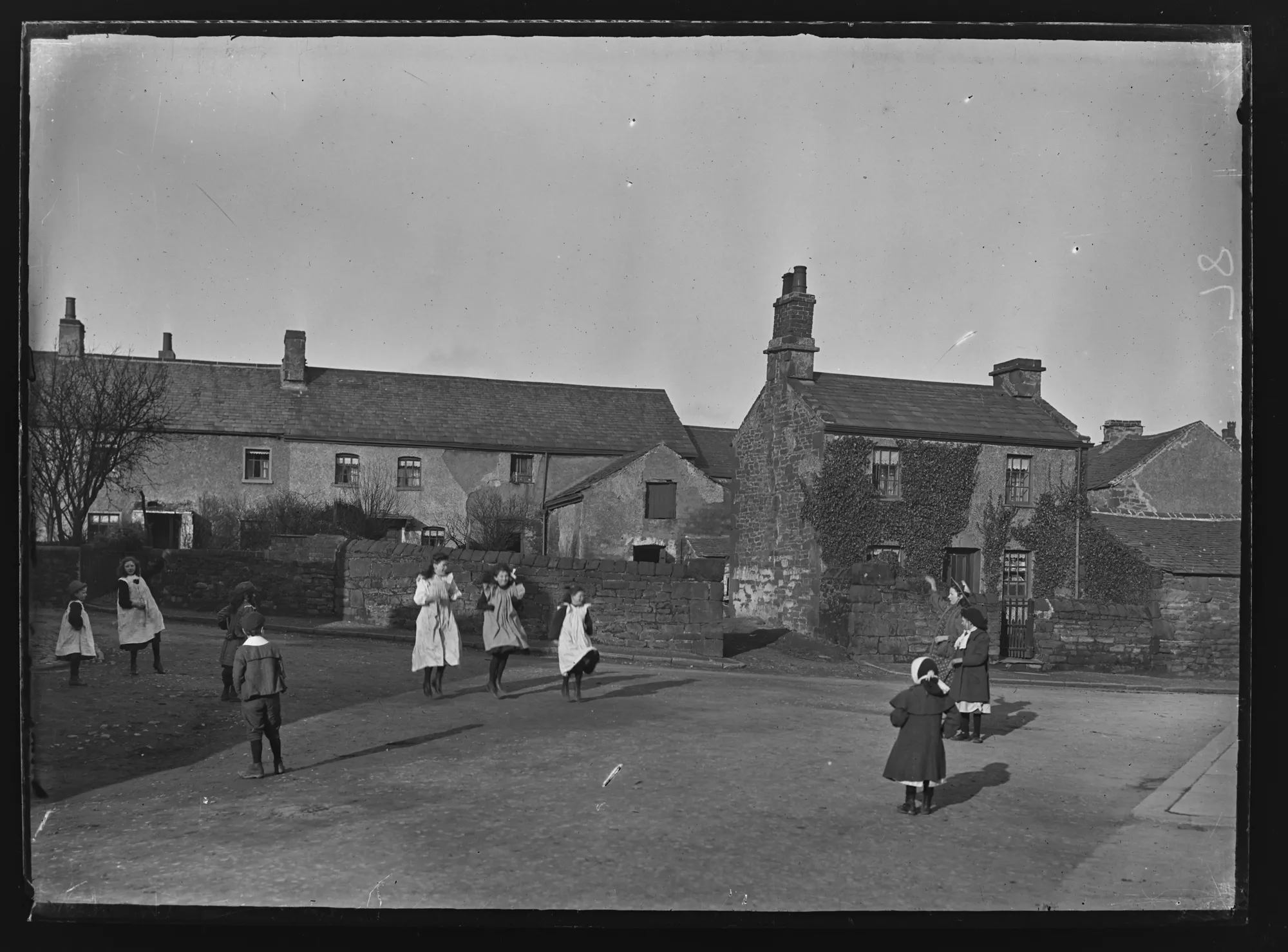
Hawcoat - Early 20th Century
- A group of girls playing in the centre of the road at the junction of Dalton Lane and Cliffe Lane with slate roofed cottages behind. A lone boy, hands in …
Added by
Simon Cotterill
from https://www.sankeyphotoarchiv…
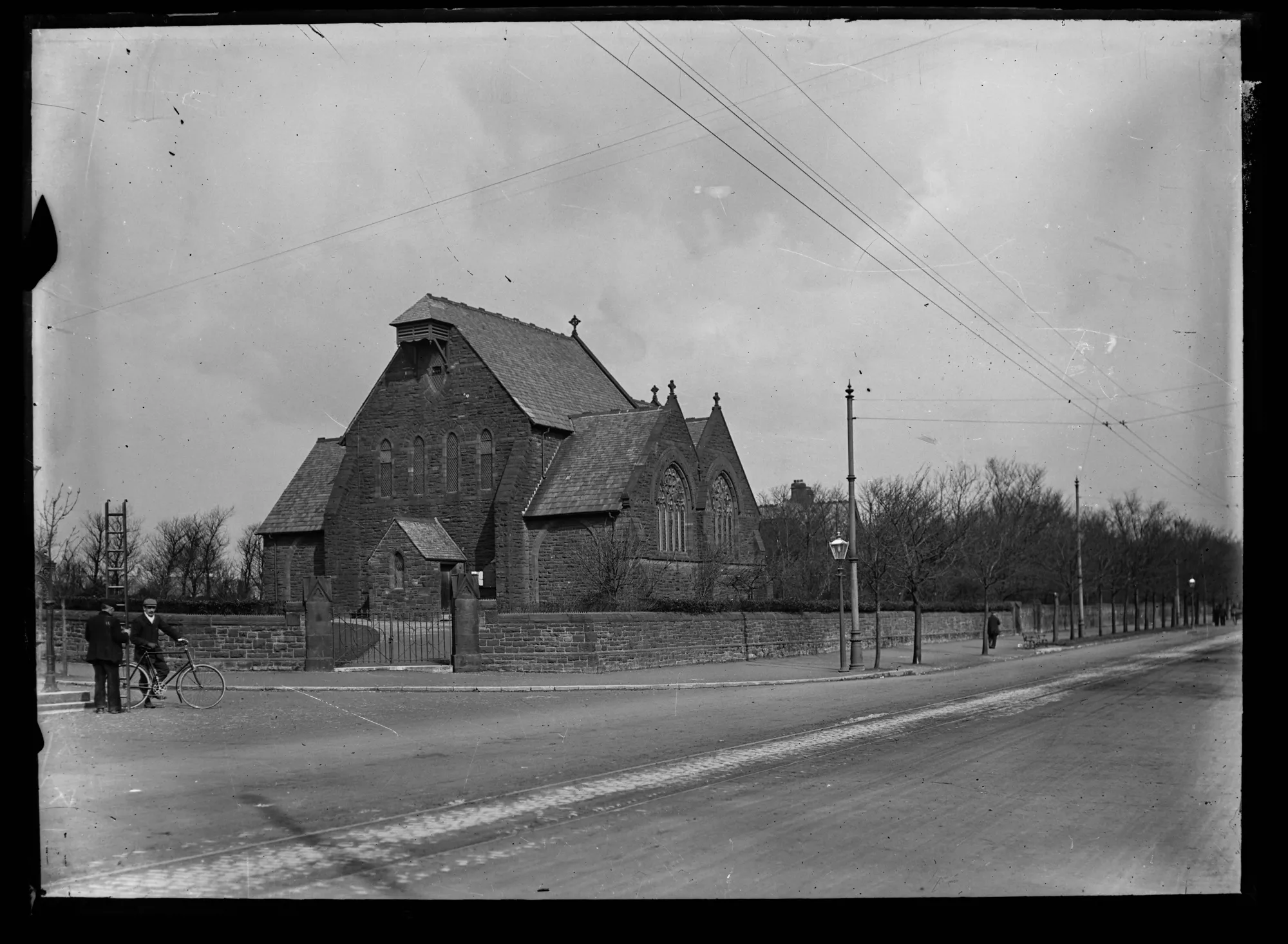
St Paul's Church - Hawcourt -
- Large sandstone church with no tower or steeple, surrounded by sandstone wall. Wide tree lined street with tram lines and wires. Man on bicycle and man with ladder. Queen Victoria …
Added by
Simon Cotterill
from https://www.sankeyphotoarchiv…
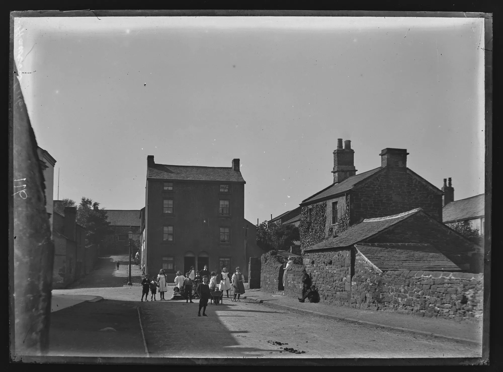
New Street, Hawcoat - Early 20th Century
- Looking West along the end of Dalton Lane to the junction with Cliffe Lane. A group of children in the centre of the road looking towards the camera. Woman with …
Added by
Simon Cotterill
from https://www.sankeyphotoarchiv…
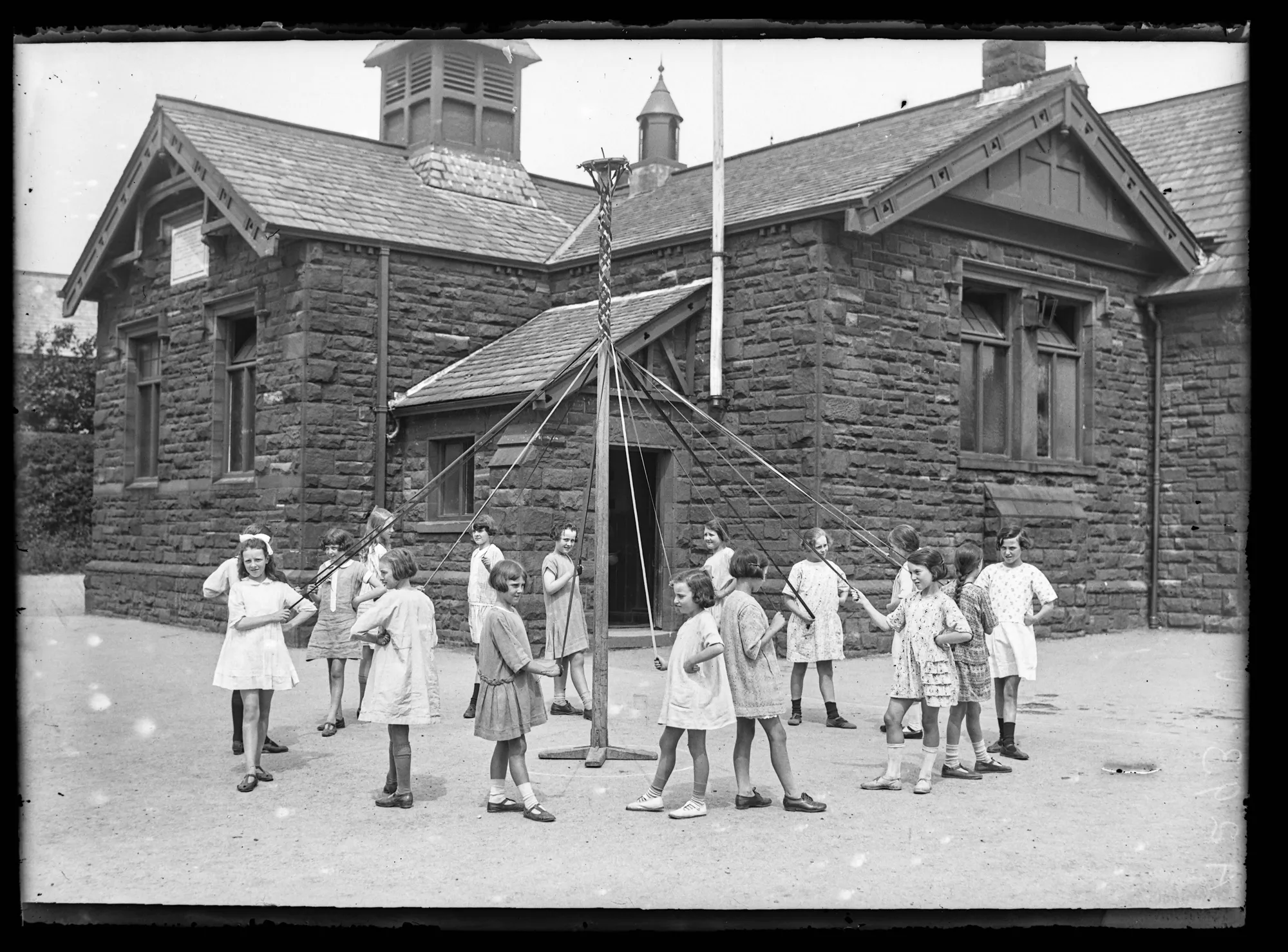
St. Paul's School (children) - Late 1920's
- Sandstone building on Hawcoat Lane, looking northeast. Girls posed dancing around maypole in yard. Image from the Sankey Family Photograph Collection (c/o Cumbria Archives), available under a Creative Commons Attribution-NonCommercial …
Added by
Simon Cotterill


from https://www.sankeyphotoarchiv…
St Paul's School Hawcoat Lane Wheatclose Road - c. 1910
- Hawcoat Ward. Children in road looking at camera. School on corner of Hawcoat Lane and Wheatclose Road behind. Image from the Sankey Family Photograph Collection (c/o Cumbria Archives), available under …
Added by
Simon Cotterill
Co-Curate Page
Hawcoat, Division of Dalton-in-Furness Parish, 1848
- The ancient parish of Dalton-in-Furness was divided into quarters or ‘bierleys’: Hawcoat, Yarlside, Above Town, and Dalton[1]. The entry below relates to the Division of Hawcoat, rather than the Township …
from https://www.sankeyphotoarchiv…
Hawcoat - Early 20th Century
- A group of girls playing in the centre of the road at the junction of Dalton Lane and Cliffe Lane with slate roofed cottages behind. A lone boy, hands in …
Added by
Simon Cotterill
from https://www.sankeyphotoarchiv…
St Paul's Church - Hawcourt -
- Large sandstone church with no tower or steeple, surrounded by sandstone wall. Wide tree lined street with tram lines and wires. Man on bicycle and man with ladder. Queen Victoria …
Added by
Simon Cotterill
from https://www.sankeyphotoarchiv…
New Street, Hawcoat - Early 20th Century
- Looking West along the end of Dalton Lane to the junction with Cliffe Lane. A group of children in the centre of the road looking towards the camera. Woman with …
Added by
Simon Cotterill
from https://www.sankeyphotoarchiv…
St. Paul's School (children) - Late 1920's
- Sandstone building on Hawcoat Lane, looking northeast. Girls posed dancing around maypole in yard. Image from the Sankey Family Photograph Collection (c/o Cumbria Archives), available under a Creative Commons Attribution-NonCommercial …
Added by
Simon Cotterill

")

