Topics > Northumberland > Elsdon > Elsdon Parish, 1848
Elsdon Parish, 1848
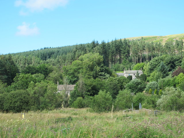
ELSDON (St. Cuthbert), a parish, partly in the union of Bellingham, and partly in that of Rothbury, S. division of Coquetdale ward, N. division of Northumberland; comprising the townships or wards of Elsdon, Monkridge, Otterburn, Rochester, Troughend, and Woodside; and containing 1,680 inhabitants, of whom 282 are in Elsdon township, 18½ miles (W.N.W.) from Morpeth. The river Rede rises at the foot of the Carter mountains, which separate England from Scotland, and runs through a great part of the parish; it gave name to the franchise of Redesdale, the lords of which, from a very remote time, exercised many royal privileges, such as trying causes before their own justices, etc. The inhabitants of the district were marked by many peculiar features; in the reign of Elizabeth, they lived in sheds, during the summer months, pasturing their cattle on the moorlands, and plundering and levying contributions upon their neighbours on both sides of the border. The parish comprises 74,918 acres, of which 1,756 are arable, and 477 woodland. A large portion consists of dreary moors, but nearly two-thirds are well adapted for rearing black-cattle and sheep, having been much improved by the drainage of the heaths and morasses; oats and barley ripen in most seasons, but wheat seldom comes to perfection. The eastern part rests upon beds of limestone, and the western upon porphyry and basalt, with some mountain limestone.
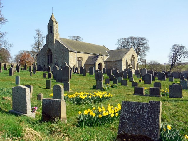
The township of Elsdon contains 6,403 acres, of which 374 are arable, and the remainder pasture. Elsdon common, containing 10,245 acres, was inclosed in 1729. The Castle was erected in the 14th century, by Sir Robert Taylboys, whose arms are on the south parapet; it is a strong tower-building, now the rectory-house, the lower story of which is spanned by a single arch. A market was formerly held, which had been granted by Edward I., in 1281, to William de Umfraville, at the same time as the fair, which latter (for cattle, sheep, and linen and woollen cloth) is held on August 26th. The village consists of a circular row of houses, having in the centre a green of several acres. The living is a rectory valued in the king's books at £20, and in the patronage of the Duke of Northumberland: the tithes have been commuted for £800, and the glebe contains 64 acres. The church is a large cruciform structure, supposed to have been built soon after the time of Richard II.: some years since, in clearing away the earth against the north transept, upwards of 100 skeletons were discovered. At Byrness is a separate incumbency, in the gift of the rector. North-east of the village are the Moat Hills, which, from the relics discovered in them, seem to have been raised by the Britons, and afterwards occupied by the Romans.
Extract from: A Topographical Dictionary of England comprising the several counties, cities, boroughs, corporate and market towns, parishes, and townships..... 7th Edition, by Samuel Lewis, London, 1848.

Co-Curate Page
WoodsideTownship
- WOODSIDE-WARD, a township, in the parish of Elsdon, union of Rothbury, S. division of Coquetdale ward, N. division of Northumberland, 1½ mile (N.) from Elsdon; containing 124 inhabitants. It lies …

Co-Curate Page
Troughend Township
- TROUGHEND-WARD, a township, in the parish of Elsdon, union of Bellingham, S. division of Coquetdale ward, N. division of Northumberland, 7¼ miles (N.N.E.) from Bellingham; containing 314 inhabitants. This ward …

Co-Curate Page
Byrness
- Overview About Byrness Map BYRNESS, a chapelry, in the parish of Elsdon, union of Rothbury, S. division of Coquetdale ward, N. division of Northumberland, 13¾ miles (N.N.W.) from Bellingham. This …

Co-Curate Page
Monkridge Ward, Township, 1848
- MONKRIDGE-WARD, a township, in the parish of Elsdon, union of Rothbury, S. division of Coquetdale ward, N. division of Northumberland, 8 miles (N.E.) from Bellingham; containing 111 inhabitants. About the …

Co-Curate Page
Rochester Township
- ROCHESTER-WARD, a township, in the parish of Elsdon, union of Bellingham, S. division of Coquetdale ward, N. division of Northumberland, 12 miles (N.) from Bellingham; containing 437 inhabitants. This district …

Co-Curate Page
Otterburn Ward Township, 1848
- OTTERBURN-WARD, a township, in the parish of Elsdon, union of Bellingham, S. division of Coquetdale ward, N. division of Northumberland, 11 miles (N.E. by N.) from Bellingham; containing 412 inhabitants. …


Co-Curate Page
WoodsideTownship
- WOODSIDE-WARD, a township, in the parish of Elsdon, union of Rothbury, S. division of Coquetdale ward, N. division of Northumberland, 1½ mile (N.) from Elsdon; containing 124 inhabitants. It lies …

Co-Curate Page
Troughend Township
- TROUGHEND-WARD, a township, in the parish of Elsdon, union of Bellingham, S. division of Coquetdale ward, N. division of Northumberland, 7¼ miles (N.N.E.) from Bellingham; containing 314 inhabitants. This ward …

Co-Curate Page
Byrness
- Overview About Byrness Map BYRNESS, a chapelry, in the parish of Elsdon, union of Rothbury, S. division of Coquetdale ward, N. division of Northumberland, 13¾ miles (N.N.W.) from Bellingham. This …

Co-Curate Page
Monkridge Ward, Township, 1848
- MONKRIDGE-WARD, a township, in the parish of Elsdon, union of Rothbury, S. division of Coquetdale ward, N. division of Northumberland, 8 miles (N.E.) from Bellingham; containing 111 inhabitants. About the …

Co-Curate Page
Rochester Township
- ROCHESTER-WARD, a township, in the parish of Elsdon, union of Bellingham, S. division of Coquetdale ward, N. division of Northumberland, 12 miles (N.) from Bellingham; containing 437 inhabitants. This district …


