Topics > Northumberland > Matfen > East Matfen medieval village
East Matfen medieval village
Map showing the Scheduled Monument area of East Matfen medieval village, with Matfen to the west.
The site of East Matfen medieval village is located about a mile ESE of Matfen in Northumberland. In the 13th century the manor of East Matfen was held by the Fenwick family and was recorded as having 14 tax payers in 1296. In the 17th century the estate was acquired by John Douglas of Newcastle who dispersed the villagers to other parts of the estate, probably to establish formal parkland here. The site of the deserted medieval village and it's open field system is a Scheduled Monument (legally protected).

LIDAR image of East Matfen and it's open field system c/o Dr John Wells, Wikimedia Commons. This is based on data from the Environment Agency - National LIDAR programme, availale under the OGL licence.
Scheduled Monument (#1016351): East Matfen medieval village and open field system
Click the headings below to expand (selected extracts from the Historic England scheduling)
The deserted medieval village of East Matfen is well preserved and retains significant archaeological deposits. The village is a good example of its type which, taken together with the remains of its open field system, will add greatly to our knowledge and understanding of medieval settlement in the region.
The monument includes the deserted remains of the medieval village of East Matfen and part of its surviving open field system, situated on the right bank of the now canalised River Pont. It is divided into two separate areas by a later trackway.
In the 13th century the manor of East Matfen was held by the Fenwick family and a document records that in 1296 14 individuals from the village were eligible to pay taxes. Part of the manor was subsequently granted to the priory at Hexham, and later documents record a fall in the village population. After the Dissolution of the Monasteries, the manor was regained by the Fenwicks. During the mid- to late 17th century the estate was acquired by John Douglas of Newcastle who depopulated the village and dispersed the farms to other parts of the estate. Maps of a similar date indicate that the northern half of the village became incorporated into a formal park which was established in the area at this time.
The plan of the medieval village is a type well known in this part of Northumberland in which two parallel lines of houses face onto a broad rectangular village green, with crofts, or garden areas to the rear. This type of village is thought to be the result of deliberate planning by Norman rulers attempting to exert control over a rebellious region during the 11th and 12th centuries. The two rows of houses are oriented east to west, and each is visible as a series of rectangular enclosures or tofts containing the foundations of timber long houses. The house foundations stand to an average height of 0.3m. The ruined remains of Pead House at the centre of the south row of the village indicate that at least one of the original medieval plots continued in use into the post-medieval period. To the rear of each street, there are the well defined remains of linear crofts, each bounded from its neighbour by a bank on average 0.5m high. Some of the crofts, particularly on the north row of the village, contain the remains of rig and furrow cultivation.
The two streets face onto a broad rectangular open space containing the remains of banks and hollows. This was formerly the village green. Subsequent to its desertion, part of the village green was ploughed up, and the remains of rig and furrow are visible at its north eastern end. A well defined hollow way crosses the green and opens out at its eastern end to form a funnelled access or driftway across the surrounding open fields to the pasture beyond.
At the eastern end of the village, part of the open fields which once surrounded the village on all sides, survive in the form of a large medieval furlong or field bounded on some of its sides by intact headland. The remains of two smaller furlongs beyond it to the south east. Each furlong contains rig and furrow cultivation which survives well and stands to a maximum height of 1m.

from https://www.geograph.org.uk/p…
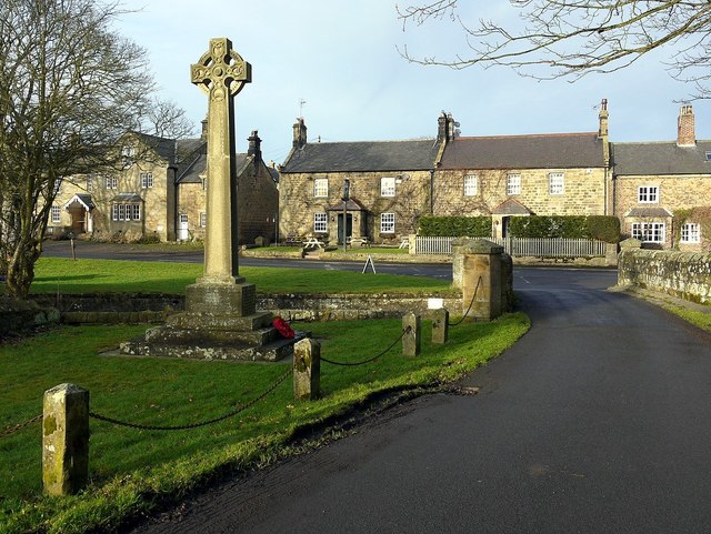
East Matfen medieval village and open field system (site of)
- Photo by Jeff Buck, 13 July, 2023, Geograph. c/o Wikimedia Commons, licensed under the Creative Commons Attribution-Share Alike 2.0 Generic license.
Added by
Simon Cotterill

from https://historicengland.org.u…
East Matfen medieval village and open field system - Scheduling
- ......Medieval villages were organised agricultural communities, sited at the centre of a parish or township, that shared resources such as arable land, meadow and woodland. Village plans varied enormously, but …
Added by
Simon Cotterill

from https://www.geograph.org.uk/p…
East Matfen medieval village and open field system (site of)
- Photo by Jeff Buck, 13 July, 2023, Geograph. c/o Wikimedia Commons, licensed under the Creative Commons Attribution-Share Alike 2.0 Generic license.
Added by
Simon Cotterill
from https://historicengland.org.u…
East Matfen medieval village and open field system - Scheduling
- ......Medieval villages were organised agricultural communities, sited at the centre of a parish or township, that shared resources such as arable land, meadow and woodland. Village plans varied enormously, but …
Added by
Simon Cotterill