Topics > County Durham > Civil Parishes in County Durham > Brancepeth Civil Parish > Crook with Billy-Row, Township, 1848
Crook with Billy-Row, Township, 1848
CROOK, with Billy-Row, a township, in the parish of Brancepeth, union of Auckland, N. W. division of Darlington ward, S. division of the county of Durham, 5½ miles (N.W. by N.) from Bishop-Auckland; containing 538 inhabitants. The township comprises by computation 4,310 acres. Crook is a scattered village, situated on the road between Willington and Wolsingham, and partly extending into the adjoining township of Helmington-Row. Coal is worked. A branch of the Clarence railroad, from Ferry-Hill upwards, affords an easy communication with the coast; and the Bishop-Auckland and Weardale railway terminates here, after a course of eight miles, from the Stockton and Darlington line. The Incorporated Society, in 1841, granted £50 in aid of the expense of building a district chapel, containing 306 free sittings: it is dedicated to St. Catherine, and the living is in the gift of the Rector of Brancepeth. The tithes have been commuted for £68. 16. 8. An eminence in the township, called Billy Hill, is seen by mariners in very clear weather, though so distant from the sea.
Extract from: A Topographical Dictionary of England comprising the several counties, cities, boroughs, corporate and market towns, parishes, and townships..... 7th Edition, by Samuel Lewis, London, 1848.

Co-Curate Page
Crook
- Overview About Crook Map Street View "Crook was little more than a hamlet with a village green until the early 19th century. Although coal had been mined near Crook since …
Co-Curate Page
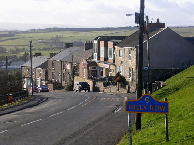
Billy Row
- Overview About Billy Row Map Street View Billy Row is a village in County Durham, England. It is situated a short distance to the north of Crook. According to …

Co-Curate Page
Crook
- Overview About Crook Map Street View "Crook was little more than a hamlet with a village green until the early 19th century. Although coal had been mined near Crook since …


