Topics > Geography > Rivers > River Rede > Cottonshope Burn
Cottonshope Burn
Cottonshope Burn is a tributary of the River Rede in Northumberland. The burn arises near Cottonshope Head, flows south past Cottonshope to join the River Rede at Cottonshopeburnfoot. The upper parts of the valley of Cottonshope Burn is part of an MOD range, with restricted access most of the year. The burn has a catchment area of 15.6 km2 and is 6.4km long.[1]


from Geograph (geograph)
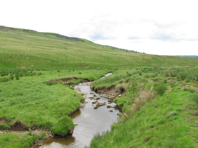
Cottonshope Burn below Devil's Crag and Great Dour
Pinned by Simon Cotterill


from Geograph (geograph)
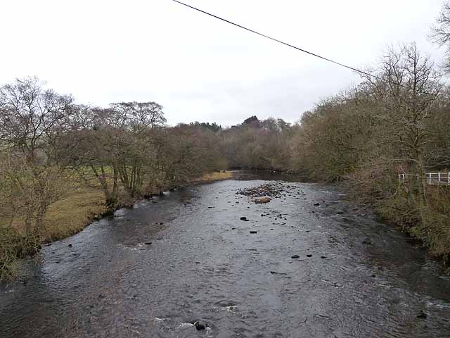
Confluence of the River Rede and Cottonshope Burn
Pinned by Simon Cotterill

from https://environment.data.gov.…
Cottonshope Burn Catchment (trib of Rede)
Added by
Simon Cotterill

Co-Curate Page
Cottonshope
- Overview Map Street View Cottonshope is a remote farm, located 9 miles north-west of Otterburn and 2 miles north-east of Byrnes. The farm is situated in the valley of Cottonshope …

Co-Curate Page
Cottonshope Head
- Overview Map Street View Cottonshope Head is a remote farm building, located 9½ miles north-west of Otterburn and 3¼ miles north-east of Byrnes. It is situated in the upper valley …

from Geograph (geograph)
Cottonshope Burn below Devil's Crag and Great Dour
Pinned by Simon Cotterill
from Geograph (geograph)
Confluence of the River Rede and Cottonshope Burn
Pinned by Simon Cotterill
from https://environment.data.gov.…
Cottonshope Burn Catchment (trib of Rede)
Added by
Simon Cotterill
Co-Curate Page
Cottonshope
- Overview Map Street View Cottonshope is a remote farm, located 9 miles north-west of Otterburn and 2 miles north-east of Byrnes. The farm is situated in the valley of Cottonshope …